Snow Observations List
This wet loose avalanche is a great example of where they often occur. Rocks absorb extra heat from the sun and can quickly melt and destabilize the snow. Either move under areas like this early in the morning (as we did), or if you have to travel under them later in the day, move quickly.
Full Snow Observation Report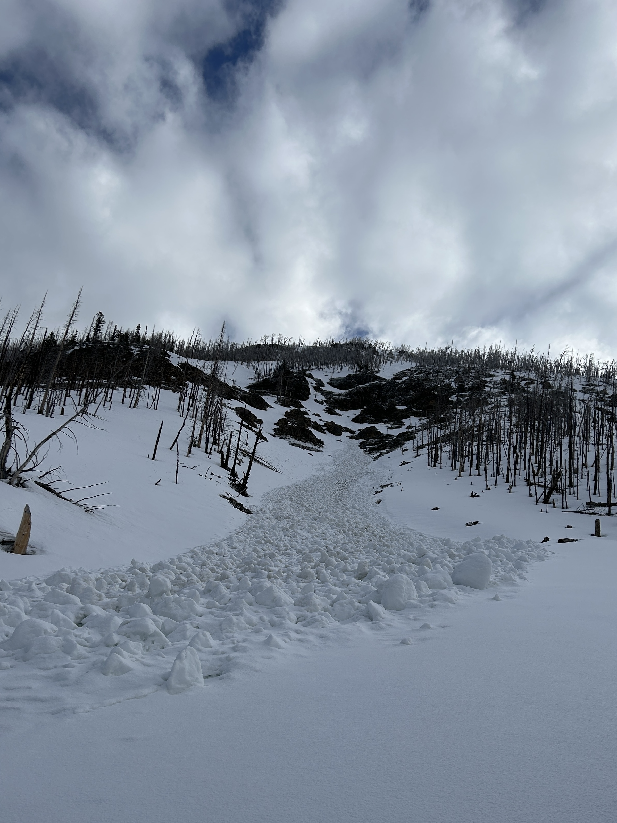
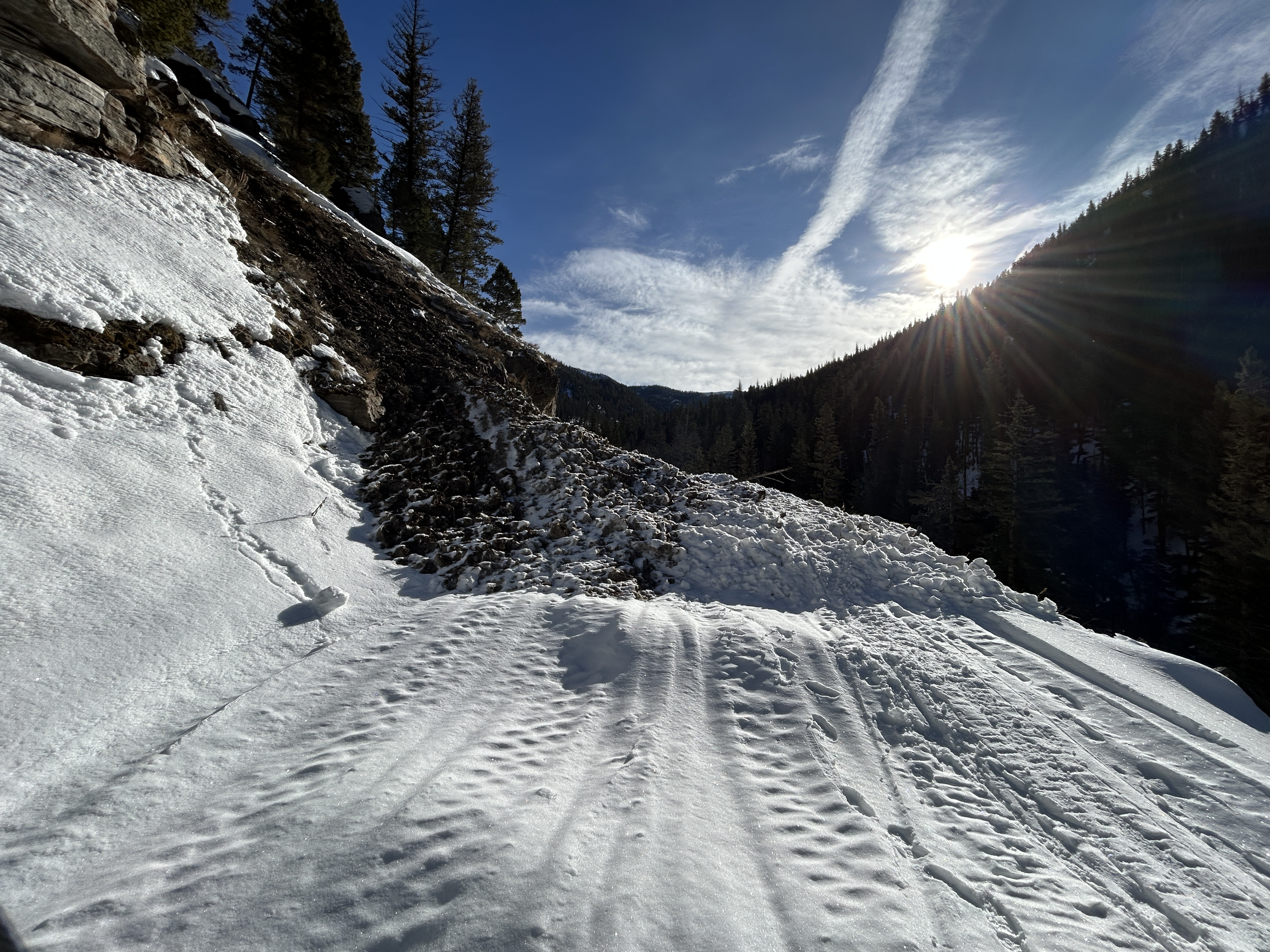
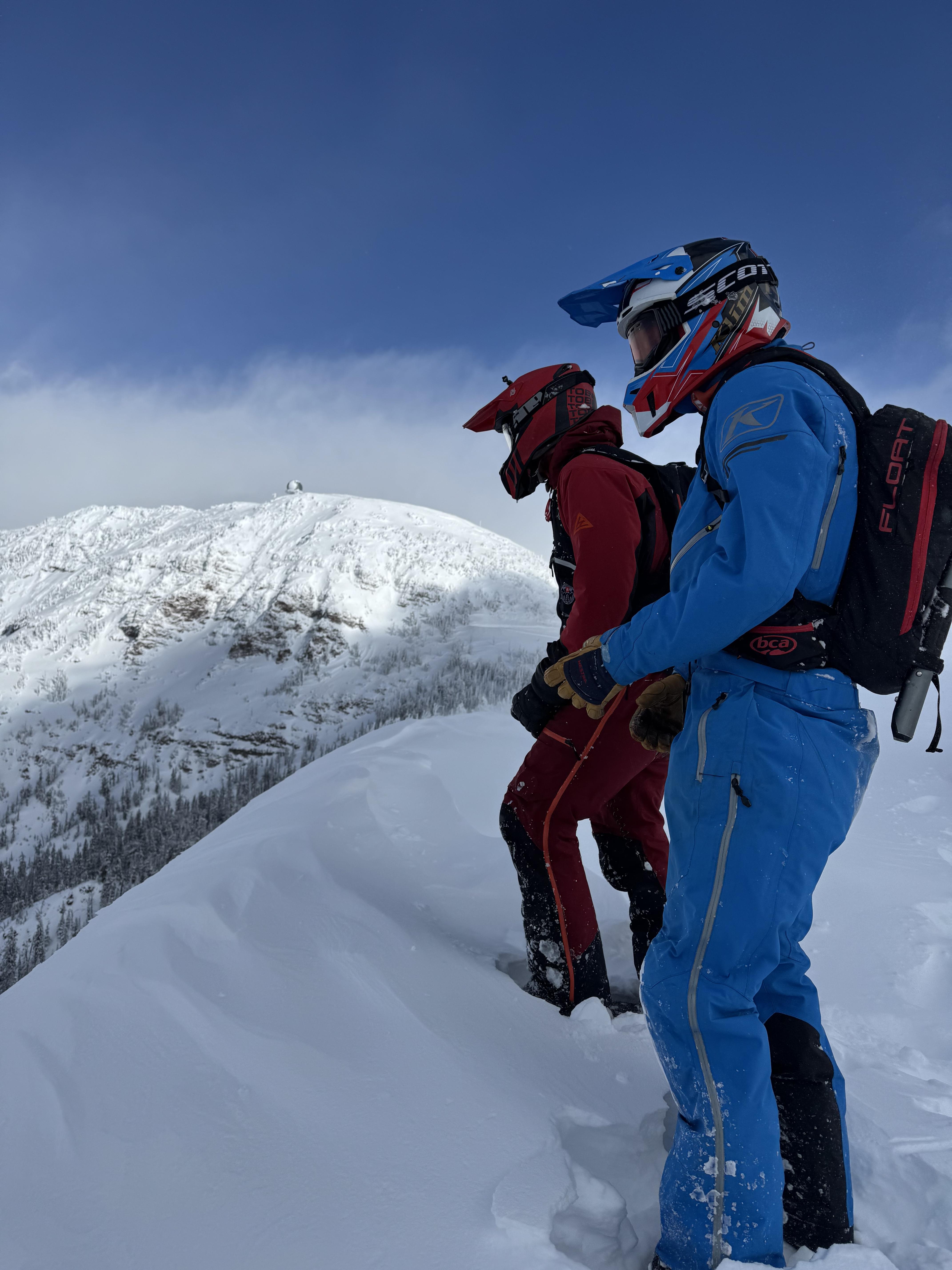
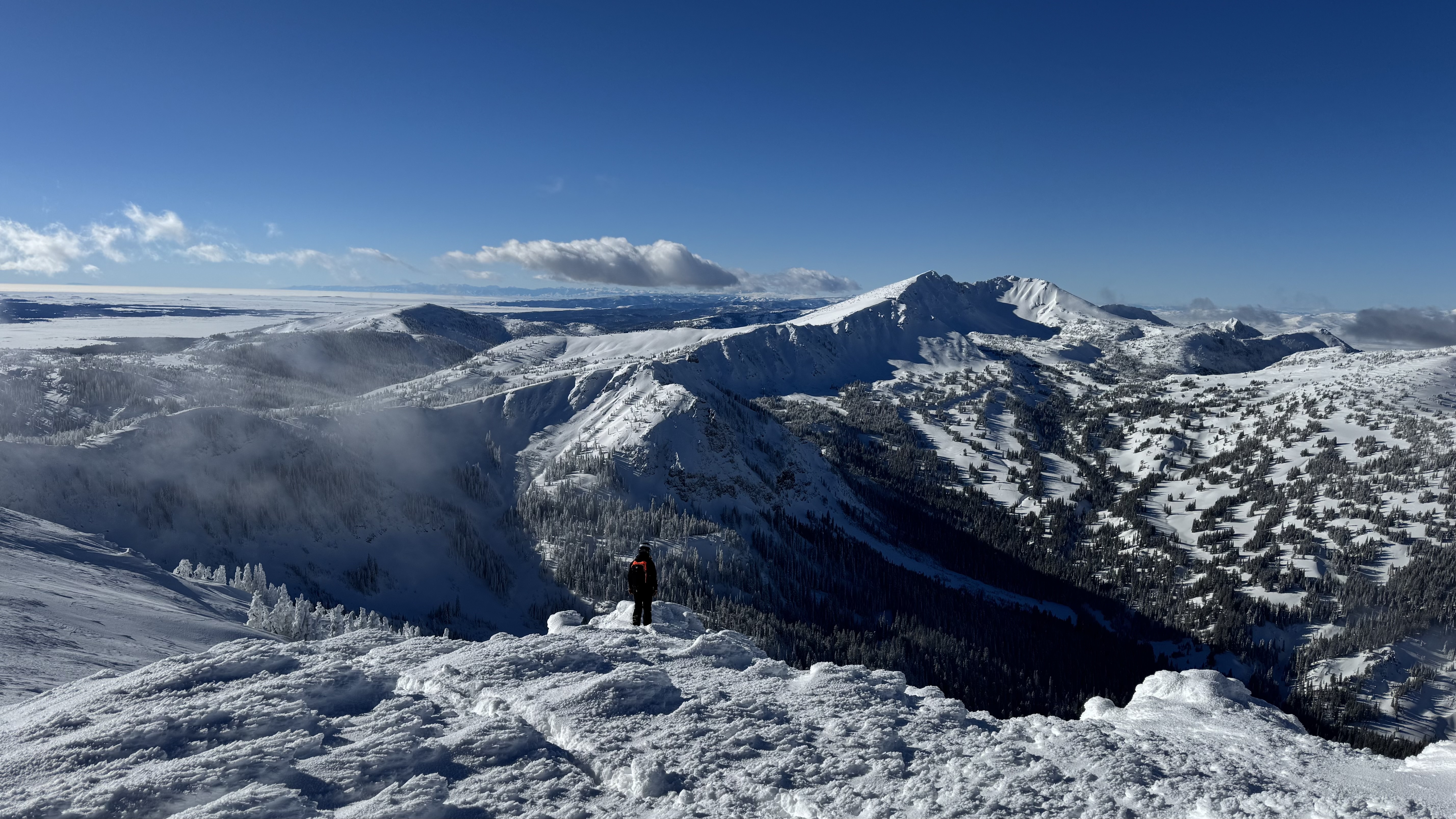
Skied Hellroaring Hut in the Centennials from Friday Mar 28 through Mon Mar 31.
Skied and observed all aspects between 7700' and 10,200' in the vicinity of Mt Jefferson and Reas Peak.
We had good visibility for three days and saw no signs of slab avalanches; no whumphing or cracking; and no signs of blowing or drifting snow (prior to new snow arriving today (Mar 31) snow surface was locked up with solid melt-freeze crusts on all aspects and elevations).
Snow surface starting to show meltwater runnels on S through E aspects below 9000'.
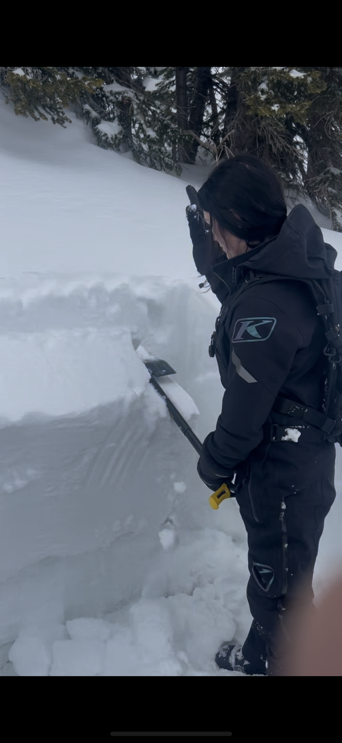
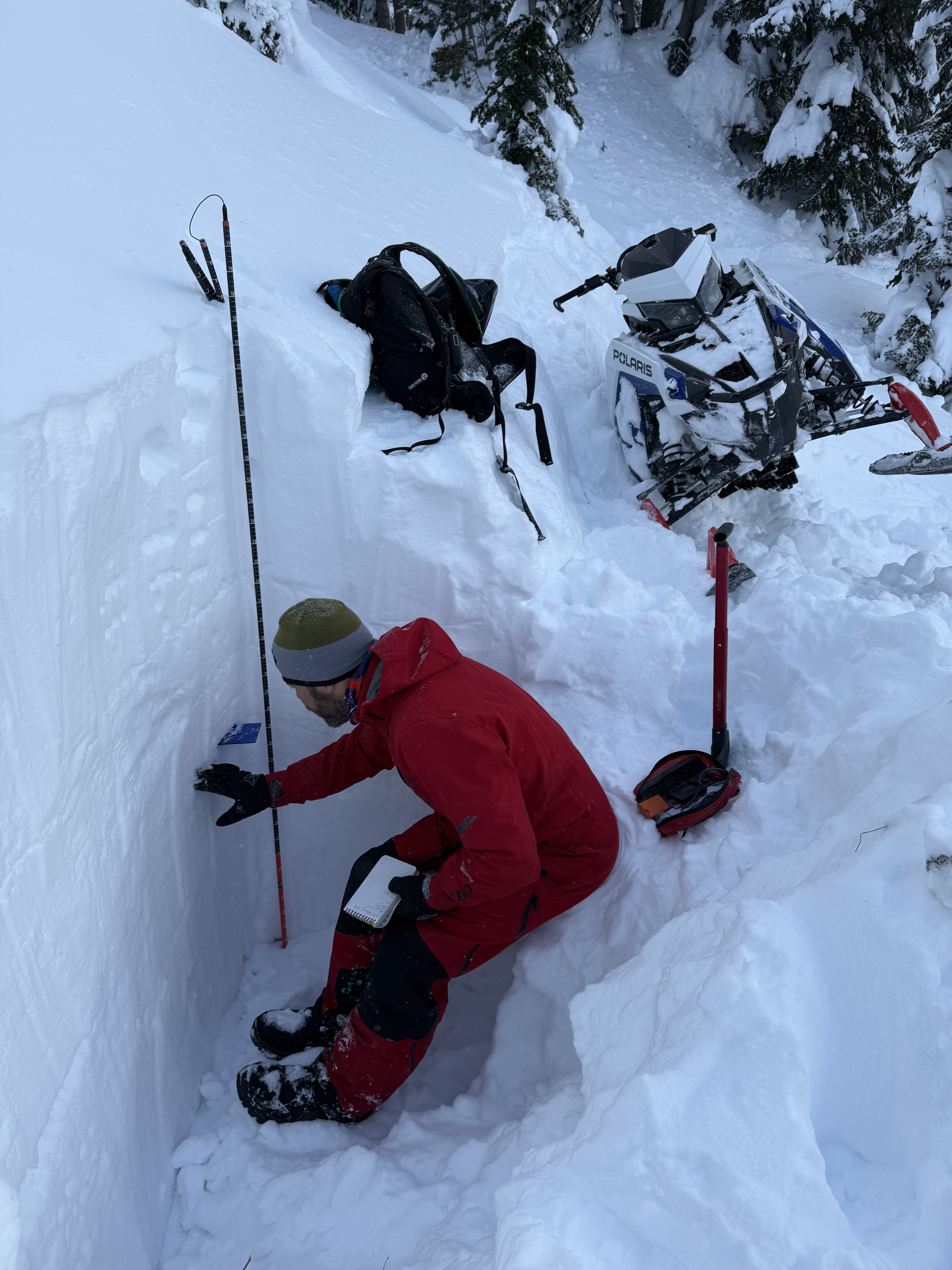
Test pits on N and S aspects at 9100' revealed moist snow under melt-freeze crusts (3" thick breakable crust on N aspects; 10" thick stout crust on S aspects) and no identifiable layers of concern in the upper 130 cm of the snowpack. HS 165 cm on S aspect at 9100' and HS 260 cm on N aspect at 9100'.
We observed pinwheels and predictable wet loose avalanches (D1 to D1.5) on solar aspects above 8000' on Fri and Sat.
Snow started this morning (3/31) and 2.5" of new snow had accumulated when we left at 11:00 a.m. Moderate to strong winds blowing from the south today.
Full Snow Observation Report
From text message: “I was out with a friend and his 2 daughters. We were east of Jefferson 8990’ elevation. East aspect ECTP 22. Down 78cm from surface. Melt freeze layer I would describe as breaking up?? garbage.”
Full Snow Observation Report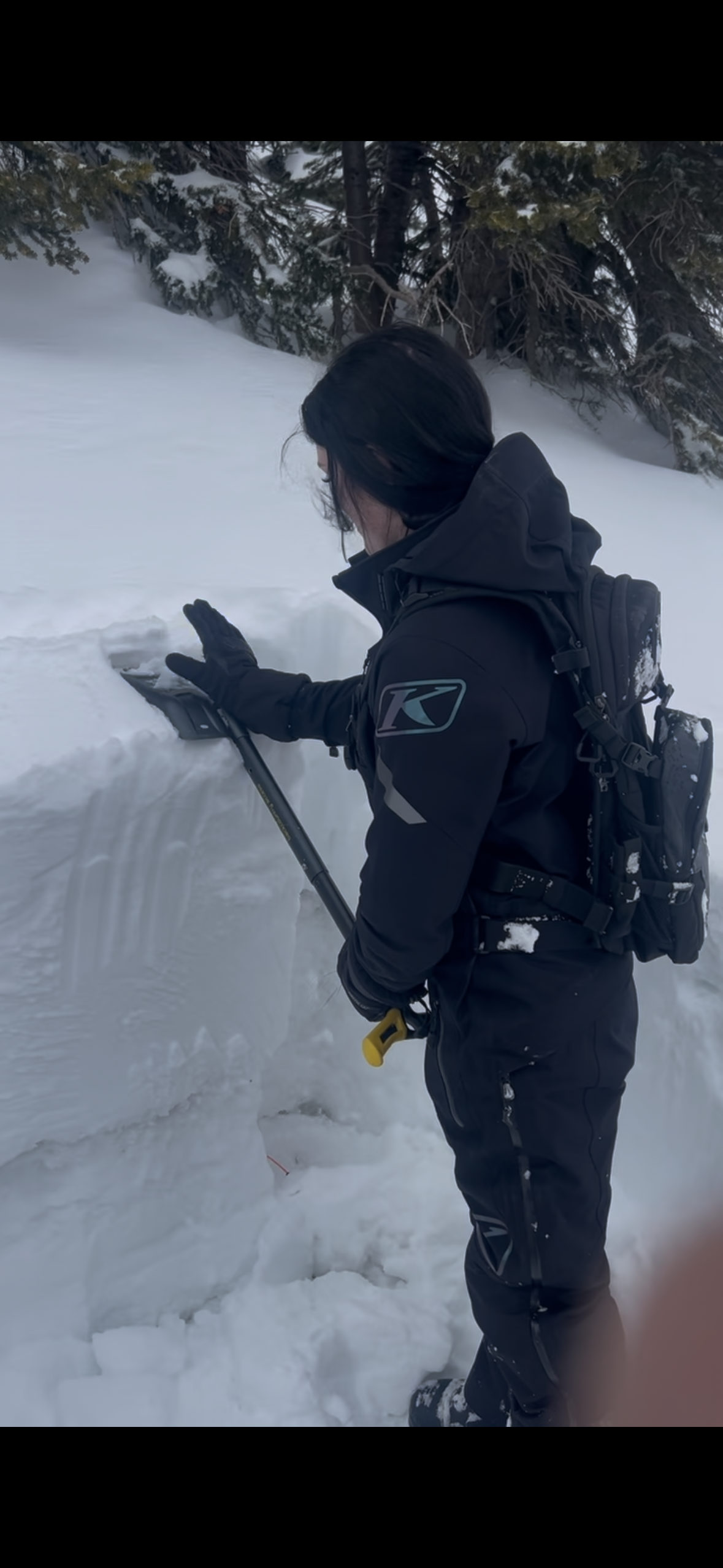
All elevations in Island Park experienced heavy snowfall combined with high winds,this made for unstable wind slabs and cornices.
Full Snow Observation Report
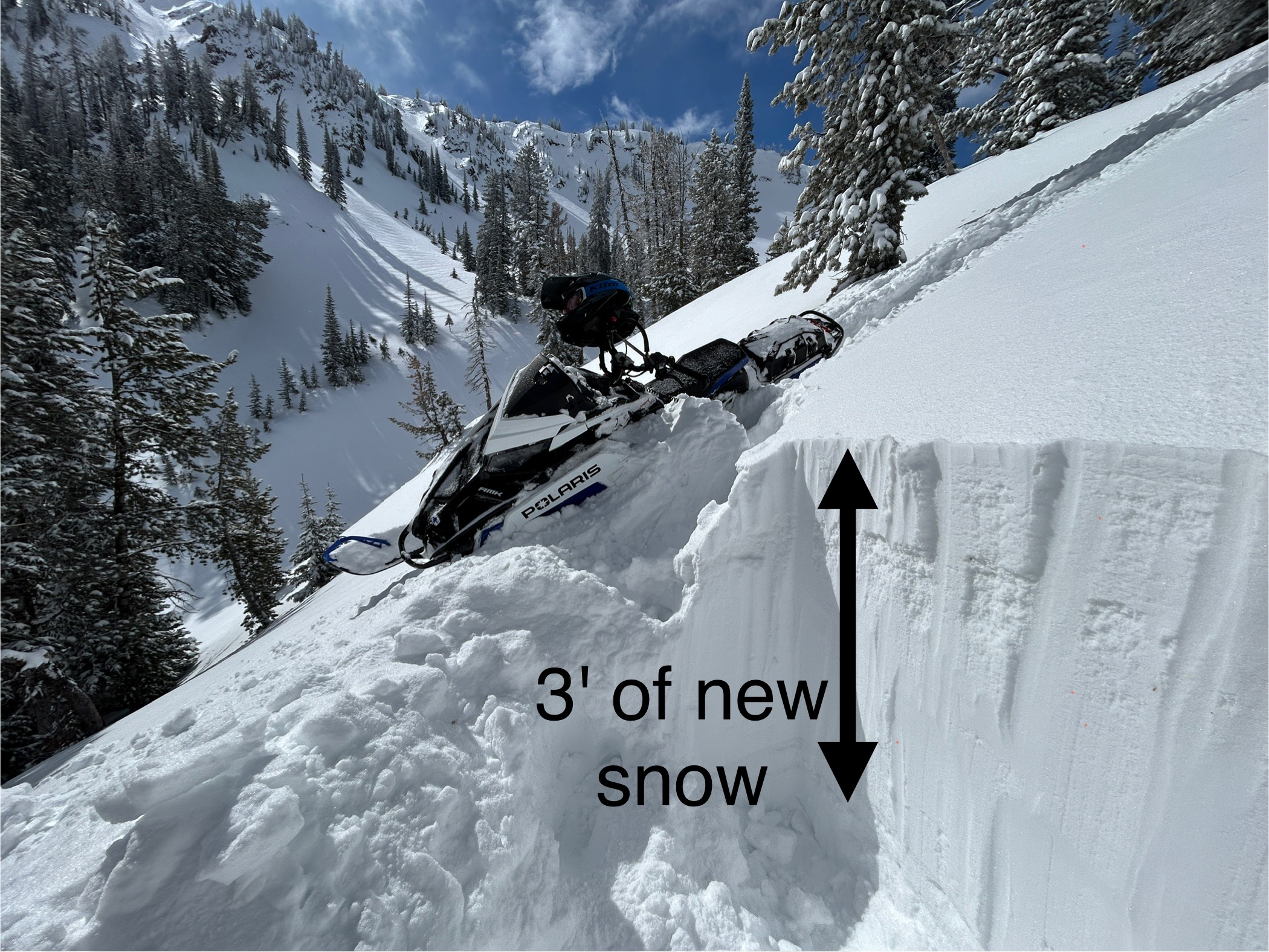
In the last five days, this area has received snowfall containing 4.5-5.3 inches of water which has settled to about 3 feet of new snow. Winds last sunday night from the southwest reached speeds up to 80 mph before easing, but then they blew from the north today.
We saw a handful of avalanches above treeline terrain that seemed to be wind slabs. However wind and snow had obscured them and I suspect there had been a lot more.
No cracking in the new snow and one possible collapse. Interestingly - My stability test scores had actually improved since Friday when there was less new snow. They broke and propagated just under a crust under the new snow. ECTP12's on Friday. ECTN & ECTP25 today. The reason is that they have been breaking on old, broken snowflakes....not facets.
Key points
- The new snow seemed mostly stable on sheltered slopes
- Wind loading is the main issue.
- With this kind of loading, it often finds weaknesses in the snowpack. I don't expect any moster slides, but also wouldn't be surprised to hear of one being triggered if tomorrow were a busy weekend day with lots of people out
- Avoid alpine terrain above treeline where winds have drifted lots of snow. Avoid hanging out in runout zones of big paths
Full Snow Observation Report
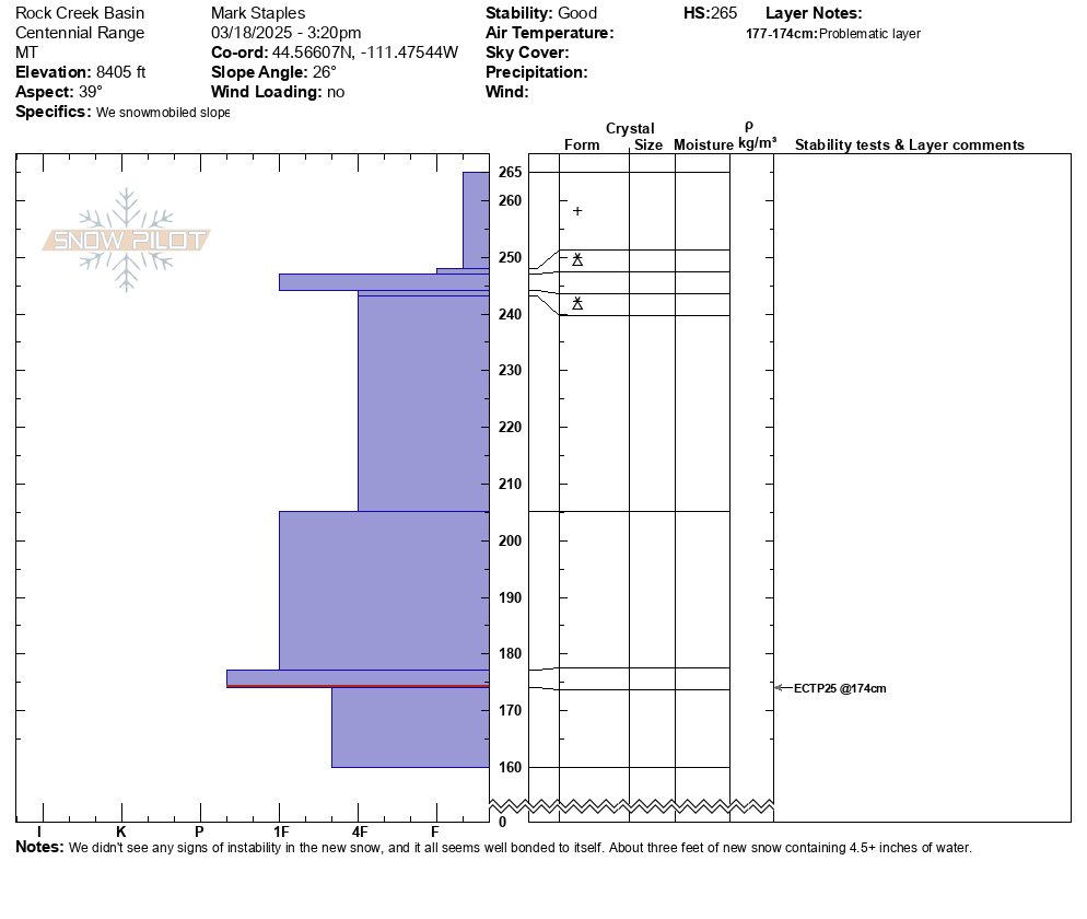

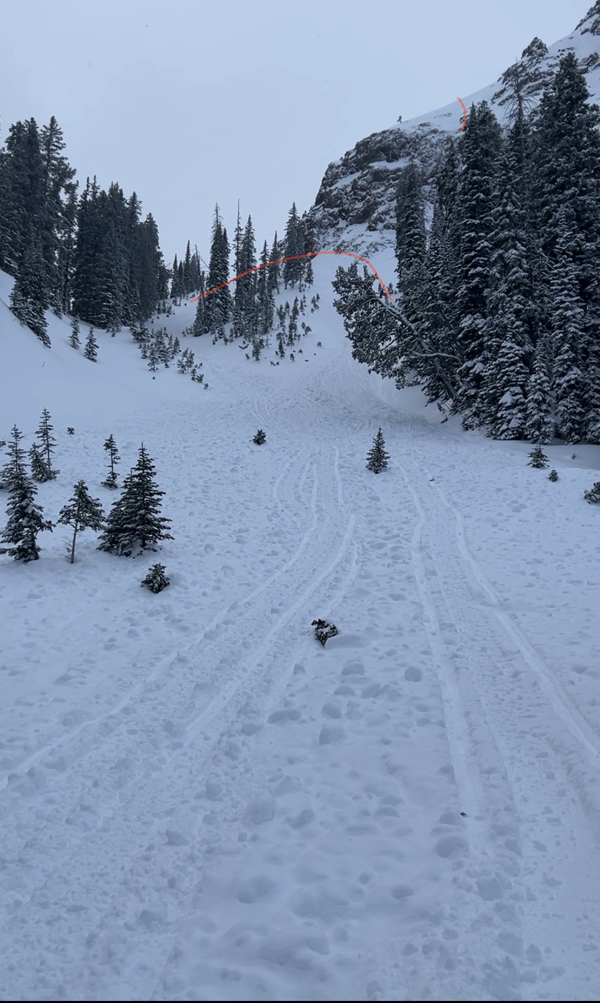
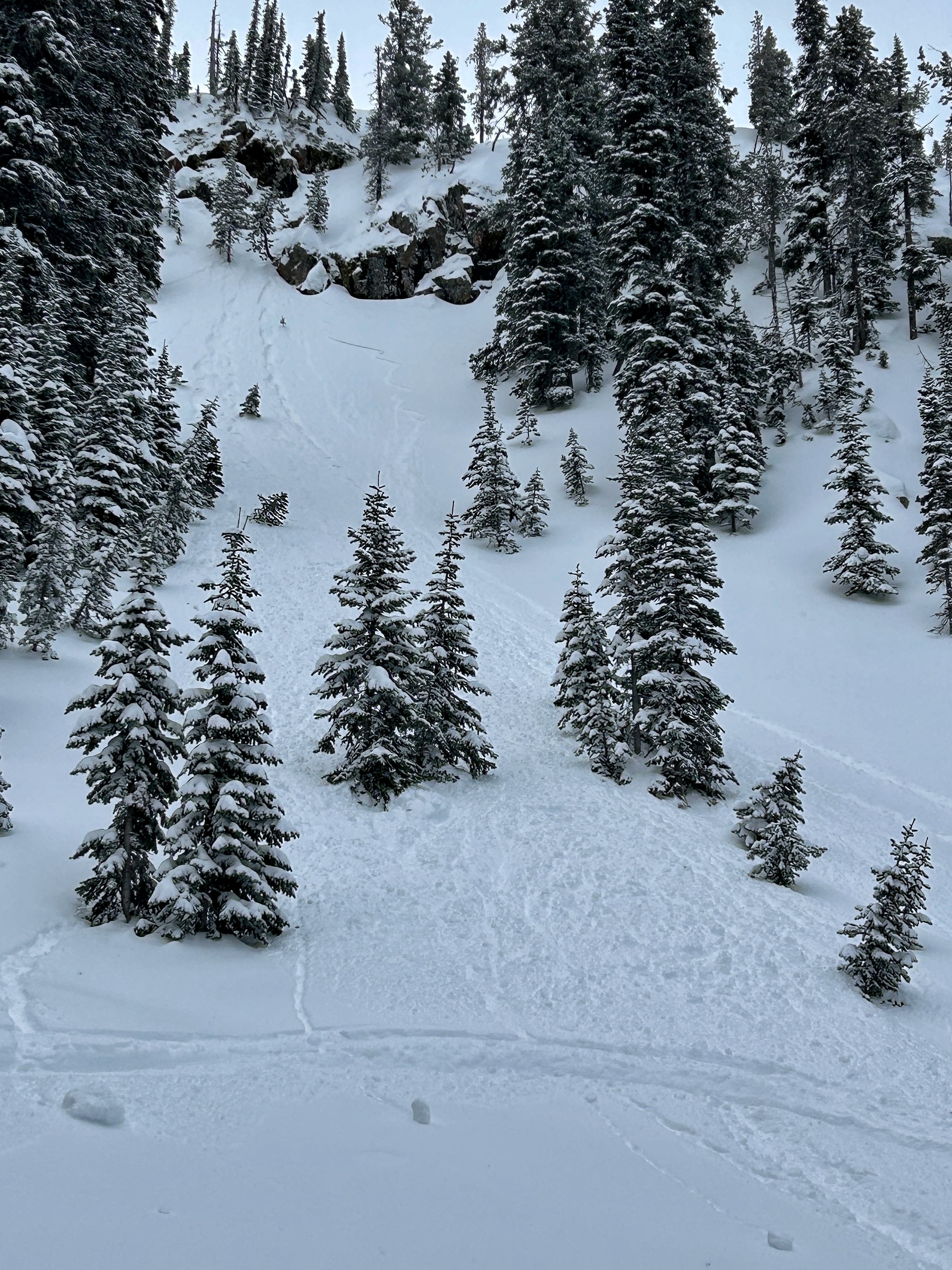
We rode to the top of Sawtelle to de-rime the anemometer (wind sensor) and then down into Rock Creek Basin under all the big north facing avalanche paths.
Key findings:
- New snow amounts ranged from 6-8" at lower elevations and 18" at higher elevations
- We did not observe any cracking or collapsing on non wind loaded slopes.
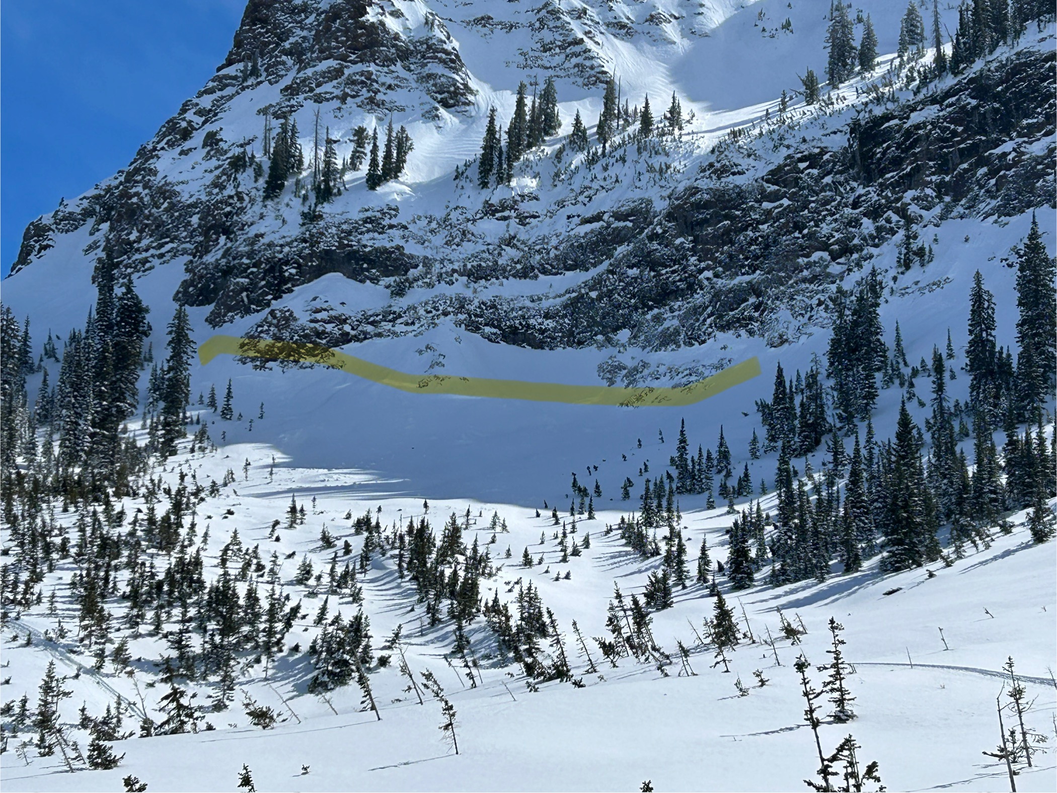
- We observed two very recent natural storm slab avalanches about a 1.5 feet deep. One of them entrained a significant amount of snow an ran a long ways.
- There has been minimal wind effect except at ridgetops
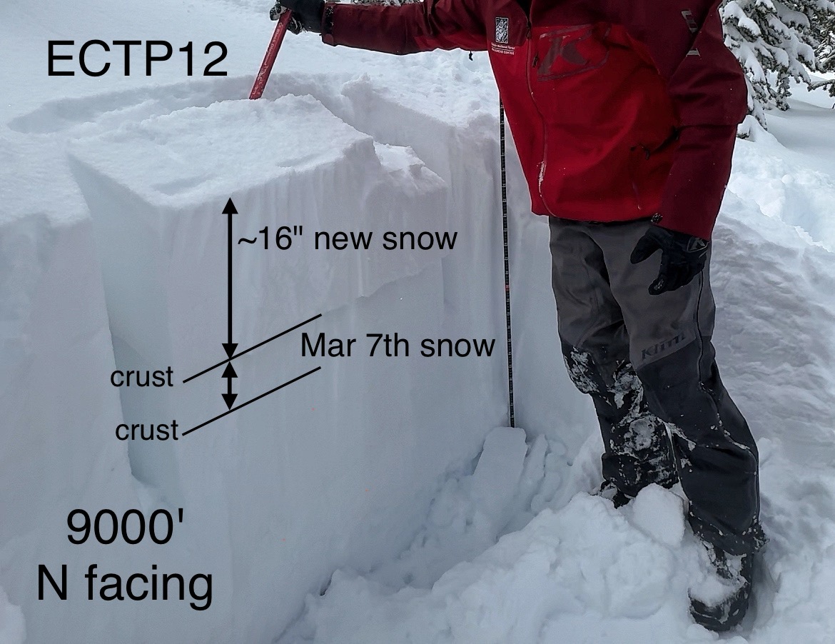
- Extended Column tests on north facing slopes continuously broke and propagated after 12 taps (ECTP12) just under a soft crust in snow that fell last weekend. These appeared to be breaking on broken stellars/snowflakes. On other aspects, the crust was much thicker and harder.
Conclusions:
The likelihood of triggering a soft slab avalanche about 1.5' deep seemed low on non-wind loaded slopes. Any amount of wind affecting a slope whether loading a slope or just stiffening the new snow, dramatically increased the odds of triggering a slide. We felt comfortable riding in avalanche runout zones and even climbing into the paths some. The main strategy was to stay out of the upper starting zones that are steeper and have seen some wind. HOWEVER - we carefully limited our exposure in big runout zones where a falling cornice could have triggered a slide that could have crashed down onto us. We did not think that we would trigger an avalanche from below
Looking ahead - Strong winds Sunday through Monday will have plenty of snow to transport along with additional snow that will fall. This should increase the danger and the size of possible avalanches.
Full Snow Observation Report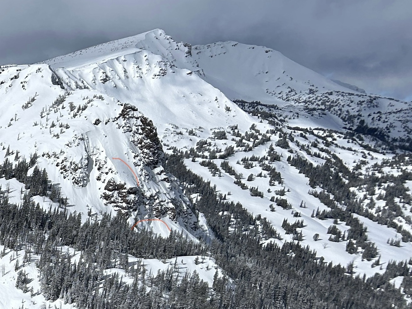

From phone call:
Kevin took a group into the Centennials.
8" of new snow at 8000'. Surface crust below the new snow was 3 CM thick. There was a facet layer below crust that was concerning. ECTN3 below crust.
Kevin found the January facet layer 90 CM down (4F hardness) a couple miles north of White Elephant at 7800-7900' (0.5-1mm size). No results in tests but was concerned about their activation if the storm snow start stacking up.
He noted that the Wind Slab and Storm Slab problems are growing. He saw shooting cracks in the new snow, several feet in front of his skis.
Winds were light to moderate but gusting into the 20s mph.
Full Snow Observation ReportWe rode from the Sawtelle Parking area up the shoulder of Sawtelle, across Yale Creek and above East Hotel Creek, through Jefferson Bowl, into Hellroaring Creek drainage to the base of Reas before reversing the order and heading out. We saw no avalanches and no signs of instability. Three snowpits (above East Hotel, in Jefferson Bowl, and above Hellroaring) revealed nothing remarkable - ECTXs and ECTNs in the 20s. The south-facing pit above East Hotel had many crust facet sandwiches, but none are currently an issue. It would take a significant load to bring up any concerns about avalanches breaking on persistent weak layers deeper in the storm.
Stability is good. There are tracks everywhere, and we are looking forward to a reset, hopefully arriving Wednesday night. Most slopes have a melt-freeze crust at the surface. There is no remarkable weakening at the surface to note at this point. Unless something changes between now and Wednesday, instability should be limited to the incoming snow and wind-drifted snow.
Full Snow Observation Report
8-12 inches of new snow on the ground in the Centennials near Nemesis mtn. New snow that fell early this morning was very touchy on hard/icy surfaces from the melt/freeze activity we saw the prior days.
Full Snow Observation Report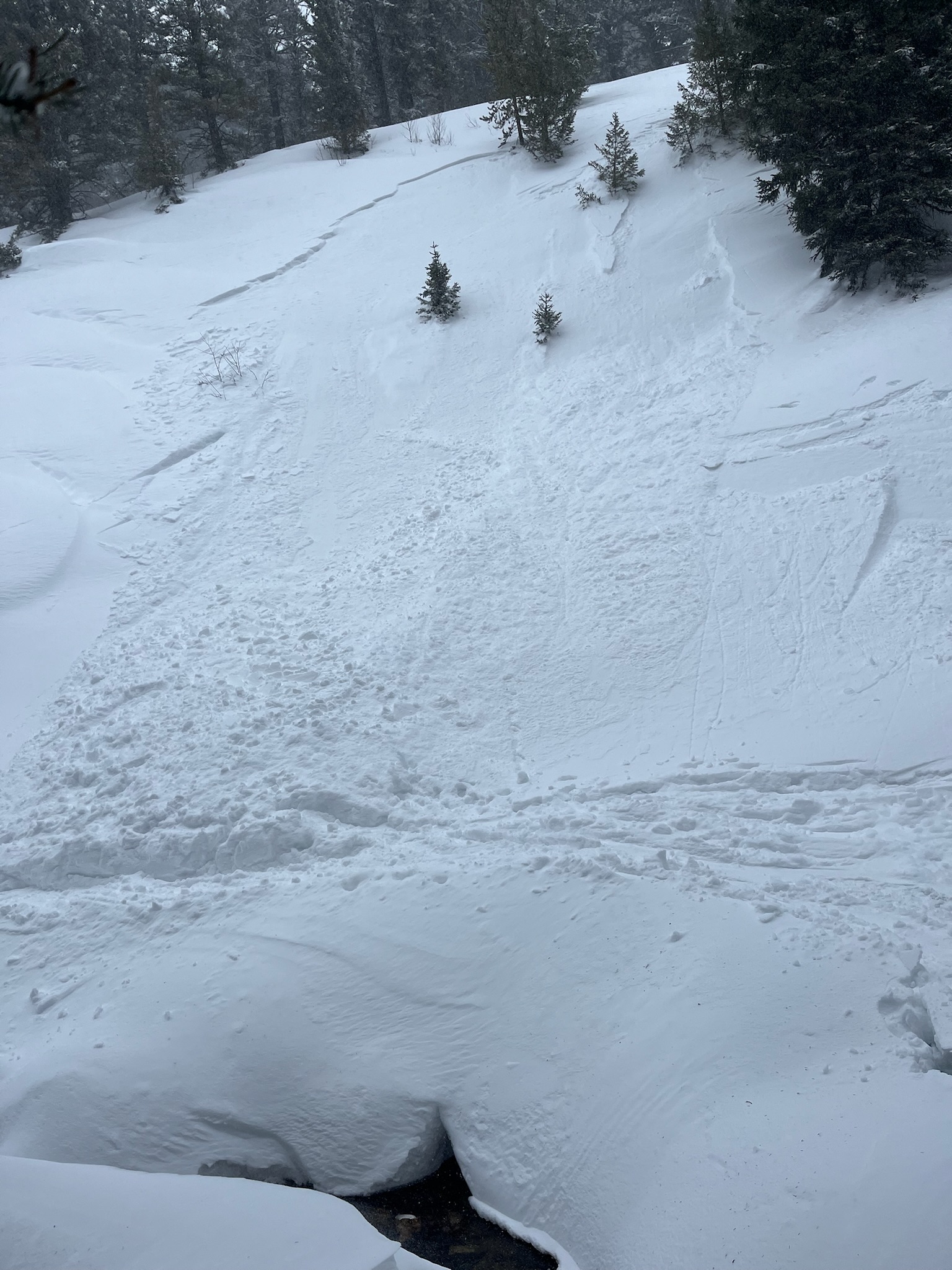
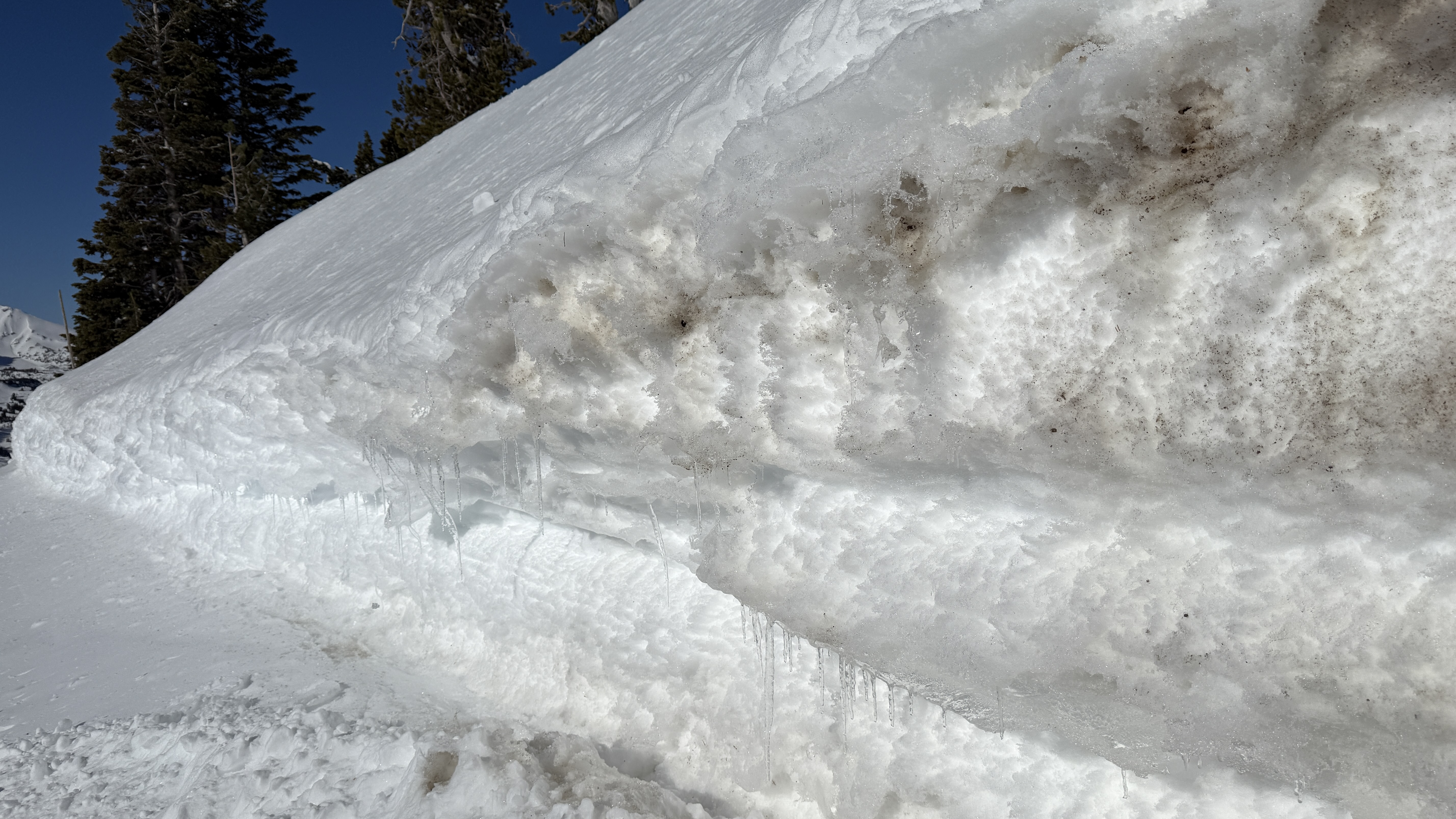
Riding in this morning, we saw this older wet slide on the Portal Creek road down low at about 6400' in elevation on a south facing slope by lots of exposed rocks. For reference, Gallatin River is 5800' in this area.
We didn't see any fresh ones on our way out at about 2:30.
The most likely places for big wet slides are slopes or areas with exposed rocks and cliffs. Generally these wet slides happen a little predictably in the afternoon as the snow gets wet. We know what time of day they'll happen, but it's hard to know exactly when they'll release, so watch out when the snow is obviously wet if traveling under slopes like this.
You don't need to worry about them in the morning, when the snow is frozen. What a nasty avalanche with sticks, rocks, and dirt in it?
Full Snow Observation Report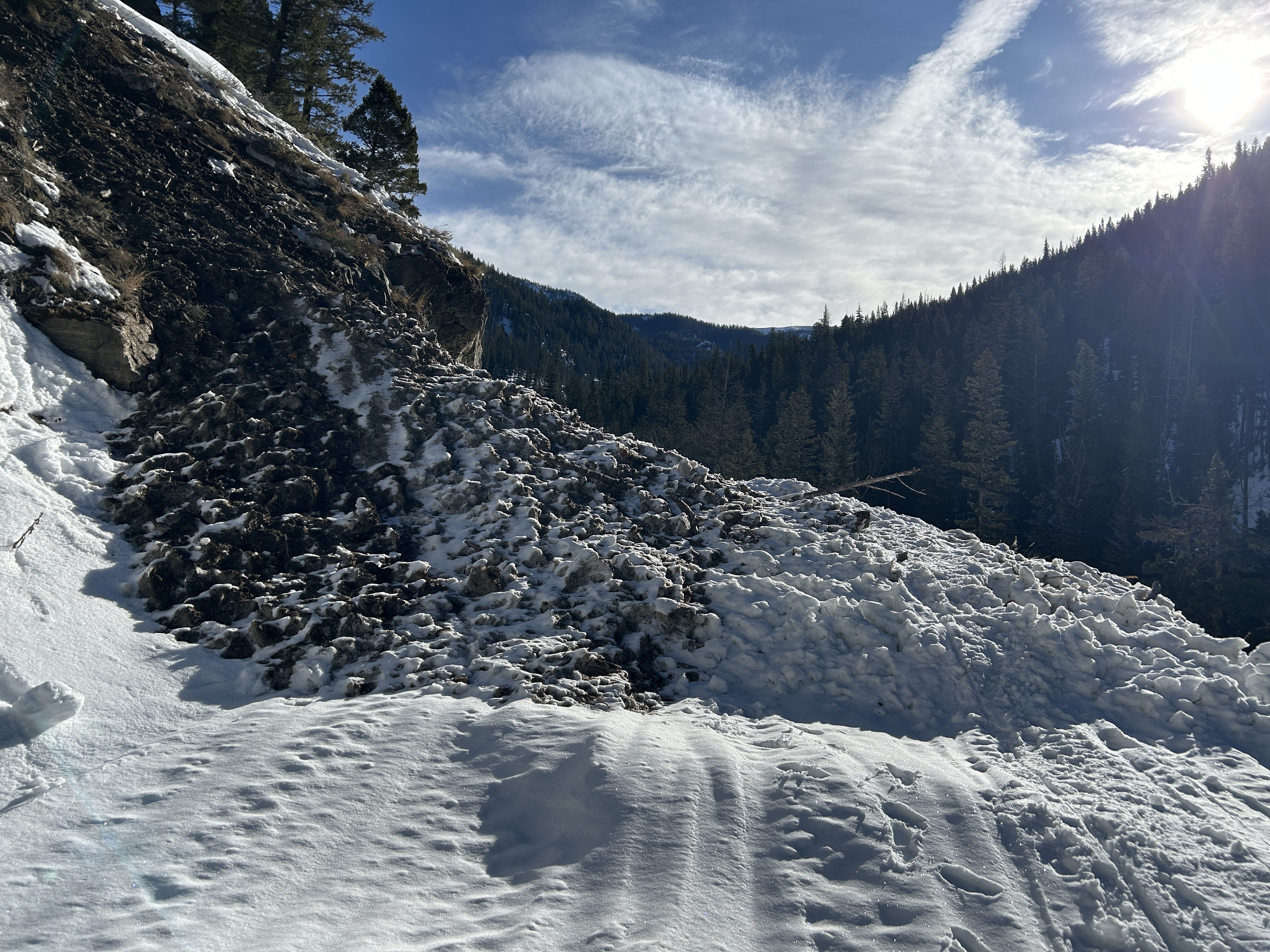
We got lucky in the Centennials with great snow and good visibility. There was about 20" of new snow from this weekend's storm. We covered 35 miles of backcountry riding and got eyes on a lot of avalanche terrain from lower elevation slopes, to Jefferson Bowl, the terrain in and above Hellroaring Creek, and East Hotel Creek. We didn't see any avalanche activity. However, we observed shooting cracks in drifts and triggered small wind-loaded slopes and cornices. So, human-triggered avalanches on wind-loaded slopes are likely.
We dug three quick pits but prioritized getting eyes on terrain over in-depth snowpack analysis:
Low-elevation slope on Sawtelle - NE @ 7600' on a slope with no wind effect: ECTX in a 160 cm deep pit
Above Hellroaring - S @ 8400' on a wind loaded slope: ECTP1 6" deep (wind slab) and ECTP21 20" deep (wind slab)
Arange - SW @ 8700' non-wind-loaded slope: ECTP21 20" deep on facets below a melt-freeze crust
Travel Advice:
- Avoid wind-loaded slopes
- While stability on non-wind-loaded slopes seemed good, it snowed a lot. So, I would either carefully assess for instability in the upper 3 feet of the snowpack with an ECT , or I would give it a few days to settle out before getting on steeper, non-wind-loaded slopes.
The danger was CONSIDERABLE on wind-loaded slopes (human-triggered avalanches likely) and MODERATE in non-wind-loaded terrain (human-triggered avalanches possible).
Full Snow Observation Report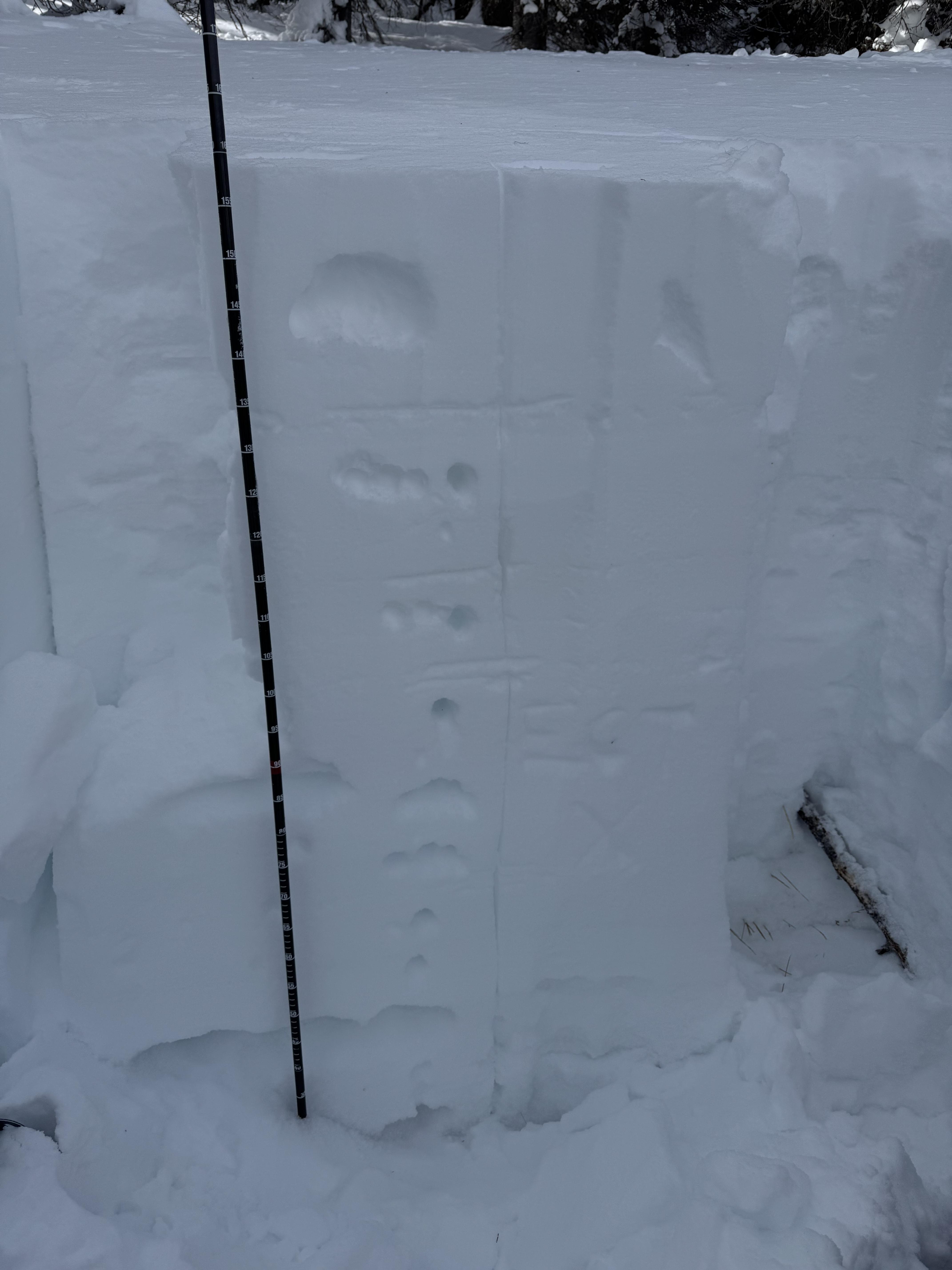

Two Point release avalanches on south slope ofTwo Top
Full Snow Observation Report
Wide spread layer of Surface Hoar mid and upper elevations Two Top area
Full Snow Observation Report
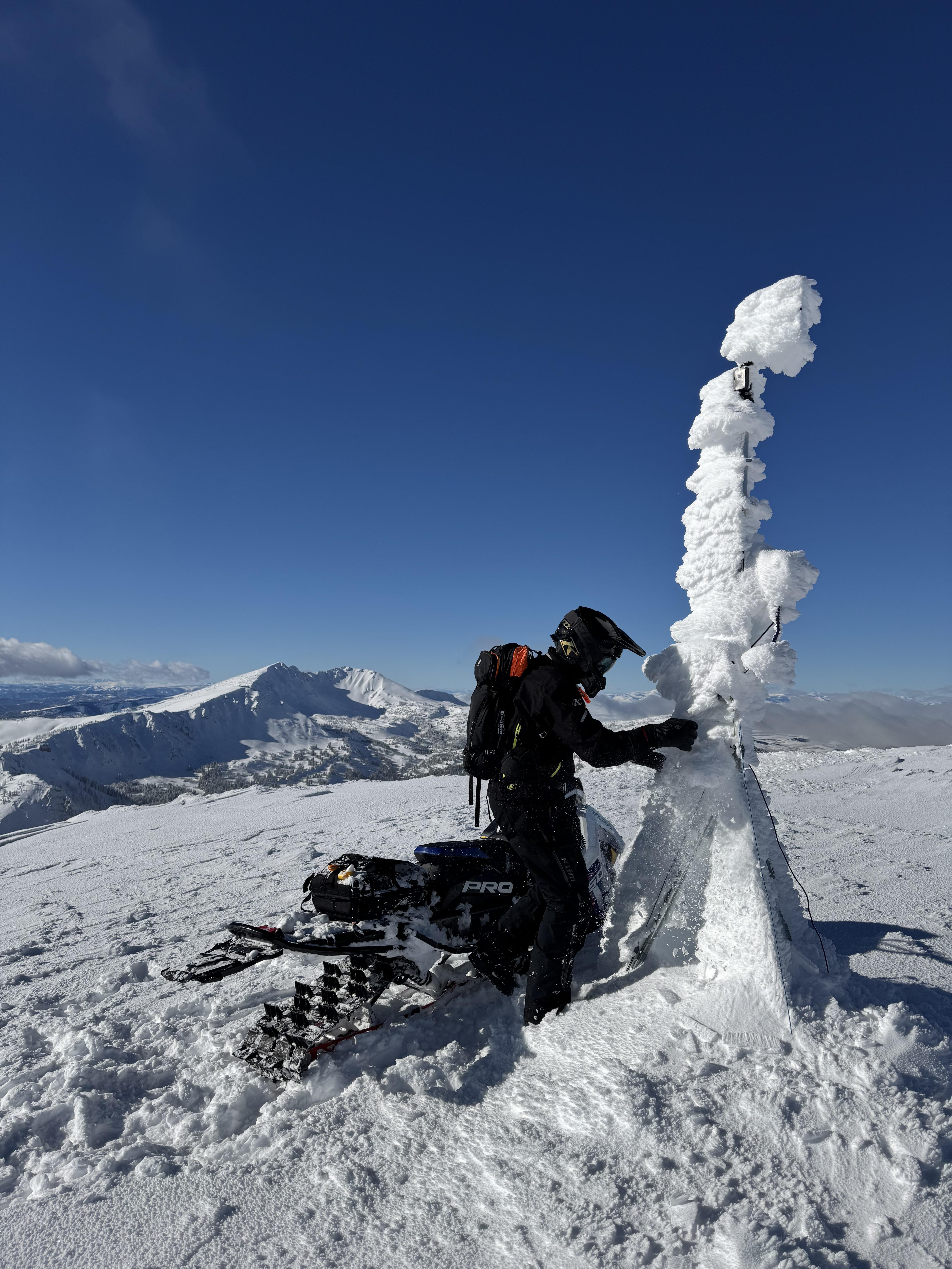
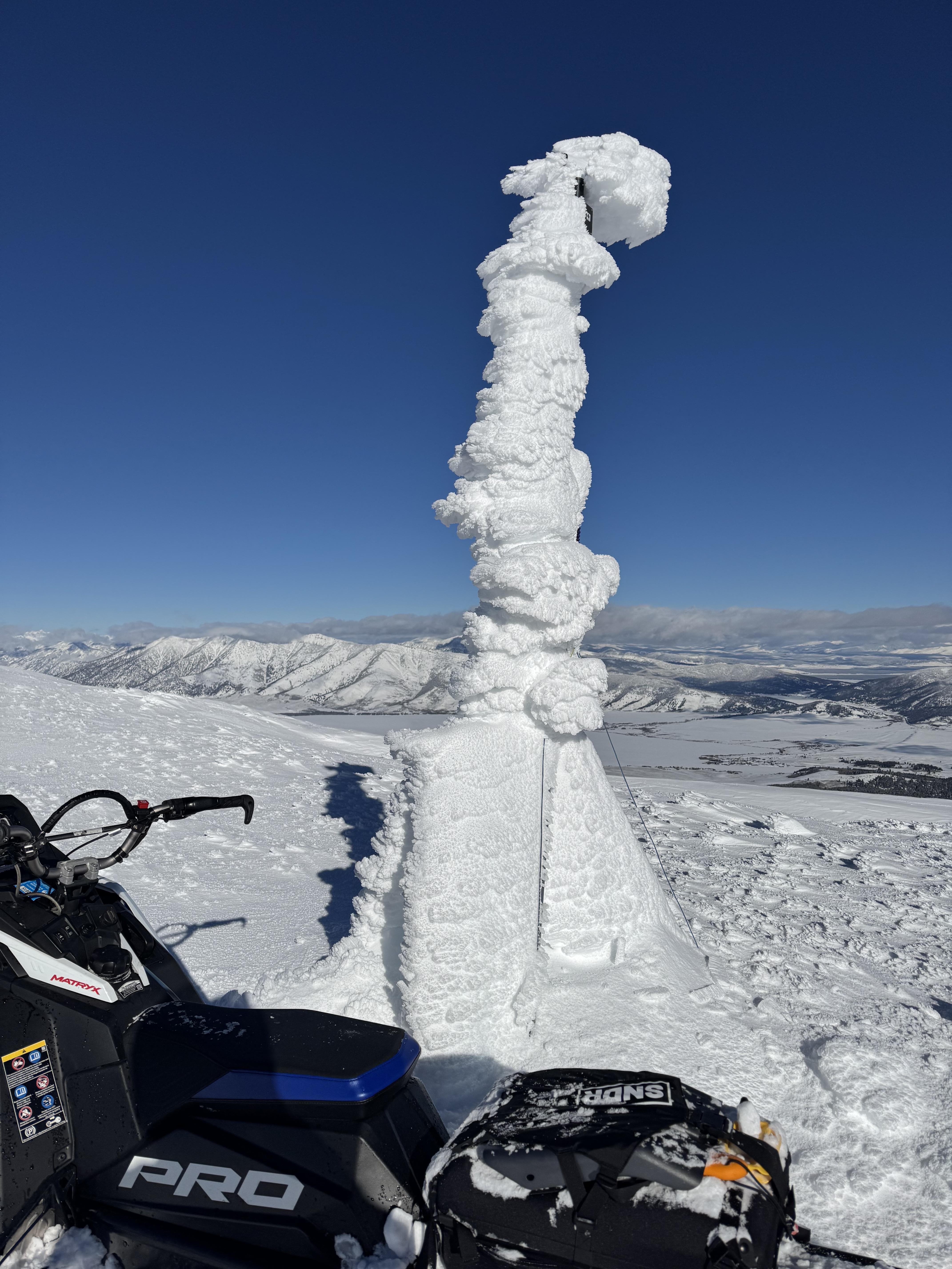
Drove up the road to the summit of Sawtell Peak for some weather station maintenance (it's back up and fully operational!).
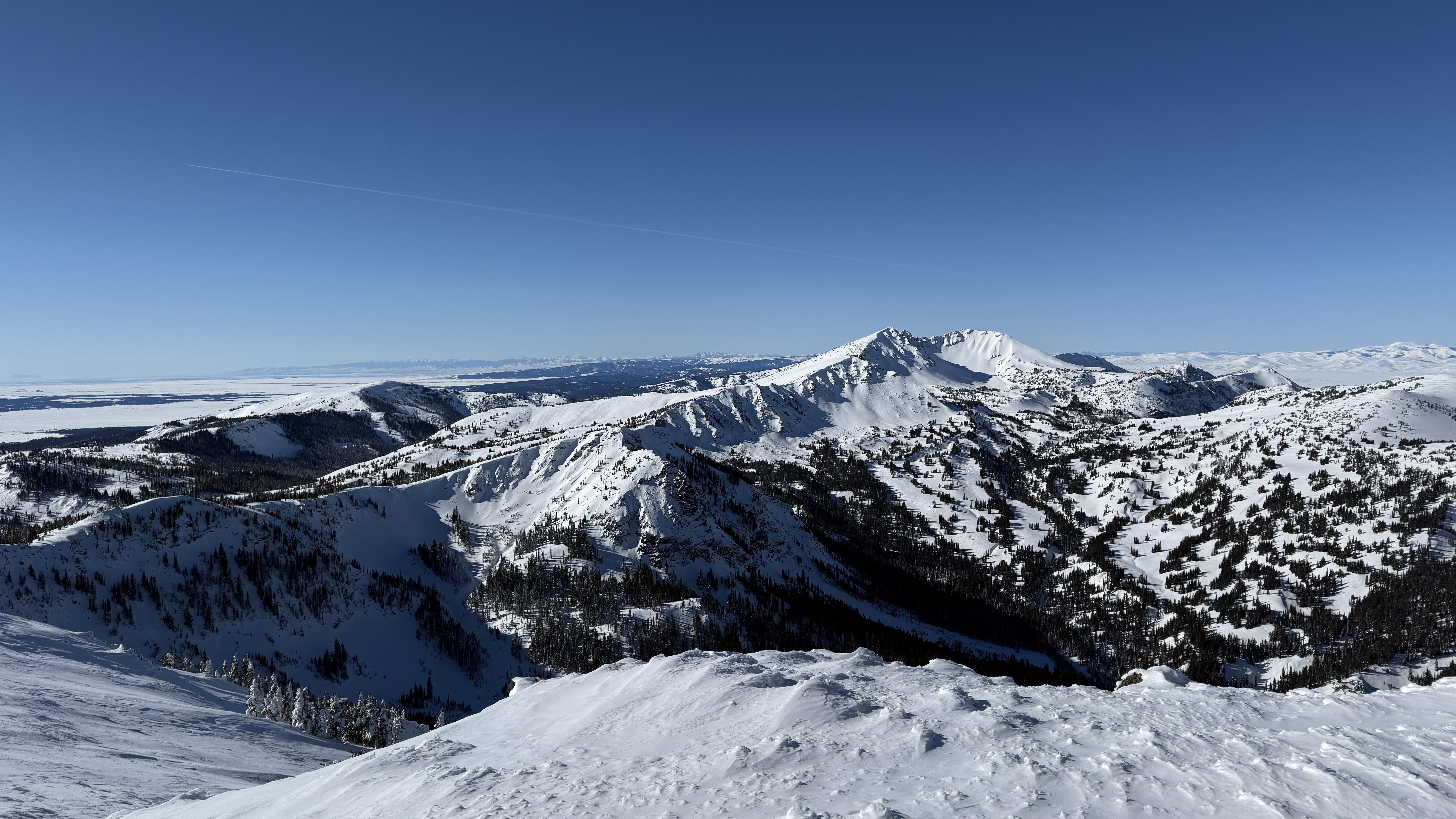
Had good views into the Centennial Mountains from the summit (Mt Jeffferson, Reas Peak, head of Yale Creek) and saw no signs of avalanche activity.
The top inch of the snowpack was moist on south facing slopes at 9800 ft around noon and there was water running out of the cutbank onto the road. A few roller balls were visible, but didn't see any other wet loose activity.
Full Snow Observation Report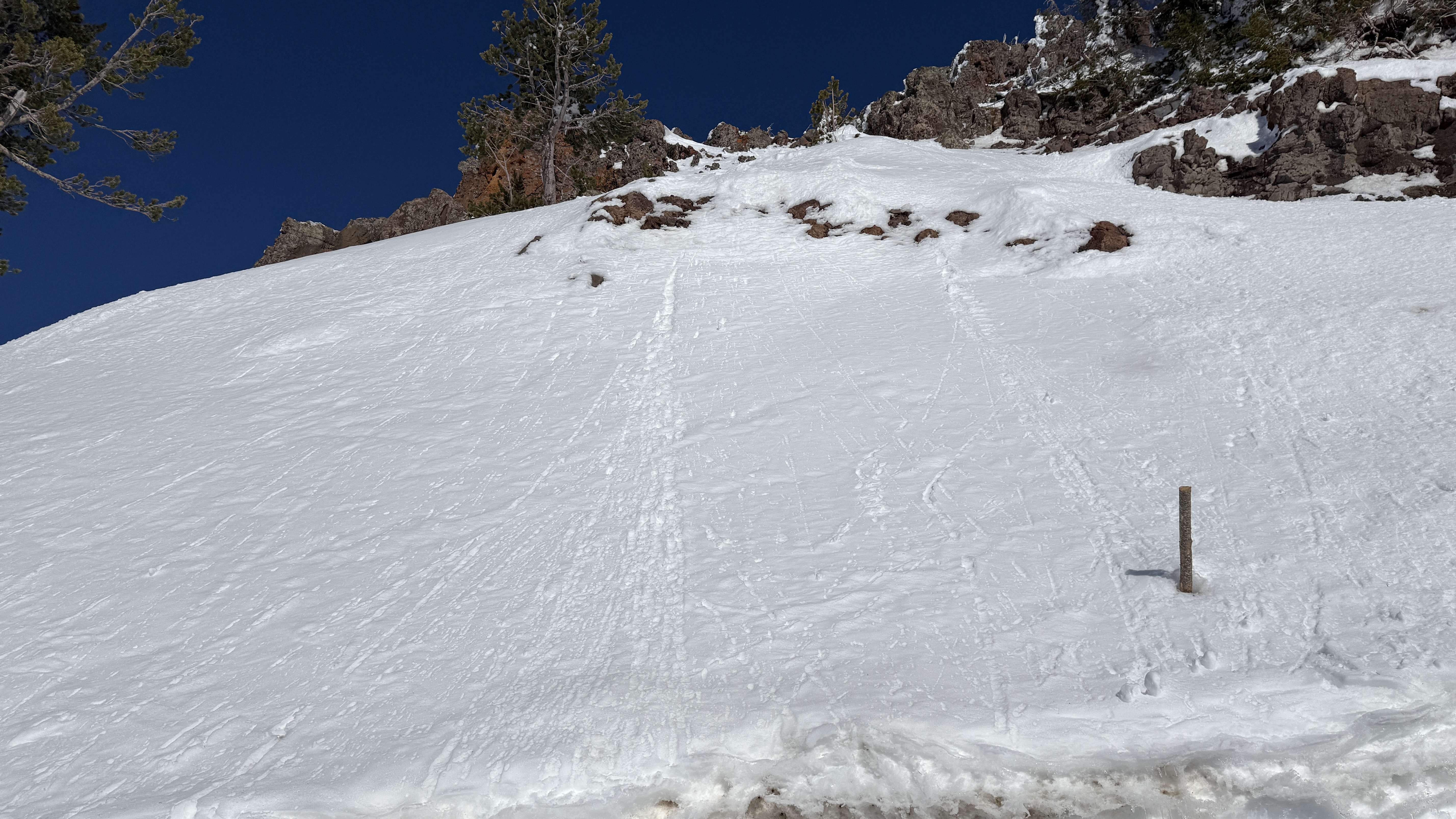
Toured up W. Facing terrain on Mt. Nemesis coming out of the hut. Full range of sun crust, rime crust, wind crust, and consolidated powder between SW to NW aspects. Snow structure felt consolidated and stable in most areas but became hollow and slabby in rocky terrain ~8,800’ . We turned back and found a lower angle path down to the skin track.
Full Snow Observation Report
We rode around the north and south sides of Mt Jefferson, and Yale Creek. The danger has definitely dropped and the snowpack has stabilized a lot since I was last here on New Year's Eve when we experienced big thunderous collapses. The peak instability was around the first week of January. We could see evidence of just a few slides from that time. All the snowfall during that time made conditions dangerous then....but stable now. Since Xmas eve, this area has received snow containing 4.5-6.5 inche of water.
Today we didn't see any recent avalanches. We didn't experience any collapsing or cracking. We had stubborn stability tests with columns that took a lot of hard hits to break even where the snowpack was thinner.
I'm not ready to climb up steep chutes on Jefferson, but I'm feeling really comfortable in many other areas - especially places with a 5-6 ft deep snowpack.
Winds were moving a little snow. One wind slab/drift produced a shooting crack but we couldn't get any others to crack.
Full Snow Observation Report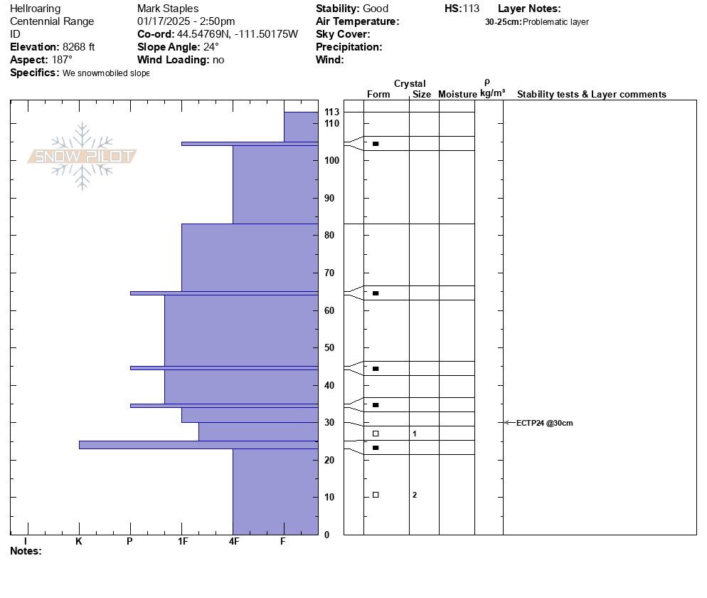

18 inches of powder at the East Fork Divide. Overall, found about 4 feet of snow. Rocks lurking slightly under the snow surface in some areas. Base was pretty solid - a surprise. There is a faceted layer at the bottom but the snowpack was pretty consolidated and fun to ride with good traction. Did not see any fissures or cracks in slope and dust feel any collapsing slabs during the ride.
Full Snow Observation Report
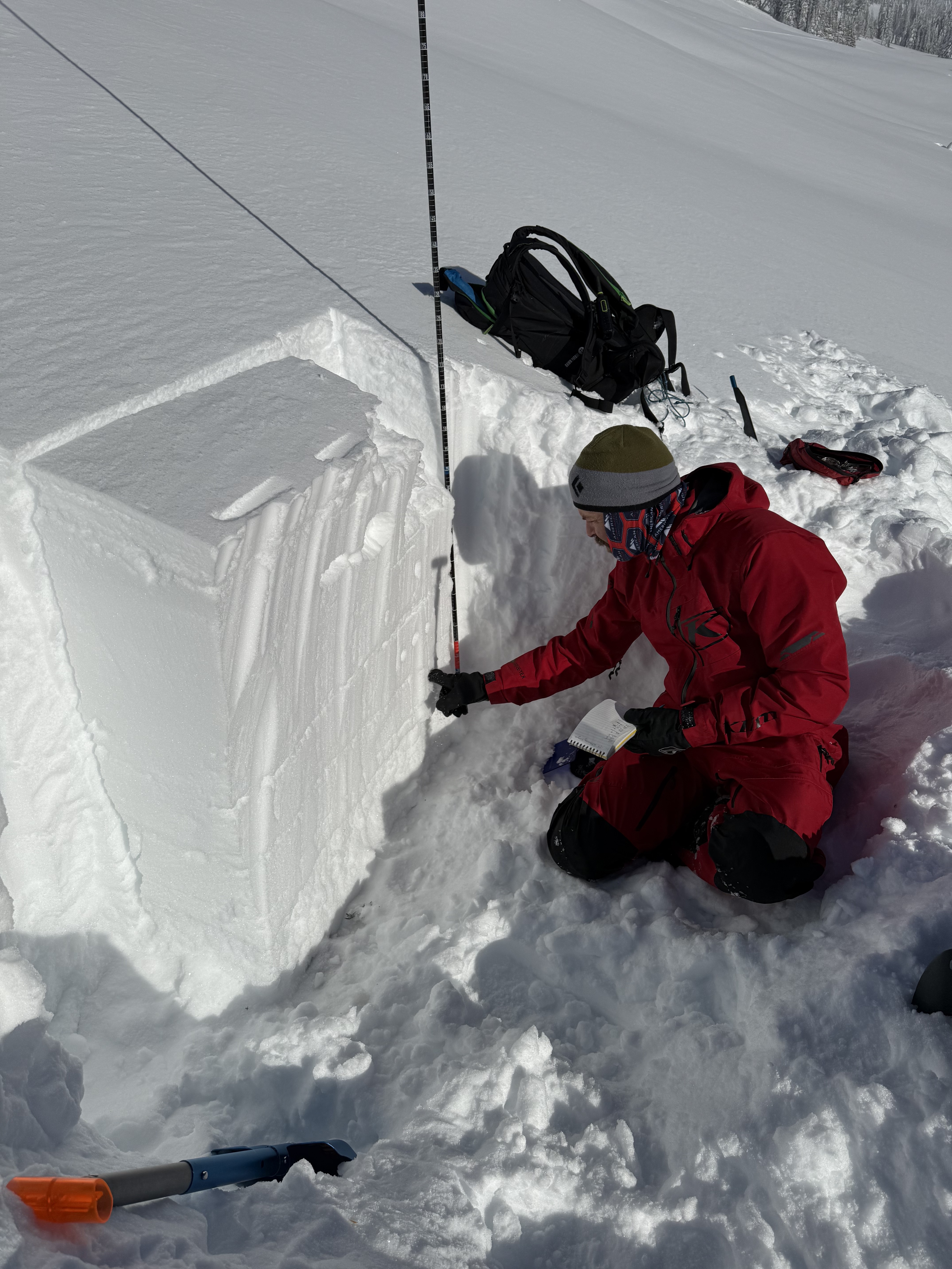
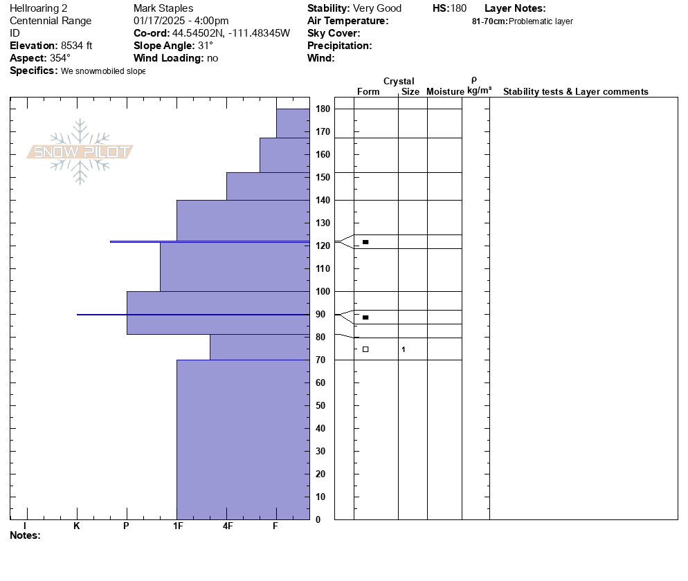
We spent the last two days in the Centennials. On Wednesday, we rode up to the vehicle shop, into Yale drainage, over to Hellroaring, and across the backside to the East Hotel Creek overlook. On Thursday, we went to our weather stations for repairs and visualized much of the range from the top of Sawtelle.
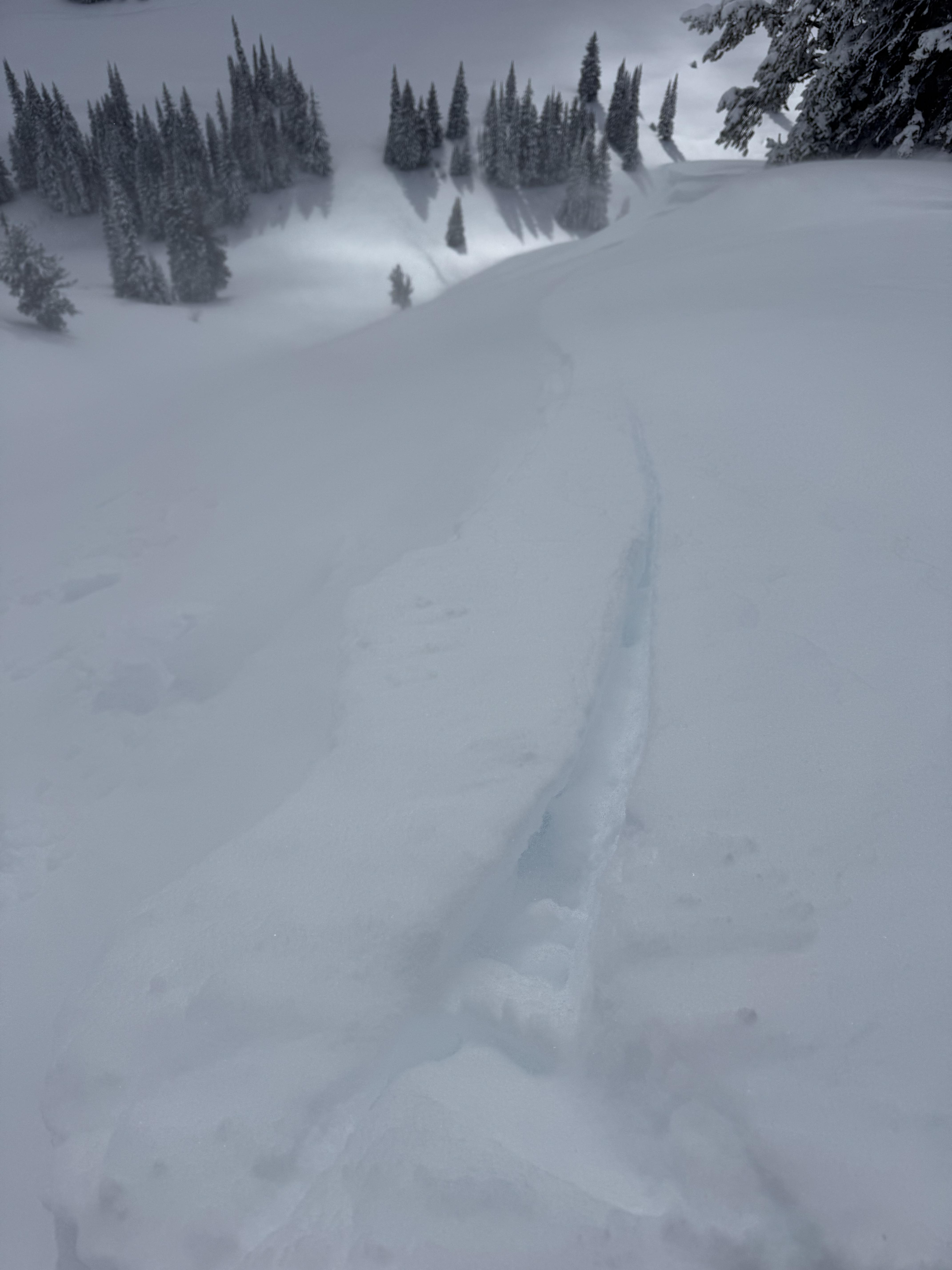
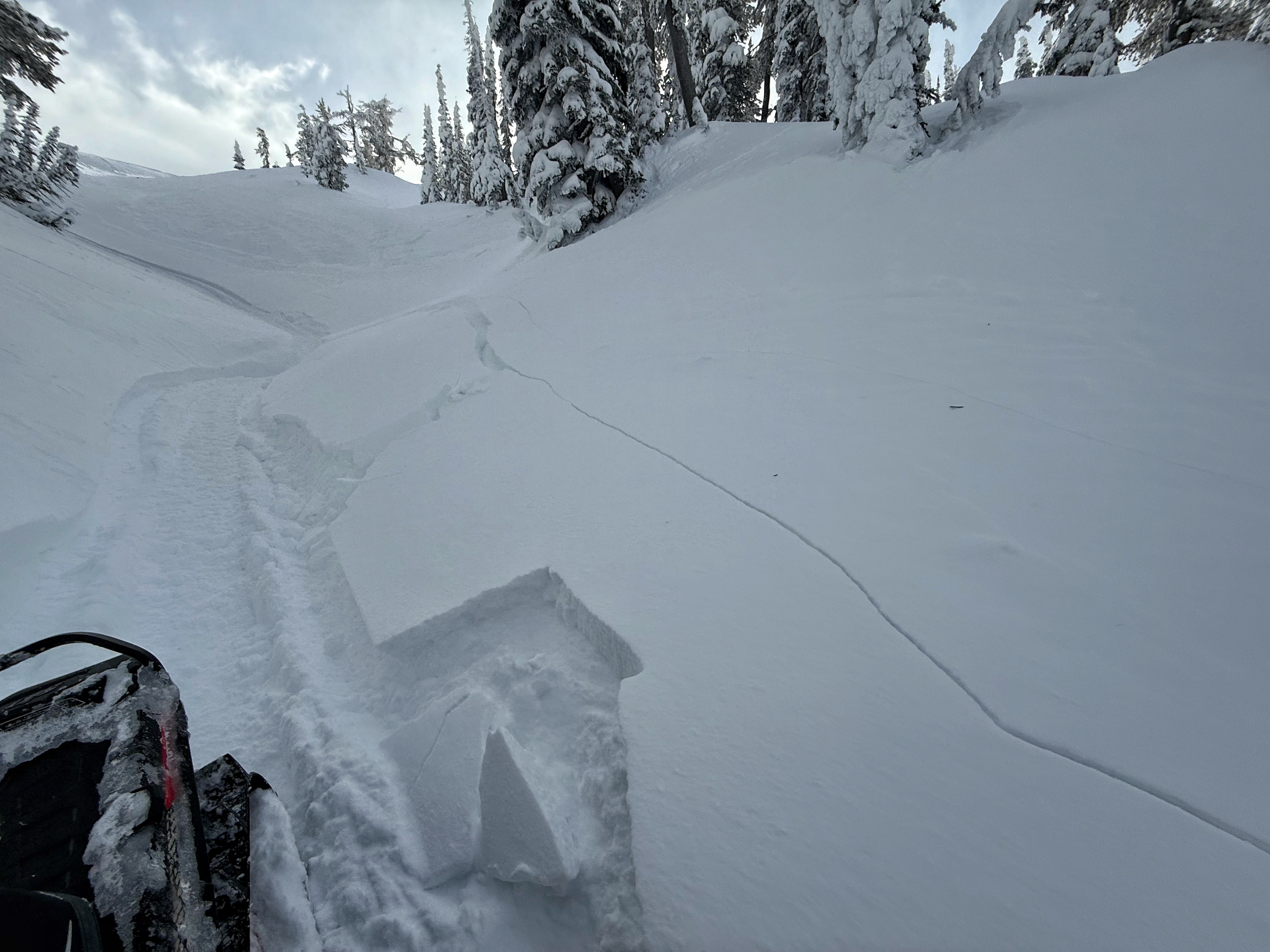
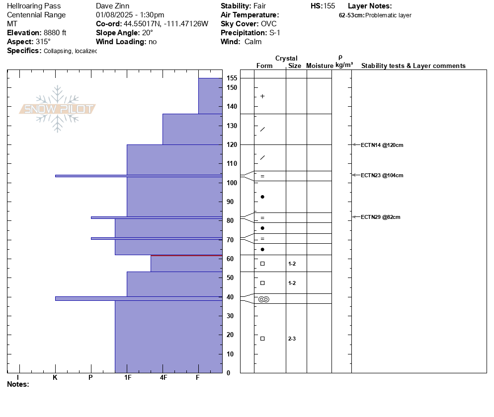
Day one focused on snowpack analysis as it was lightly snowing for most of the day S- -1 with 2-3" of accumulation throughout the day, and we did not have much for long-distance visibility. We triggered two collapses in a creek bed when someone (I) was stuck while riding toward East Hotel. We were able to see the smaller avalanche paths along Yale and the only slide was a R1, D1 cornice collapse. We dug on a north-facing slope at the pass over to Hellroaring Creek. The facet layer of concern is now buried a meter deep (4F+ hardness) with an ECTX on this layer. Total HS of 155 cm. We got ECTNs 14-29 on the three rain crust layers formed during the last storm cycle.
The south-facing pit overlooking East Hotel was a bit shallower, 125 cm HS. ECTP30 on a crust facet combo mid-snowpack and an extra-curricular ECTP31 on the facets that we have been primarily discussing this season.
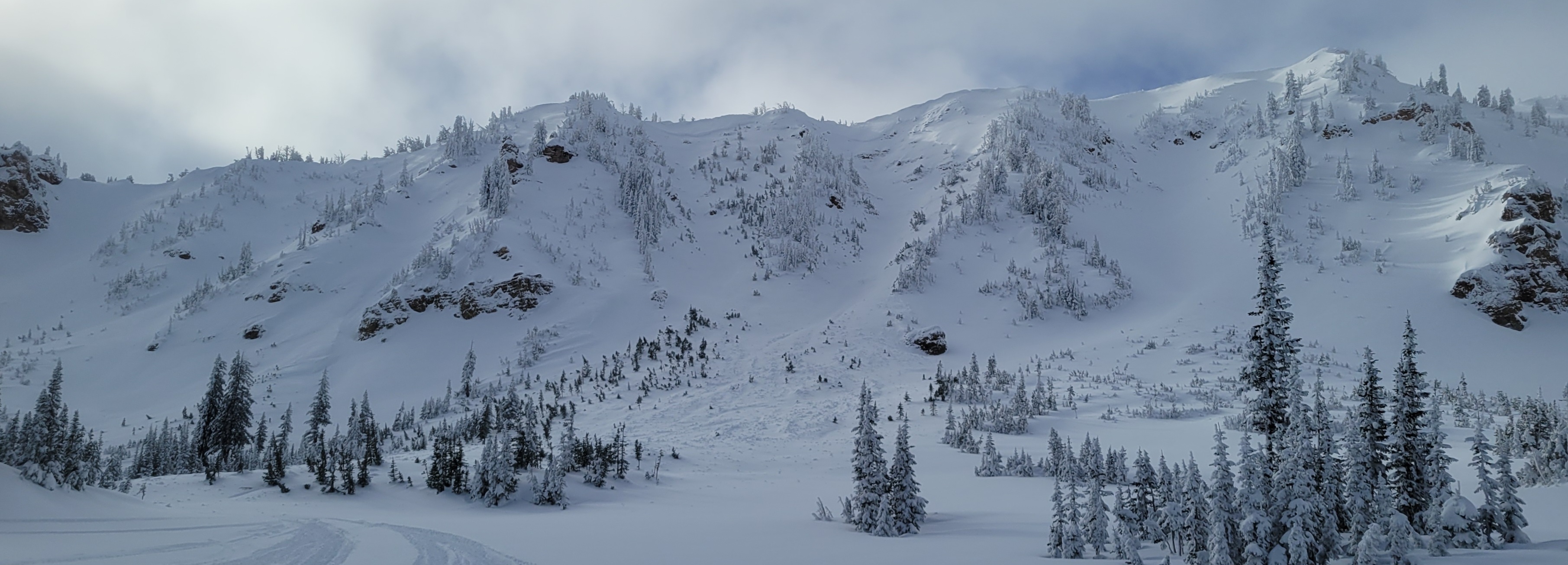
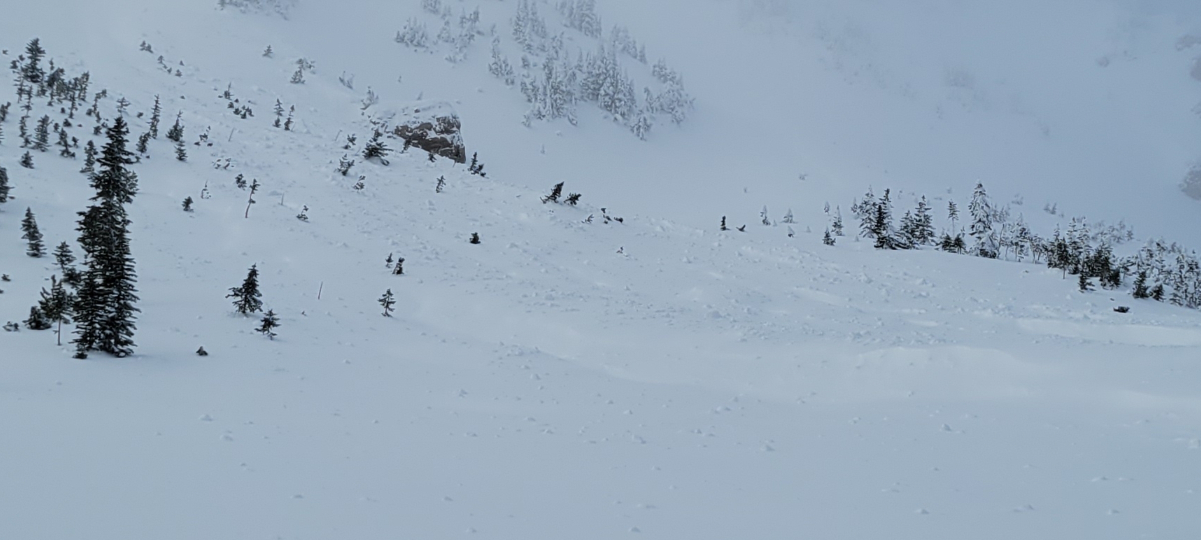
On day two, we got up high, overlooked many avalanche paths, and saw only the slide that Randy Gravett (Rescue Randy) had previously reported in Mt. Jefferson Bowl.
The collapse and the snowpack structure indicate the potential of triggering an avalanche, but the likelihood has gone down. Given the depth of the weak layers, I am not confident that the snowpack assessment will provide full and accurate information. If folks are starting to push into avalanche terrain, my emphasis is to stick to paths that are less likely to avalanche (sheltered from the wind and less steep) and paths that have lower consequences (smaller slopes with clean runouts). As always, safe travel practices.
If people don't want to mess with the uncertainty of avalanche terrain right now, conditions are fantastic on many slopes less than 30 degrees.
Full Snow Observation Report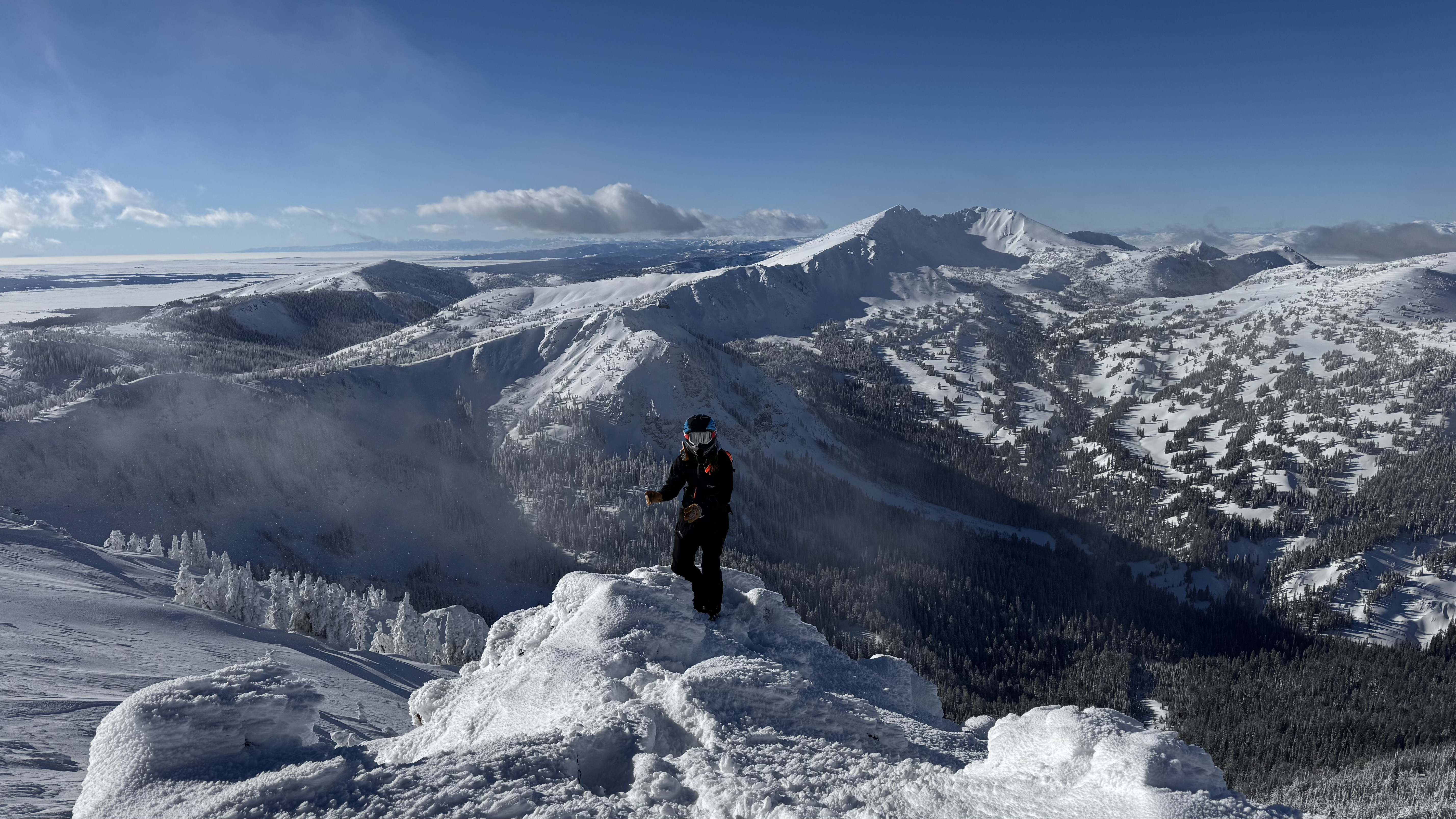

Almost constant Whumphing at higher elevation. Saw couple days old avalanche on a windloaded east north east facing slope. This area in known as Yahoo.
Full Snow Observation Report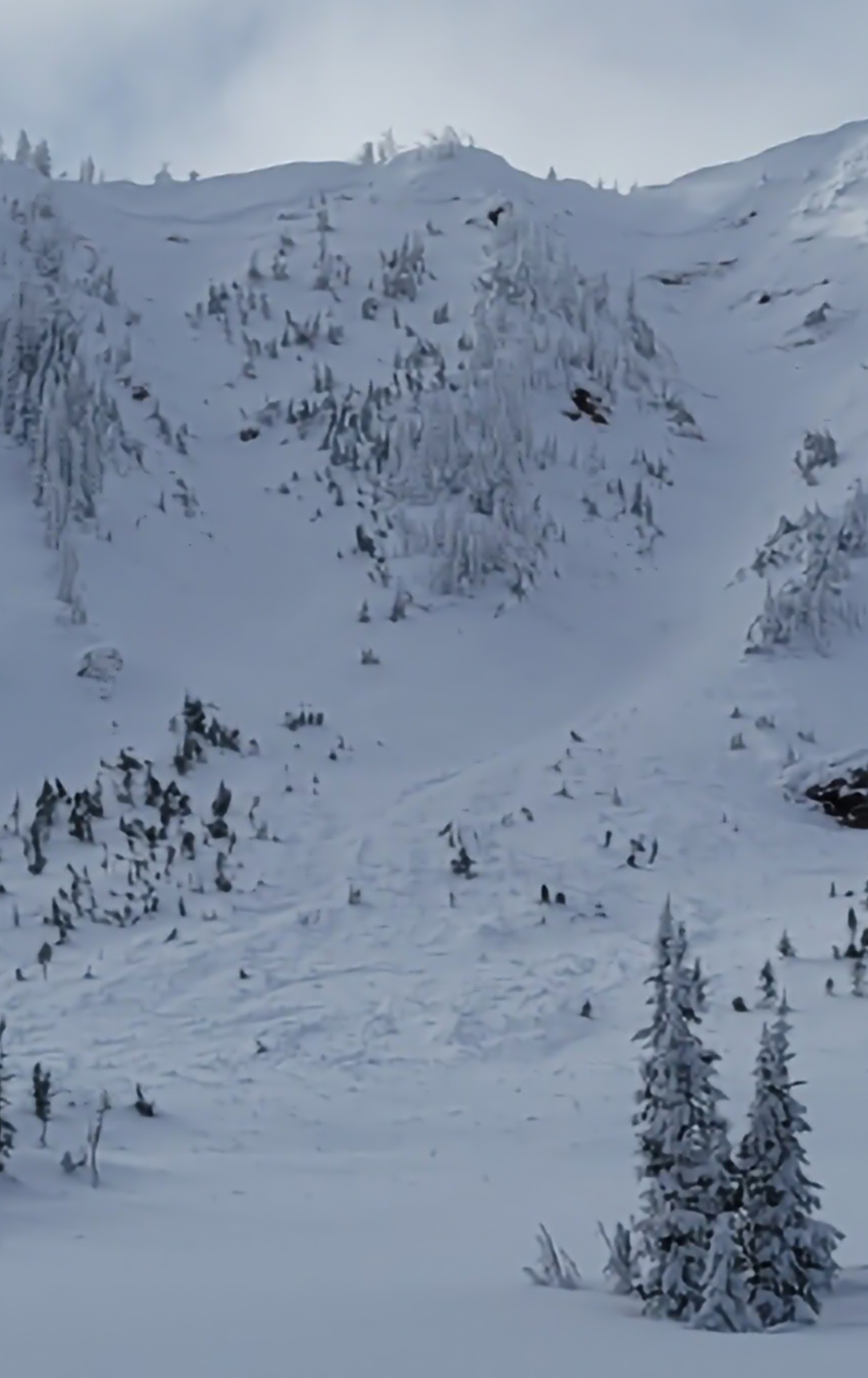
Felt two very large whoomps (collapsing) just off the big springs/two top trail. They happened in the same spot 5 minutes apart.
Full Snow Observation Report