Photos
|
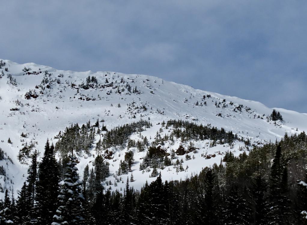
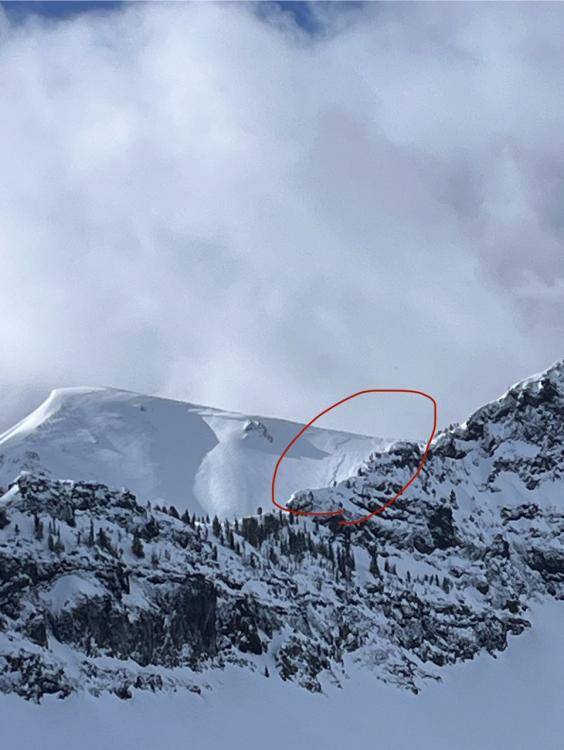
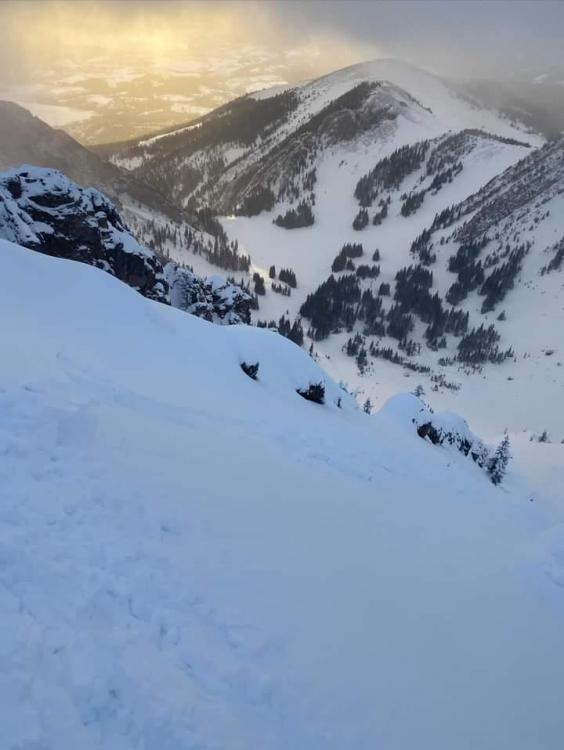
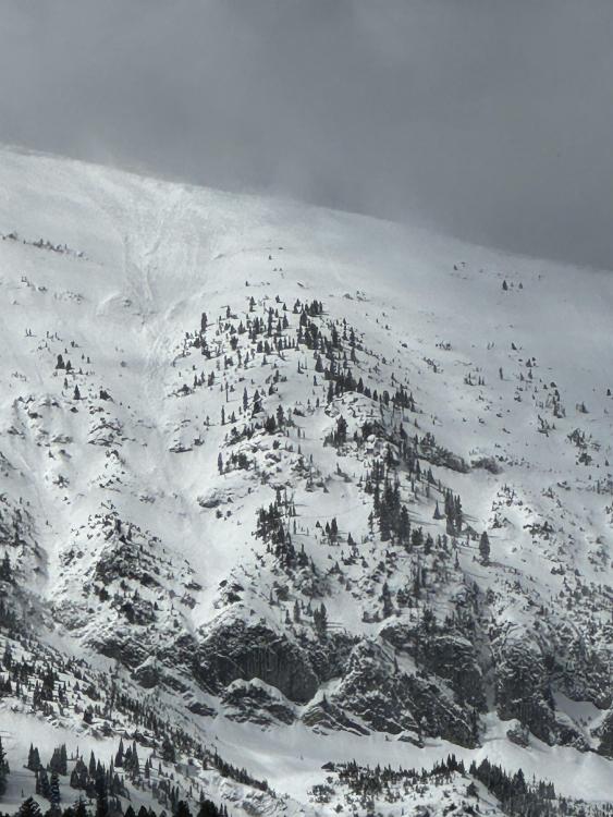
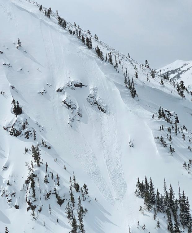
Northern Gallatin, 2024-03-30 We toured up to Flanders Mtn and saw a big, deep 2-6' deep avalanche that broke 300-500' wide in weak snow at the bottom of the snowpack. It broke across two separate start zones and included a lower angle ridge (still around 30 degrees) in between that slid. E-NE aspect at 9,800'. HS-N-R3-D3-O. Photo: GNFAC
Link to Avalanche Details |
|
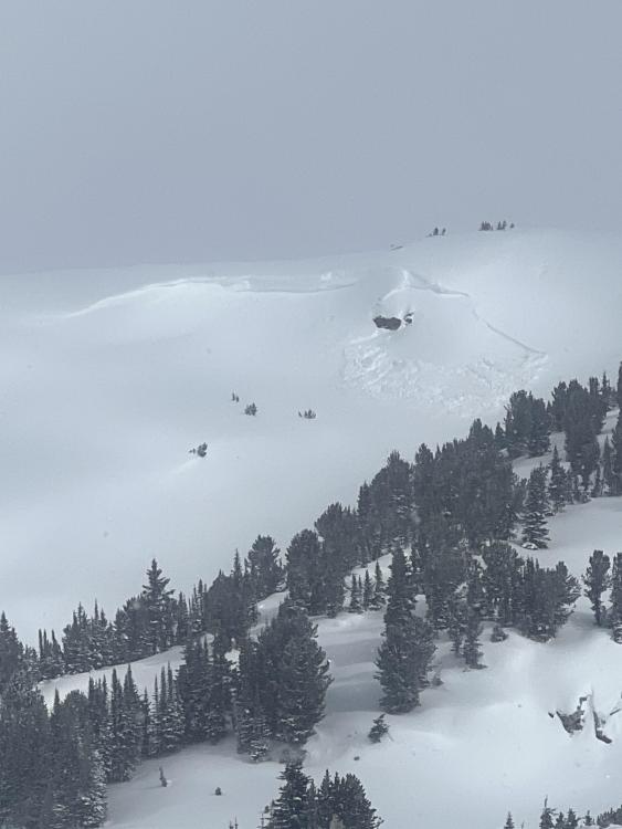
Northern Gallatin, 2024-03-30 Skiers on 03/29/2024 saw this small avalanche on Hyalite Peak that had likely happened early that morning or the day before. Photo: W. Hubbard Link to Avalanche Details |
|
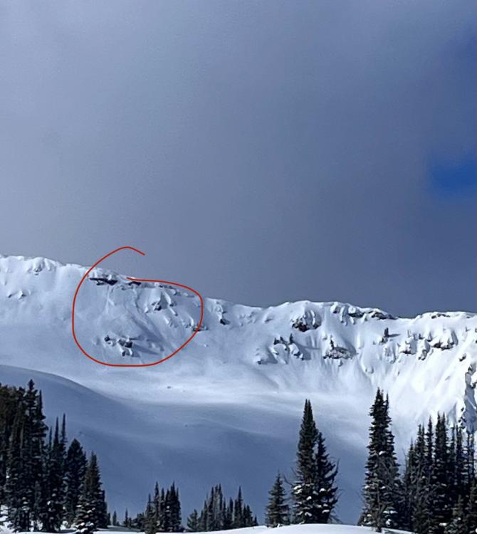
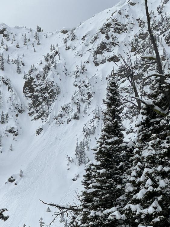
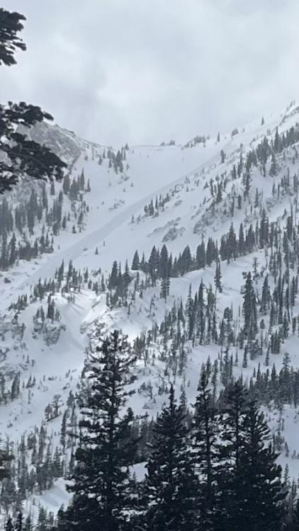
Northern Gallatin, 2024-03-29 From obs: "Spotted this big guy on the east face of Blackmore today. Seemingly natural and I believe it occurred in the last 36 hours or so. Debris had last nights snow on it. I’d estimate it at D2." Photo: E. Heiman Link to Avalanche Details |
|
Northern Gallatin, 2024-03-29 From obs: "Spotted this big guy on the east face of Blackmore today. Seemingly natural and I believe it occurred in the last 36 hours or so. Debris had last nights snow on it. I’d estimate it at D2. " Photo E. Heiman Link to Avalanche Details |
|
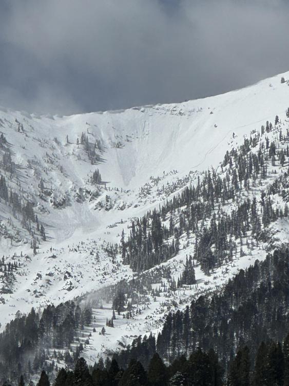
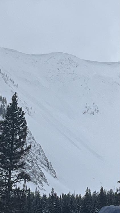
Northern Gallatin, 2024-03-29 Skiers on 03/29/2024 saw this avalanche on the N face of Hyalite Peak from Divide Cirque. This avalanche likely occurred in the last 24 hours. Photo: E. Webb Link to Avalanche Details |
|
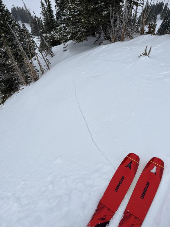
Northern Gallatin, 2024-03-29 On 03/29/2024 skiers saw this recent avalanche on a NE aspect in the Divide Cirque at 9800'. This likely happened in the last 24 hours. Photo: E. Webb Link to Avalanche Details |
|
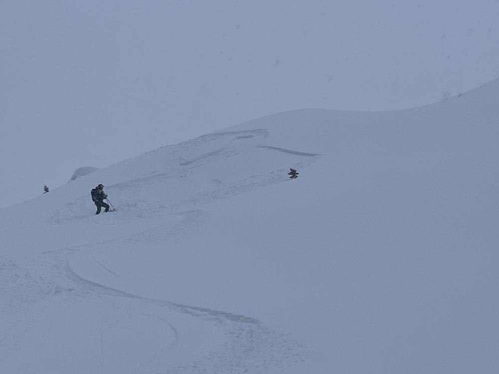
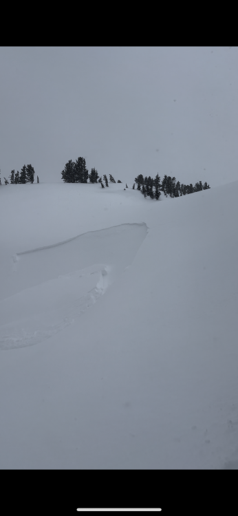
Cooke City, 2024-03-28 We triggered this small avalanche on a steep windloaded rollover on an otherwise mellow slope. This avalanche was 15-20' wide, 8" deep, and ran for about 30-40 vertical feet. The skier easily skied away from the slide and was not caught. Photo: GNFAC Link to Avalanche Details |
|
Bridger Range, 2024-03-28 From IG: Very touchy on Hollywood wall this morning. All slopes easily propagated 4-6” deep on a firm bed surface. Most were less than 50’ wide with the exception of the slide in the couloir which propagated down the entire couloir, maybe 500’ wide, and ran through the exits into the main bowl. Link to Avalanche Details |
|
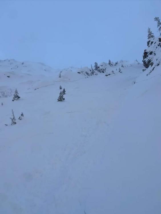
Cooke City, 2024-03-27 From obs: "skiing north of cooke city today observed this Small windslab on a South facing slope ~9800 ft." G. Roe Link to Avalanche Details |
|
Bridger Range, 2024-03-27 There was a small wind-slab release out of Gibbs (I think), I suspect skier triggered, but I could make out a track. Photo: GNFAC Link to Avalanche Details |
|
Bridger Range, 2024-03-27 On our drive home we saw, what I assume were, natural wind-slab avalanches on Quarter Saddle (looked like a cornice collapse) and in Argentina Bowl. Bridger Peak was obscured by heavy wind-loading. Photo: GNFAC Link to Avalanche Details |
|
Bridger Range, 2024-03-27 On our drive home we saw, what I assume were, natural wind-slab avalanches on Quarter Saddle (looked like a cornice collapse) and in Argentina Bowl. Bridger Peak was obscured by heavy wind-loading. Photo: GNFAC Link to Avalanche Details |
|
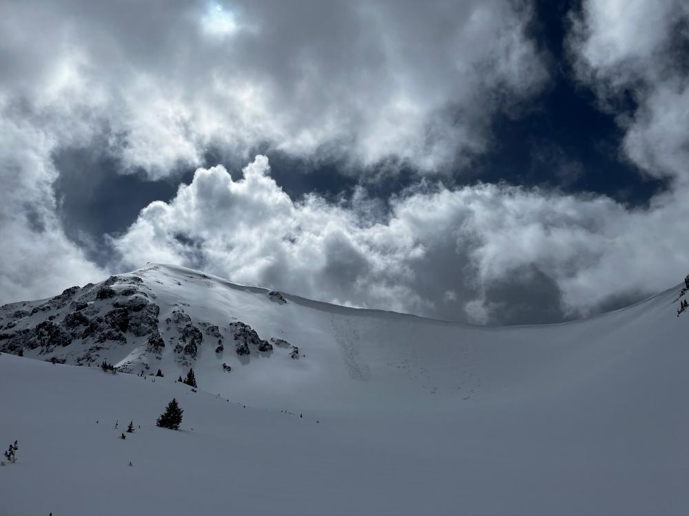
Bridger Range, 2024-03-27 The wind was transporting significant amounts of the recent snow at high elevations. This is Naya Nuki loading as seen from the Ramp. Photo: GNFAC |
|
Bridger Range, 2024-03-27 The wind was transporting significant amounts of the recent snow at high elevations. This is Saddle Peak loading as seen from the Ramp. Photo: GNFAC |
|
Cooke City, 2024-03-26 Skiers triggered this small windslab while skinning near a steeprollover at the top of an East facing slope above Zimmer Creek. Crown was ~20 ft wide and ran a similar distance. 2"-10" at the deepest. Photo: G. Roe Link to Avalanche Details |
|
Bridger Range, 2024-03-26 Skiers in Frazier Basin triggered several small wind slabs and saw widespread cracking on NW-facing terrain. Photo: C. Bayles Link to Avalanche Details |
|
Bridger Range, 2024-03-26 From obs: "Saw small avalanches on almost every wind loaded slope out of fairy lake. The one we spotted in the pomp twins had a defined crown roughly 100ft across." J. Alford Link to Avalanche Details |
|
Bridger Range, 2024-03-26 From obs: "Saw small avalanches on almost every wind loaded slope out of fairy lake. The one we spotted in the pomp twins had a defined crown roughly 100ft across." J. Alford Link to Avalanche Details |
|
Cooke City, 2024-03-26 Skiers south of Cooke City saw a recent likely cornice-triggered avalanche on a northeast face. During their tour, they saw a small part of the same cornice fall off and trigger another small avalanche. Photo: B. Daley Link to Avalanche Details |