Photos
|
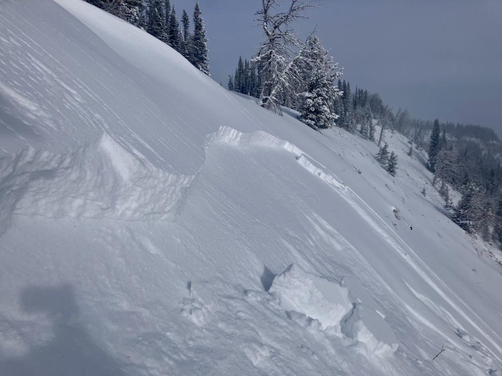
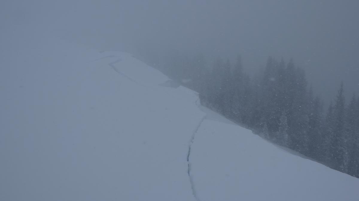
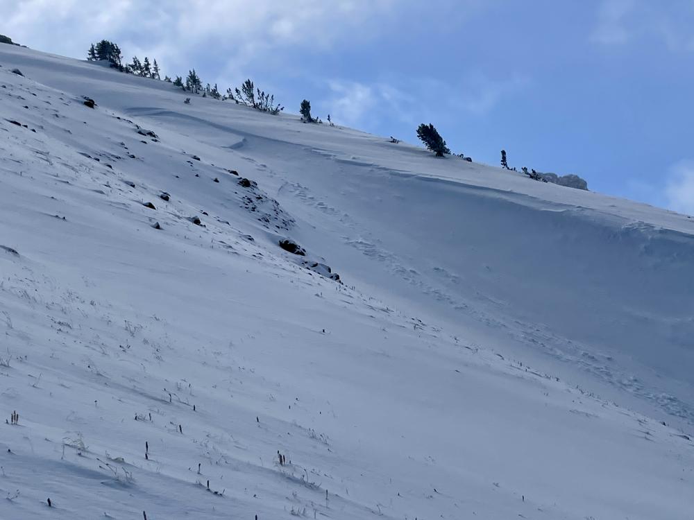
Southern Madison, 2024-01-11 The crown of a remotely triggered avalanche in Sunlight Basin. Photo: GNFAC Link to Avalanche Details |
|
Southern Madison, 2024-01-11 Remotely triggered avalanche in Sunlight Basin while walking along a flat ridge. Photo: GNFAC Link to Avalanche Details |
|
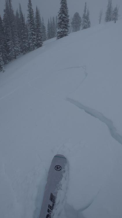
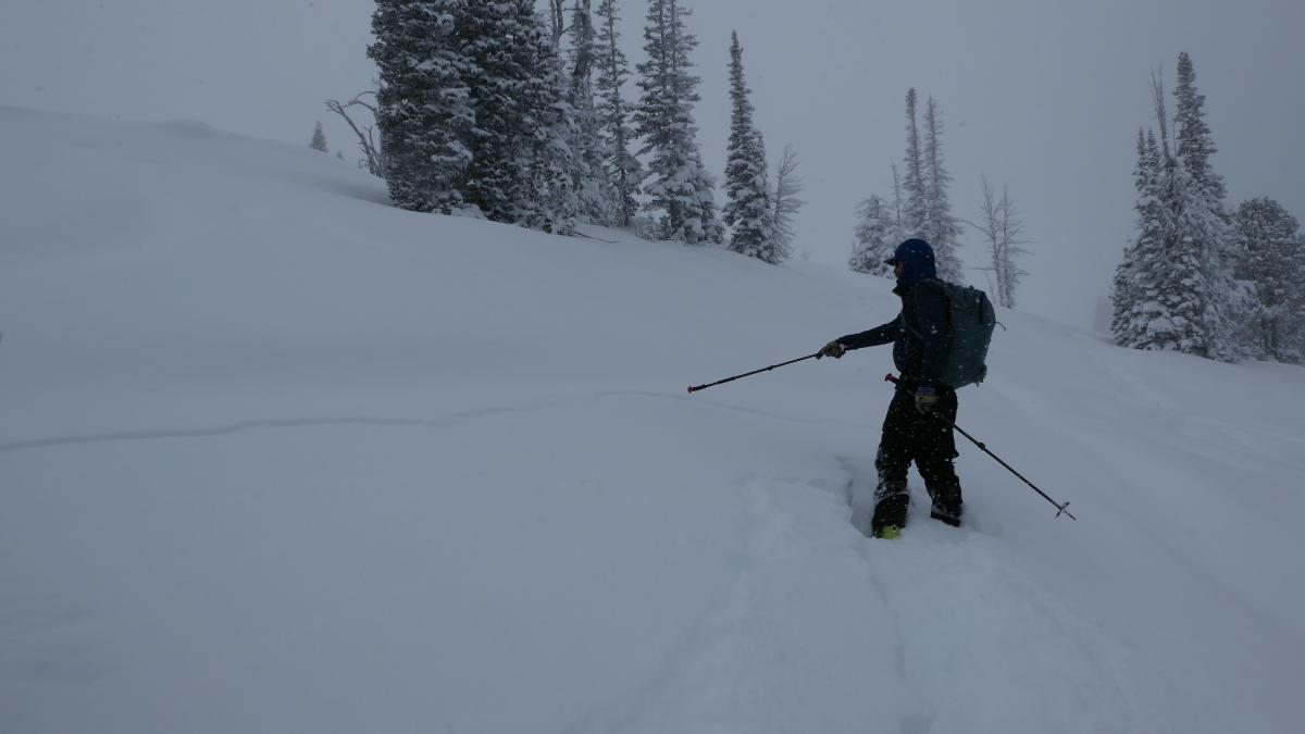
Southern Gallatin, 2024-01-11 Cracking at Fawn Pass this was accompanied by multiple collapses during the tour. Photo: S. Reinsel Link to Avalanche Details |
|
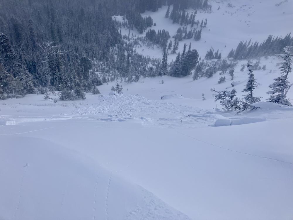
Northern Madison, 2024-01-11 Our lower ridge has not been controlled or touched yet this year so very indicative the backcountry snowpack. It released sometime before the morning of Jan 10. Photo: YCSP Link to Avalanche Details |

|
Northern Gallatin, 2024-01-10 From Obs: "While skiing one of our intended slopes, one of my partners skied over a small rollover and as he arrived at the bottom of the small slope a pocket had released above him and stopped just above where he was standing. The culprit was again the recent snow on top of older faceted snow." Photo: Anonymous Link to Avalanche Details |
|
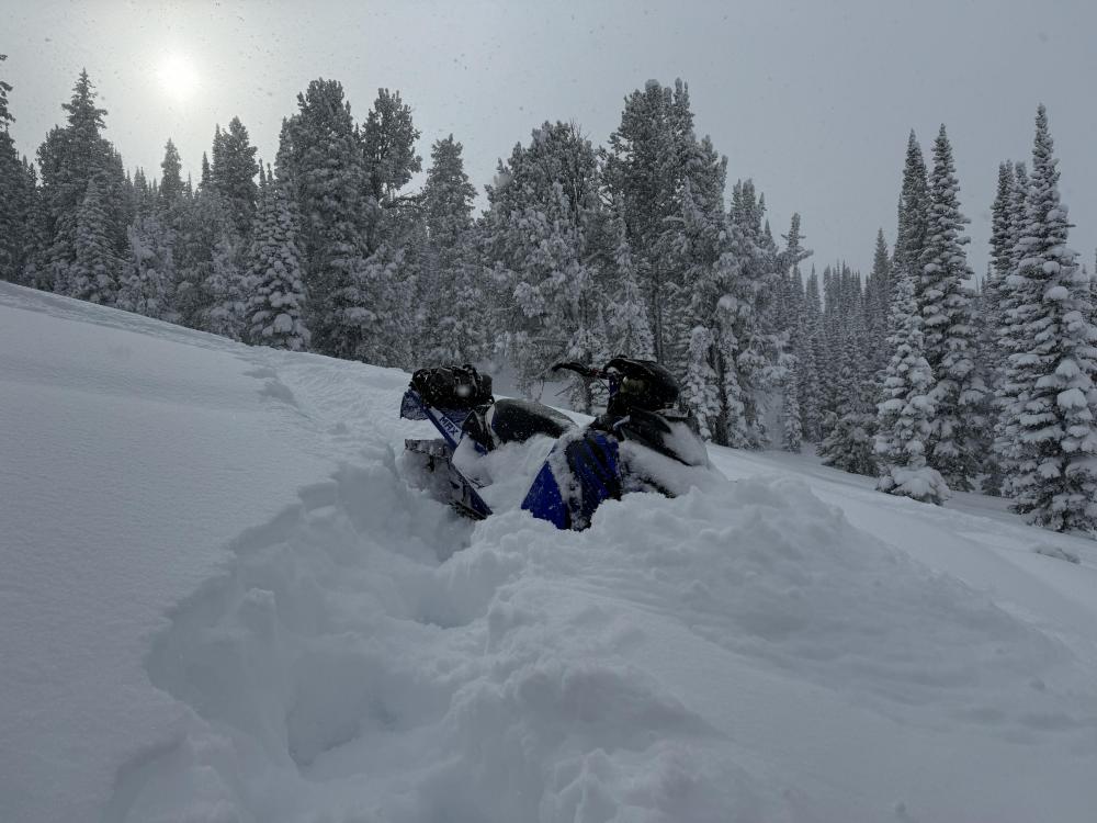
Northern Gallatin, 2024-01-10 Wind loaded gully above Crypt Orchid in Hyalite. Photo: T Hughes Link to Avalanche Details |
|
Northern Madison, 2024-01-10 We then dug on a east-facing slope to the north of the Beehive/Bear cornices and found 105 cm of snow and a 1 foot deep slab that broke in our test as an ECTP3. Low test scores, recent avalanche activity and cracking and collapsing was evidence of the snowpack's instability. Photo: GNFAC
|
|
Northern Madison, 2024-01-10 We toured up Tyler's Slope and dug at 9,200' on an west-facing slope. There was a 6" slab of snow sitting on fist hardness facets that propagated in our tests (ECTPV x2). Approaching the pit site we has some collapsing and shooting cracks. Photo: GNFAC
|
|
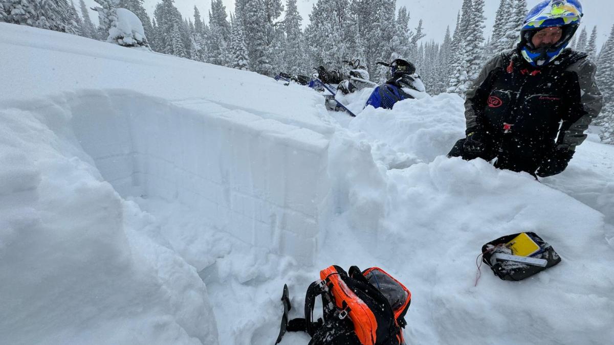
Northern Madison, 2024-01-10 Cornices on the ridge had all broken and pulled out the wind-loaded pockets with one slope sliding 100' distance. These likely occurred last night (1/09/24). Photo: GNFAC Link to Avalanche Details |

|
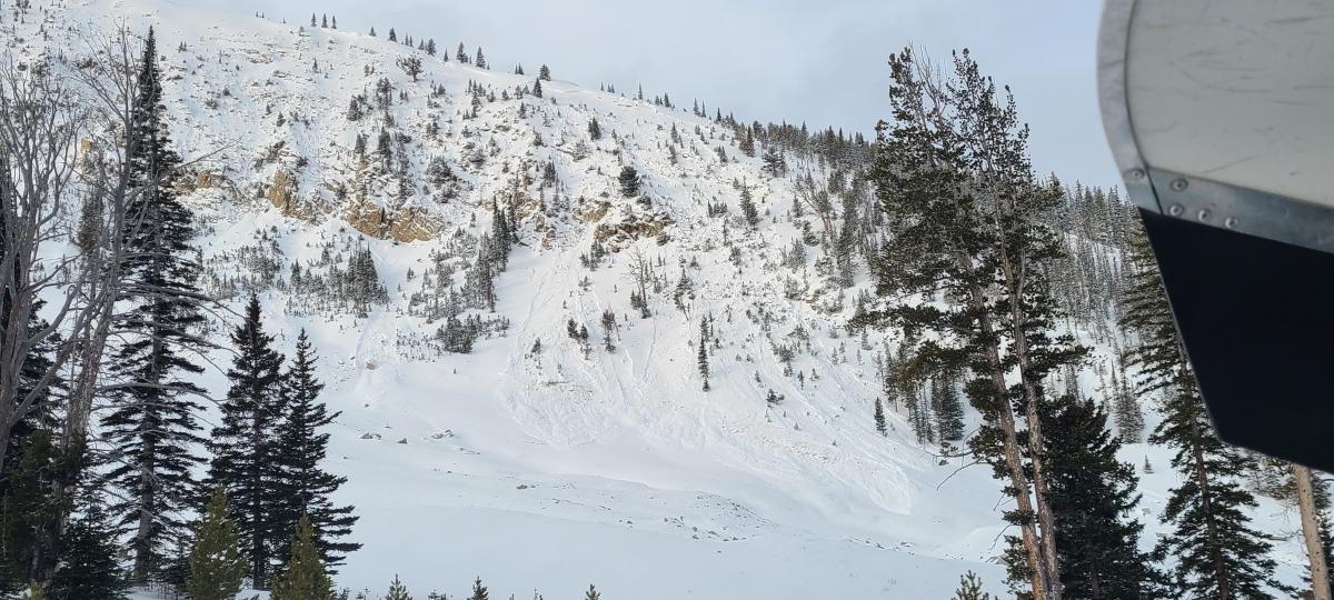
Northern Gallatin, 2024-01-09 Seen on a ski tour on 1/08. From Obs: Notice a few natural avalanches and one skier triggered avalanche near of the top of Blackmore. Looked as though it was a ski cut that popped the slab. Photo: S. Lowe Link to Avalanche Details |
|
Lionhead Range, 2024-01-09 Cornices easily broke while walking near them and avalanched onto the slope below. The slope below had already avalanched from a remote trigger below the ridgeline. Photo: GNFAC Link to Avalanche Details |
|
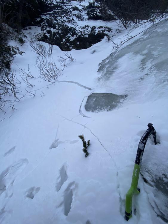
Lionhead Range, 2024-01-09 Top gray streak: Weak surface hoar buried by new snow. Second gray streak: Old surface hoar that is still visible. Photo: GNFAC Link to Avalanche Details |
|
Lionhead Range, 2024-01-09 |
|
Lionhead Range, 2024-01-09 |
|
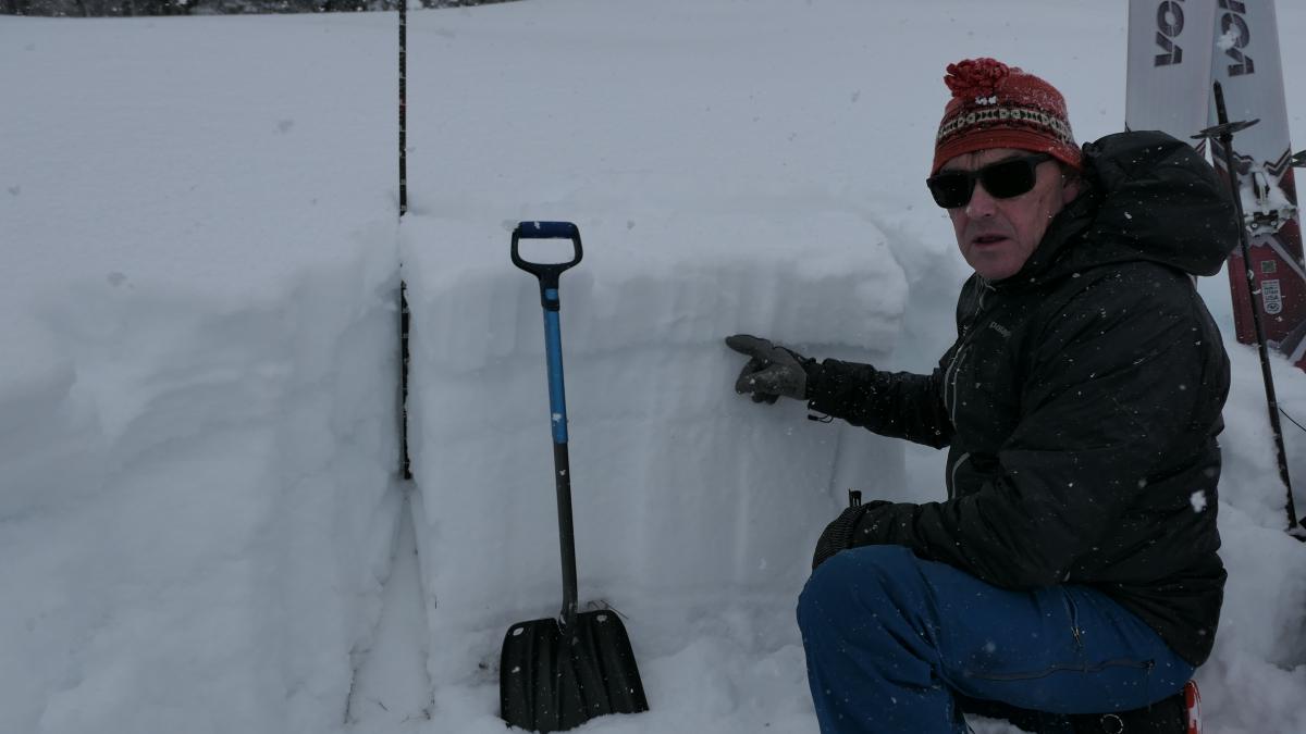
Lionhead Range, 2024-01-09 Doug Chabot pointing to a layer of buried surface hoar that failed while isolating an extended column test, ECTPV. Photo: GNFAC Link to Avalanche Details |
|
, 2024-01-09 The Darren Johnson Avalanche Education Memorial Fund is hosting two fundraisers on January 16 at The Waypoint and January 18 at Beehive Basin Brewery in Big Sky. |
|
Cooke City, 2024-01-08 Skiers on Woody Ridge saw a recent natural avalanche that likely happened yesterday, 01/07. The crown is 8-16" deep and runs a few hundred feet down the gully on a wind-loaded slope. Photo. N. Stayner Link to Avalanche Details |
|
|
Cooke City, 2024-01-08 Skiers on Woody Ridge saw a recent natural avalanche that likely happened yesterday, 01/07. The crown is 8-16" deep and runs a few hundred feet down the gully on a wind-loaded slope. Photo. N. Stayner Link to Avalanche Details |
|
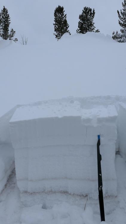
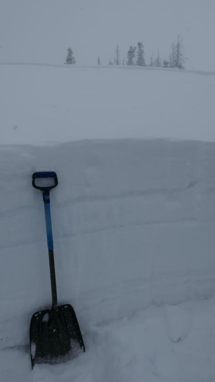
Island Park, 2024-01-07 Snowpit at the Head of Hellroaring Creek on 1/7/24. Note the two stripes of surface hoar in the pit wall. |
|
Island Park, 2024-01-07 We measured 16" of low-density snow equaling 0.7" of snow water equivalent at higher elevations in the Centennial Mountains of Island Park, ID. The new snow is sitting on a couple of layers of feathery surface hoar and a weak snowpack. It will not take much wind, settlement, or new snow to push the snowpack to the breaking point. Photo: GNFAC |