Photos

|
Lionhead Range, 2024-01-21 Riders on Lionhead Ridge spotted this natural avalanche that occurred on January 21. Link to Avalanche Details |
|
Lionhead Range, 2024-01-21 This natural avalanche failed the morning of January 21 on a steep slope at Lionhead. Photo: GNFAC Link to Avalanche Details |

|
Island Park, 2024-01-21 A rider triggered this avalanche while side-hilling across the bottom of the slope. The rider was able to quickly turn downhill and avoid the slide. No one was caught. Photo: Anonymous Link to Avalanche Details |

|
Island Park, 2024-01-21 A rider triggered this avalanche while side-hilling across the bottom of the slope. The rider was able to quickly turn downhill and avoid the slide. No one was caught. Photo: Anonymous Link to Avalanche Details |

|
Cooke City, 2024-01-21 From obs: "Remote triggered a D1 avalanche from about 150’ away from below in a meadow." Photo: Noah Mattes Link to Avalanche Details |
|
|
Cooke City, 2024-01-21 From obs: "Remote triggerd a D1 Avalanche from about 150' away. Crown was 1-2' deep. The debris ran onto an apron that was shared with a larger slope which subsequently triggered a larger D2 Avalanche that was about 100' wide with a 3'-4' crown. " Photo: B. Zavora Link to Avalanche Details |

|
Northern Gallatin, 2024-01-21 From obs: "The crown was just over 2ft deep at its max and 150ft+ wide. The were signs of recent wind loading as we approached the bowl prior to the slide." Photo. T. Hoefler Link to Avalanche Details |

|
Northern Gallatin, 2024-01-21 The debris of an avalanche that was triggered by skiers that was triggered 400 feet above them. The skiers were not on the path of the avalanche. Photo: T. Hoefler Link to Avalanche Details |

|
Northern Gallatin, 2024-01-21 Photo: T. Hoefler Link to Avalanche Details |

|
Northern Gallatin, 2024-01-21 Skiers triggered an avalanche on an east-facing slope at 9350ft. From obs: "The crown was just over 2ft deep at its max and 150ft+ wide. The were signs of recent wind loading as we approached the bowl prior to the slide. We did not observe any other avalanches while we were out." Photo: T. Hoefler Link to Avalanche Details |

|
Northern Gallatin, 2024-01-21 Skiers in the SE bowl of Flanders triggered an avalanche from the bottom of the slope. This happened on 01/20. From Obs: "as he turned into the bowl, a remote triggered avalanche ripped out above him. He was fast to reach a safe position in the trees by the time the avalanche finished its ride. The photo shows the 3 ski tracks, and the most left one is what remote triggered above." Photo: Anonymous Link to Avalanche Details |

|
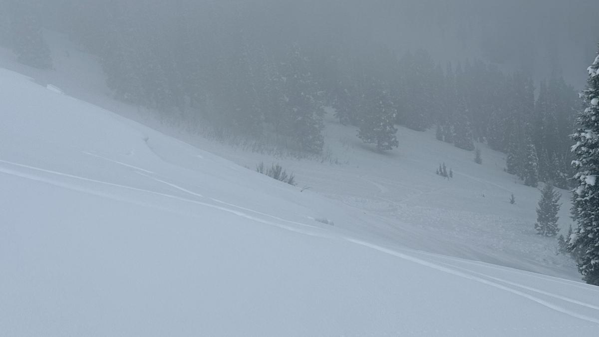
Southern Madison, 2024-01-21 |

|
Cooke City, 2024-01-20 From obs: "South of Cooke City numerous avalanches were observed on E, W, and Northern aspects. These all likely happened during or following a recent storm on 01/18." Photo: BPG Link to Avalanche Details |

|
Cooke City, 2024-01-20 Photo: BPG Link to Avalanche Details |

|
Cooke City, 2024-01-20 From obs "Widespread cracking and collapsing were observed both north and south of Cooke City. We stepped off the skin track and remotely triggered a small slope above the creek below. Took a closer look and it failed on surface hoar/facets 35 cm down. " Photo: BPG Link to Avalanche Details |

|
Southern Madison, 2024-01-20 From obs: "Saw lots of shooting cracks and triggered a small slide on a short steep hill." Photo: Anonymous Link to Avalanche Details |

|
Southern Madison, 2024-01-20 Several natural avalanches were observed on the ridge above the cabin in Cabin Creek. Photo: Anonymous Link to Avalanche Details |

|
Northern Madison, 2024-01-20 Shooting cracks along the ridge between Beehive and Middle Basins. An avalanche was triggered further down the ridgeline by the resulting cornice fall. Photo: H. Darby Link to Avalanche Details |

|
Northern Gallatin, 2024-01-20 From obs: "We considered skiing east into middle just before the prayer flags, but when approaching the slope to dig a pit we got a significant collapse and decided to ski a more conservative pitch further north. When continuing north on the ridge we saw a recent cornice collapse which triggered an avalanche" This avalanche was triggered by skiers breaking cornices on 01/20. Photo: M. Zenker
Link to Avalanche Details |

|
Northern Madison, 2024-01-20 From obs: "My partner and I were traveling along the ridgeline separating Beehive and Middle Basin. 60 meters before the prayer flags on the ridge, we were stomping on the cornices. We heard a very loud whumphf and the cornice directly below me fell. This and our stomping triggered shooting cracks along the ridge and remotely triggered a cornice 30 meters ahead of us. This cornice fall triggered a hard slab avalanche that was about 15 meters wide and ran at least 100 hundred meters, but we could not see the terminus in the trees. The crown was 1F wind slab failing on facets 35 cm deep. It immediately stepped down to basal facets in spots with total crown depth of 75 cm." Photo: H. Darby Link to Avalanche Details |