Snow Observations List
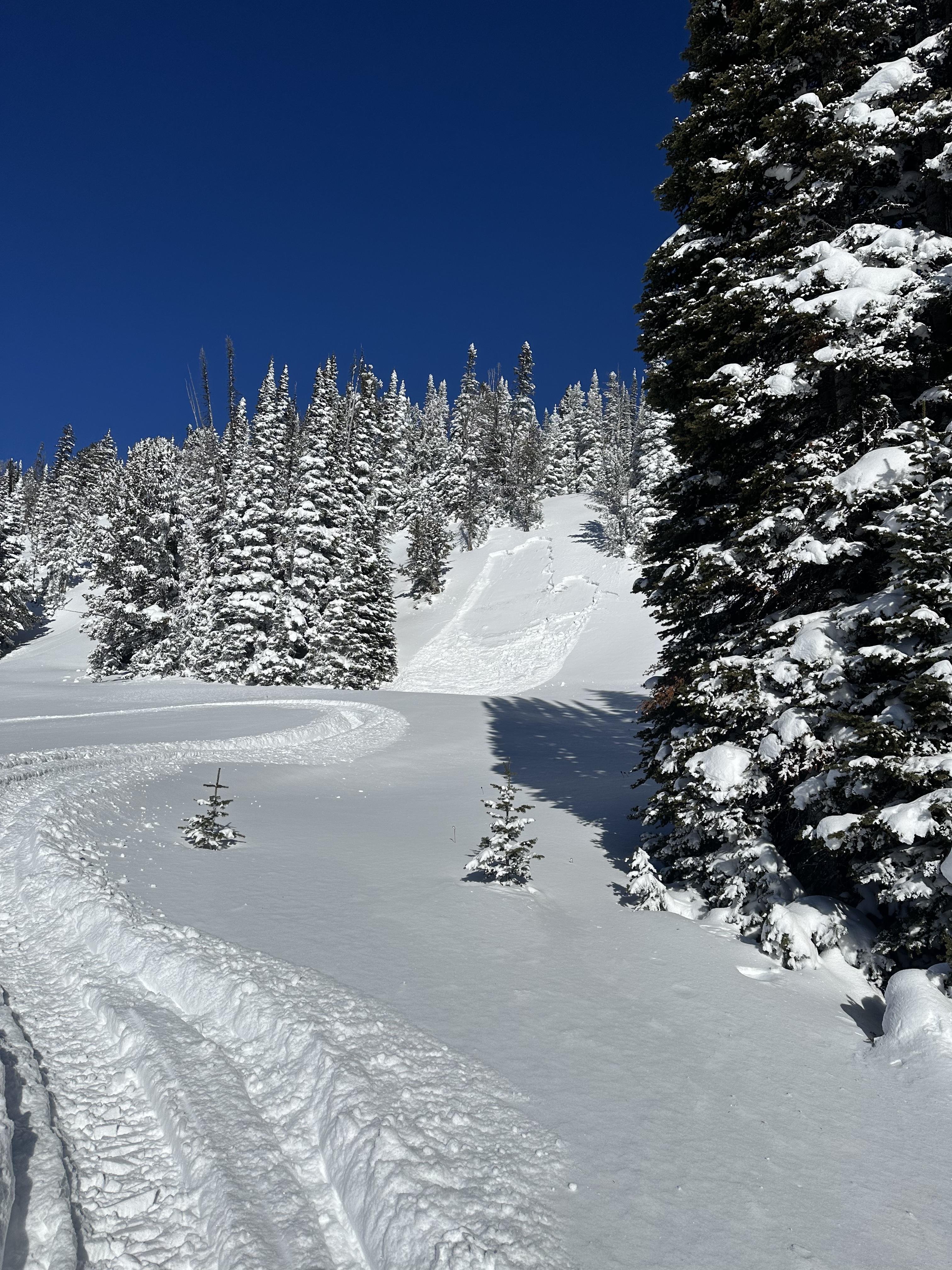
Had a nice tour in tele meadows in the AM given the avy danger. Snowpack was 5-8” of wetter snow on top of the old facet layer.
Every time we stepped away from the skin track or skied untracked snow heard a few whumpfs and saw shooting cracks (most in the few foot range but a few extended 40-50’ across the slope).
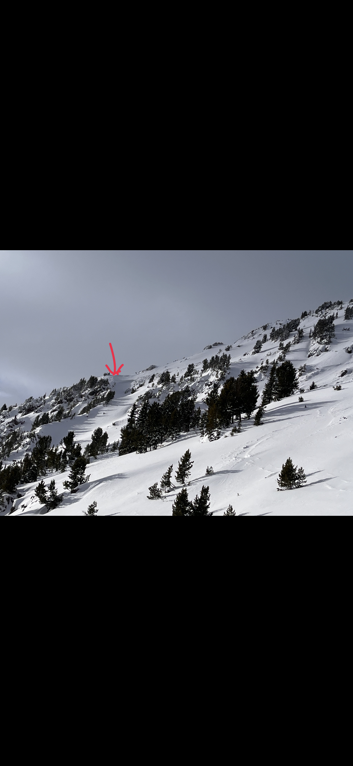
Warm temps made for wet snow and gloping on the tour up toward Blackmore. At about 8400' the conditions changed with winds keeping the snow surface dry and cold. Upon entering the basin we saw the skier triggered slide reported on 01/19 as well as another slide off the west side of the peak, both D2. The crown of the westward slide looked to be around 4'. Like the one reported the other day, it ran almost to the skin track. Winds were high in the basin and on the ridge tops, transporting snow into moderately stiff slabs. At around 12PM the snow surface up high was getting wet and by the time we reached the parking lot it felt like your typical sunny day in April.
Full Snow Observation Report


Saturday morning above freezing with wet, sticky snow and then it started to rain. Rained perhaps 1 hour from at least 7200 feet back to the parking area. Should have waxed for May!
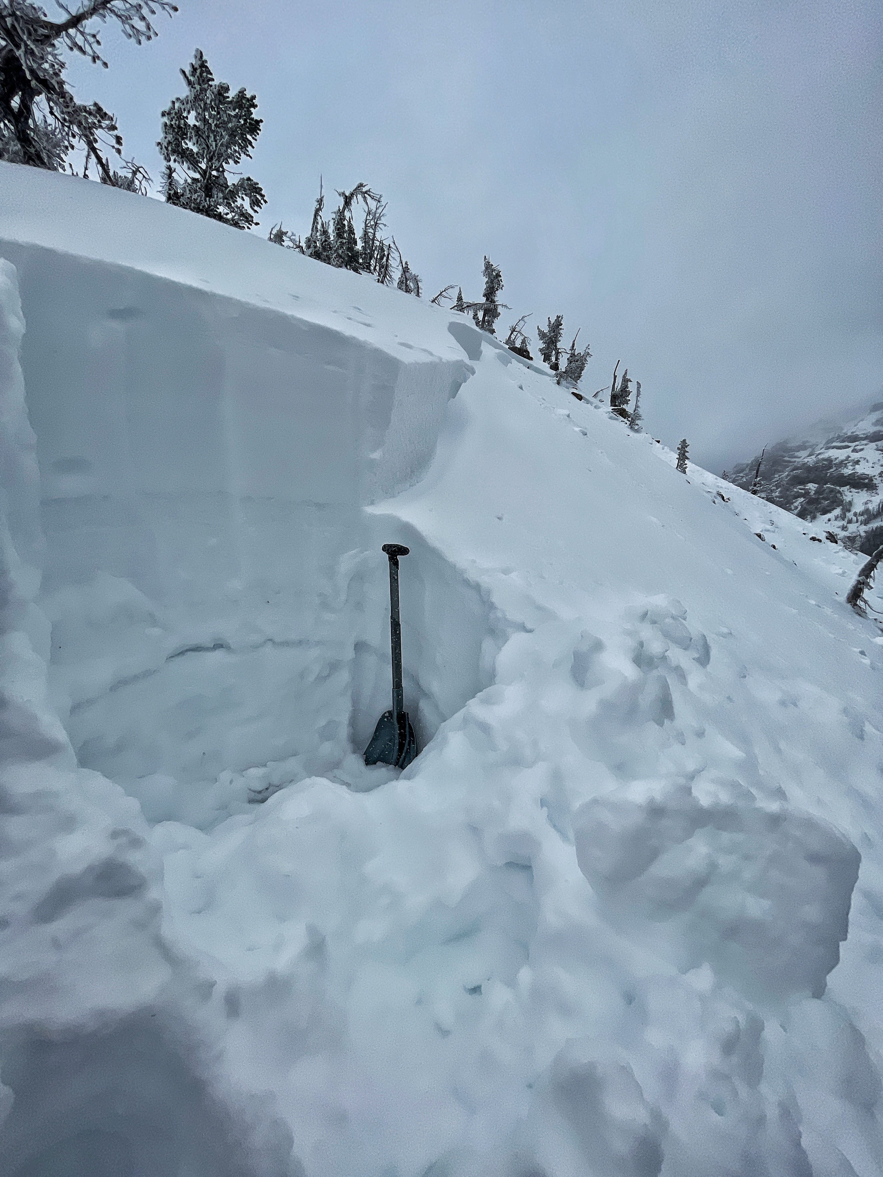
Full Snow Observation ReportSnow has weak layers from recent storm and old facets. Dug a quick pit and found what’s been going on all season.
Two distinct slides-
1. Off the top on the face of Blackmore- Talked to the guy that set this slide off, it was triggered while he was skiing down yesterday morning from the summit. Ran all the way down to almost the skin track.
2. A much bigger one on lookers left of Blackmore peak, naturally occurring as there were no tracks near it. Looked like a bigger crown. Talking to the guy who triggered the slide yesterday he stated this one wasn’t there yesterday.
Lots of wind when I was up there this morning skiing the shoulder, could see loading happening throughout the range. Sun came out and warmed everything up. 46 degrees at Hyalite parking lot when I got back to my car just before 1:00pm. Saw roller balls driving back down on the road on the steep hillsides.
Thanks for all you do!
Full Snow Observation Report


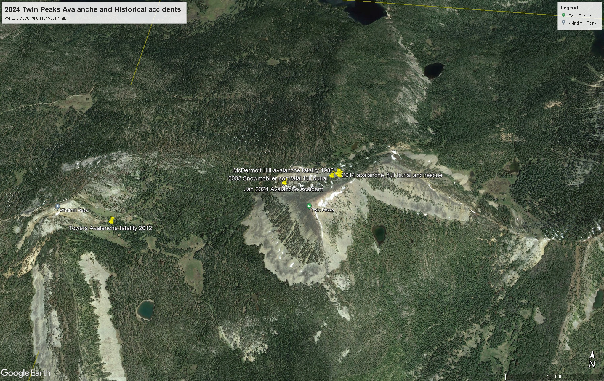
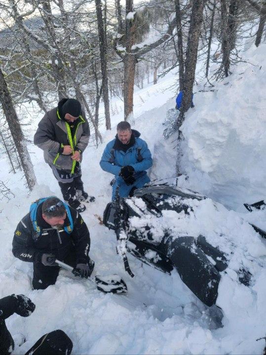
2 Snowmobilers riding into the Twin Peaks area, and one decided to sidehill a slope with patchy larch trees that is 42 degrees at the top, and consistently windloaded. The resulting avalanche took him and his sled approximately 300 feet downhill to a patch of small diameter larch trees where the trees formed a fence that strained the rider and his sled and also piled up the debris. It was likely one of these small trees that broke the victim's leg. They were very familiar with the area, and all the previous accidents (one fatality occurred north of this spot by 150 yds, and several full and partial burials have occurred along this ridge) that have happened in that area. They were carrying all rescue gear and airbags(victim did not deploy his airbag). One of the riders was at an avalanche class I put on at the toe of the slope 5 years ago. There was no real hazard evaluation, and the riders did not observe any signs of instability prior to triggering the avalanche. Once the rider sidehilled into the open everything fractured above him in the windslab. My partner and I had several large collapses assessing the area, and the victim's riding partner stated that they had several collapses moving the victim to the helicopter. The helicopter landed very close to the toe of the slope. The snow depth at the crown was 60 inches deep, with one wind slab sitting on another on facets, and at the toe of the slope the snow depth was less than 20 inches deep. The fracture traveled roughly 800 feet in and around the larch trees near the top of the slope and it deposited debris in 3 different run outs.
Victim was buried vertically with a boot sticking out, and his riding partner exposed his face in 2 minutes. He extricated his whole body in 8-10. He had a broken femur and a broken hand. As they were digging, rescuers stated that the second leg wasn't vertical, and they found it at an oblique angle to the rest of the body. They had an inreach and sent out a help signal that was picked up, and LifeFlight was nearby. Lifeflight was able to land at the base of the slope and take him to St. Pete's in Missoula at 1230 pm.
Full Snow Observation Report
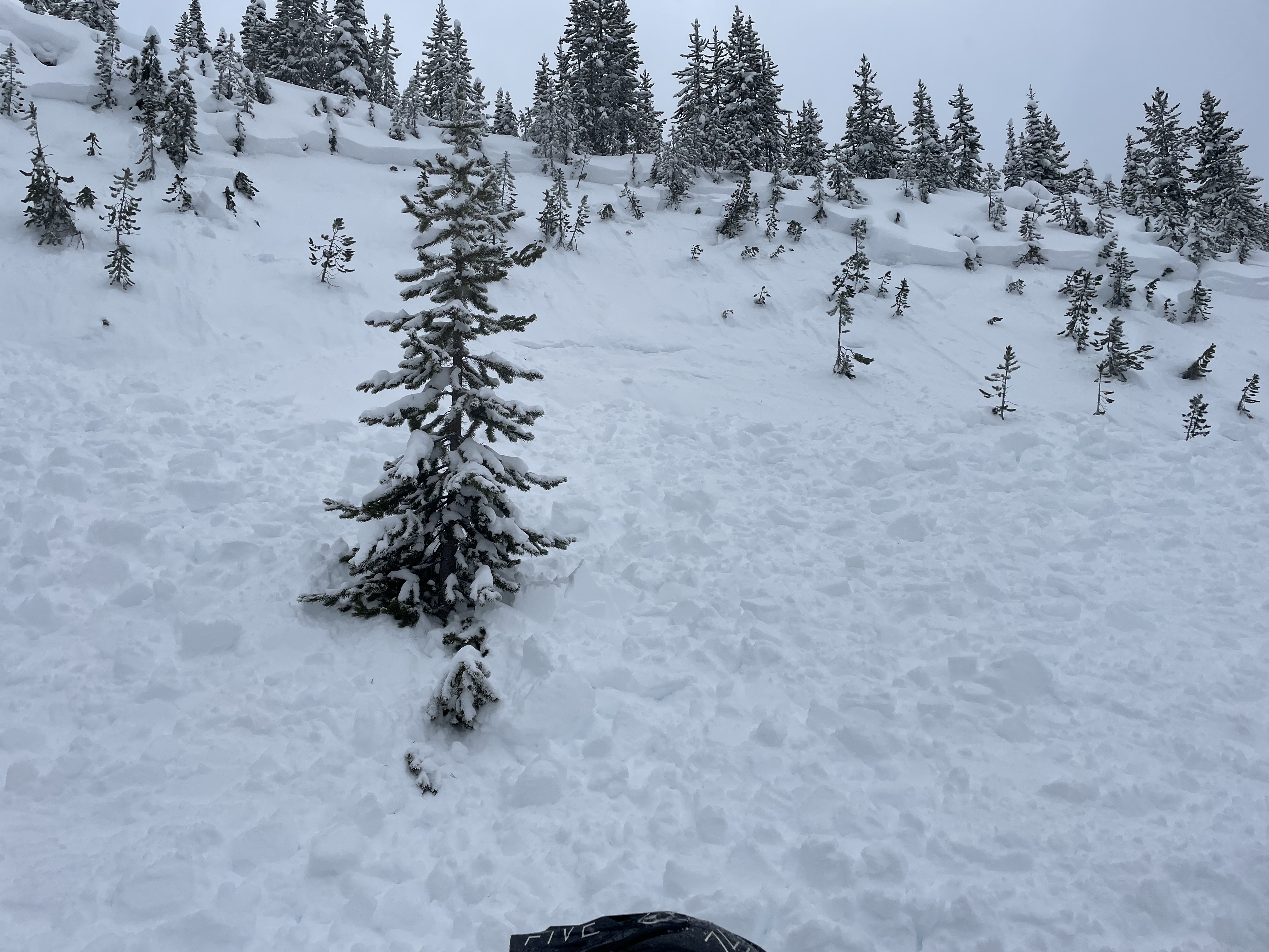
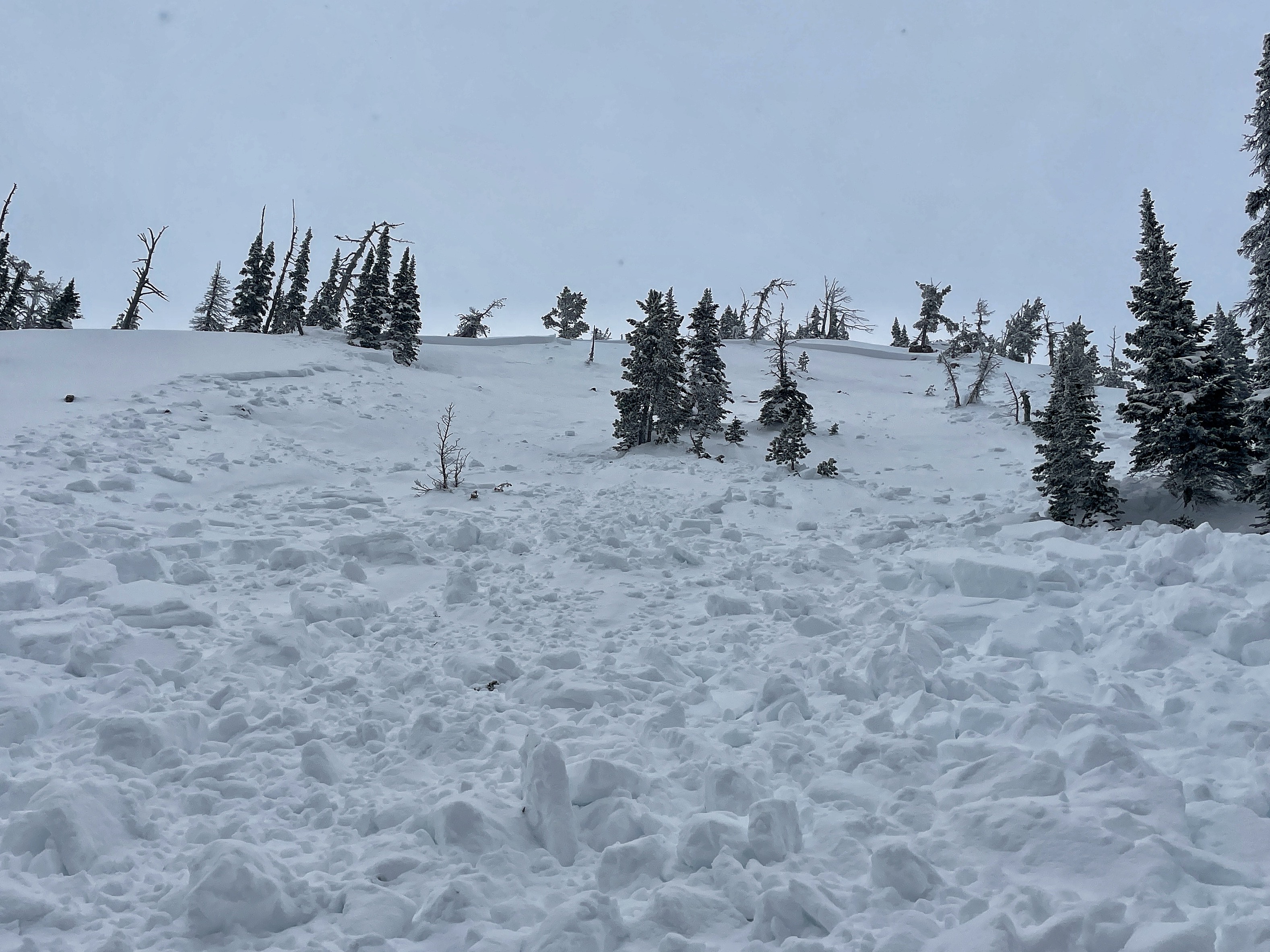
While up there investigating yesterday’s avalanche i noticed a new debris coming out of the lookers left chute on Southeast face a blackmore. got closer to the ridge and noticed this. happened last night or this morning. wind was definitely pumping a change. Directions loading this aspect. debris ran out of side of this picture. 5 feet deep 50 to 100 ft wide and ran roughly 800 feet.
Full Snow Observation Report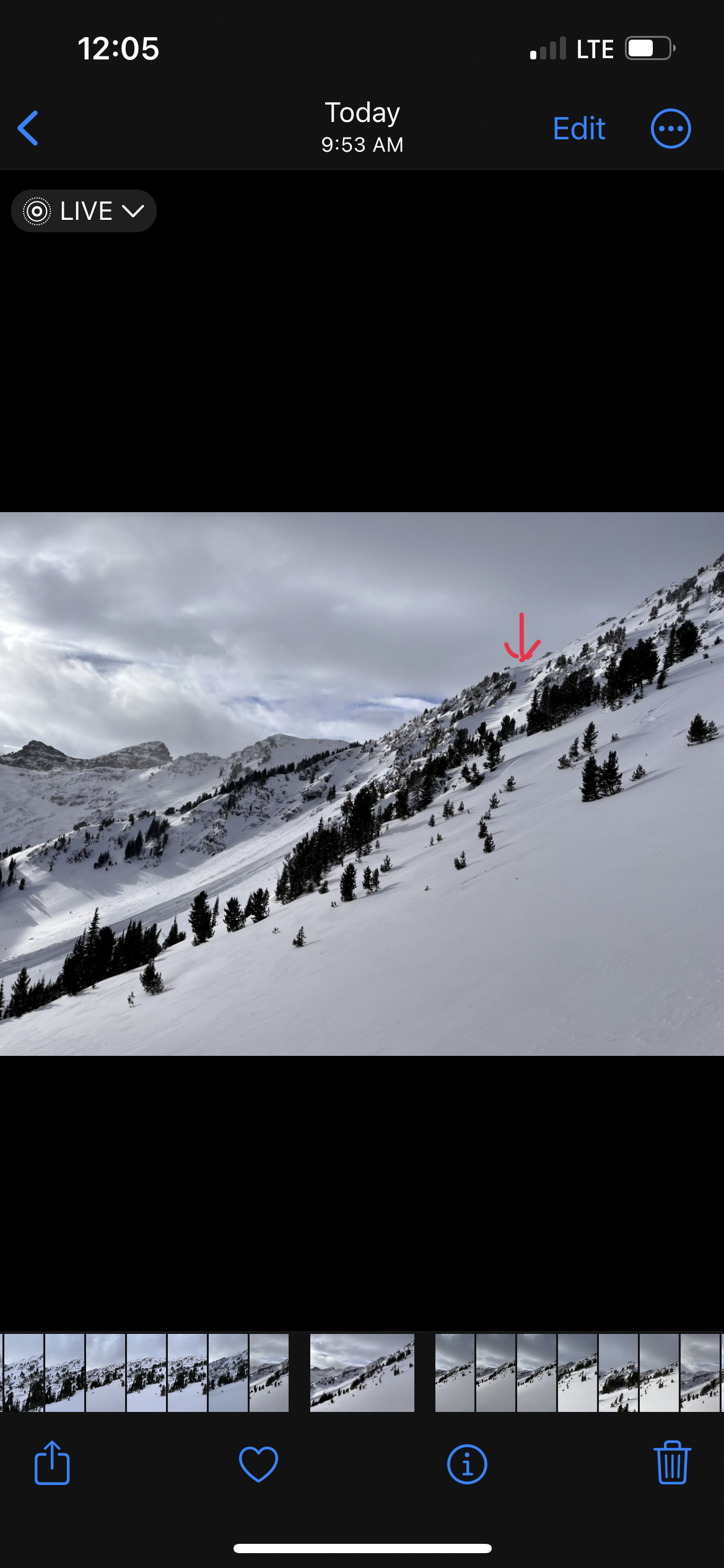
Spent a day digging out the Hut in the Centennial Saturday 1/20. Our hasty pit, 20 deg. SW aspect at 7,000’ about 1/2 way into the hut showed 75 cm snow depth and various sized facets to a depth of 45 cm from the ground overlain by new snow. The structure was poor, and weak but we did not observe propagation in an ECT. Snow surfaces were damp on all aspect that we touched below 8,000’, pin wheel rollers on many steep slopes could be seen near the creek. Plenty of collapsing and “whumfing” on the way in kept us wary. Snow depths below 7,000 feet were as shallow as I have seen in 10 years operating the hut.
Full Snow Observation ReportToday's walk was difficult. Stepping off my skies I sank to the ground when over in middle basin. There was widespread cracking, collapsing, and whoompfing. A few smaller natural avalanches but not as many as I had expected with the feedback we were getting. Still great to get out.
Full Snow Observation ReportFrom email on 01/22: "
"On 1/19, my partners and I toured into Pebble Creek just west of Cooke in hopes to find some low-angle powder skiing. Our objective was to ski a south-facing slope just north of the Pebble Creek trail.
New snow totals were around a foot at 8000ft. Winds were pretty moderate out of the west/northwest, but it looks as if the days prior had transported a lot of snow off of the south-facing ridgelines onto east-facing slopes. We had many thunderous collapses on our way uphill that echoed across the entire canyon. It was pretty hair-raising even though we weren't above or below any avalanche terrain. Towards the top of our objective, we saw a natural avalanche that occurred on a small rollover that appeared to be a day or two old (pictured below). I suspect the slope was no steeper than 30 degrees. I did a quick hand shear on the adjacent slope and the overlying slab of new snow failed upon isolation. "
Full Snow Observation Report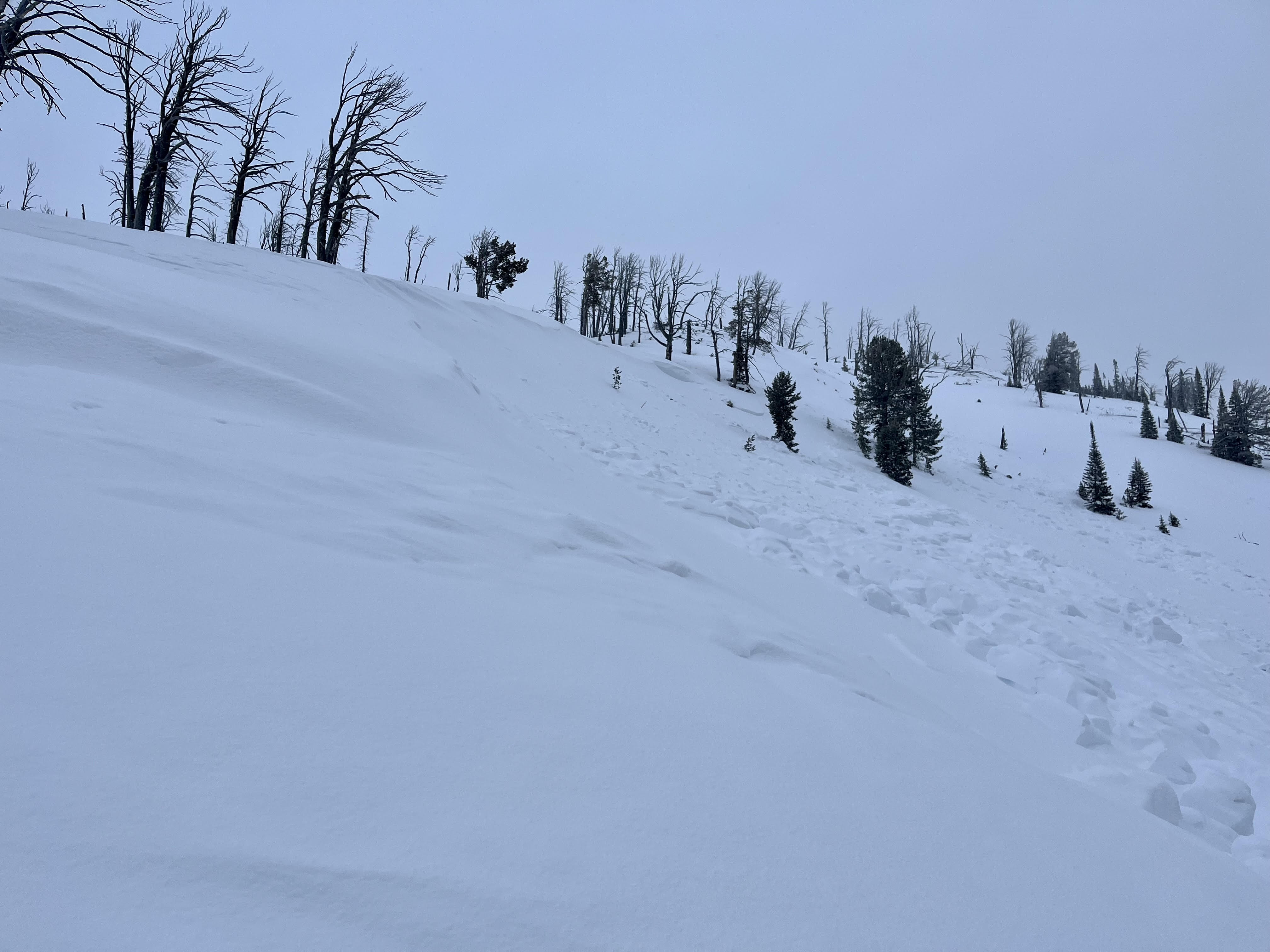
From interaction at the gas station:
“We were riding out from Island Park. We saw dramatic, collapses, and shooting cracks. I side-hilled a small slope and triggered it 1.5 to 2 feet deep. I have never seen such unstable snow.”
Full Snow Observation Report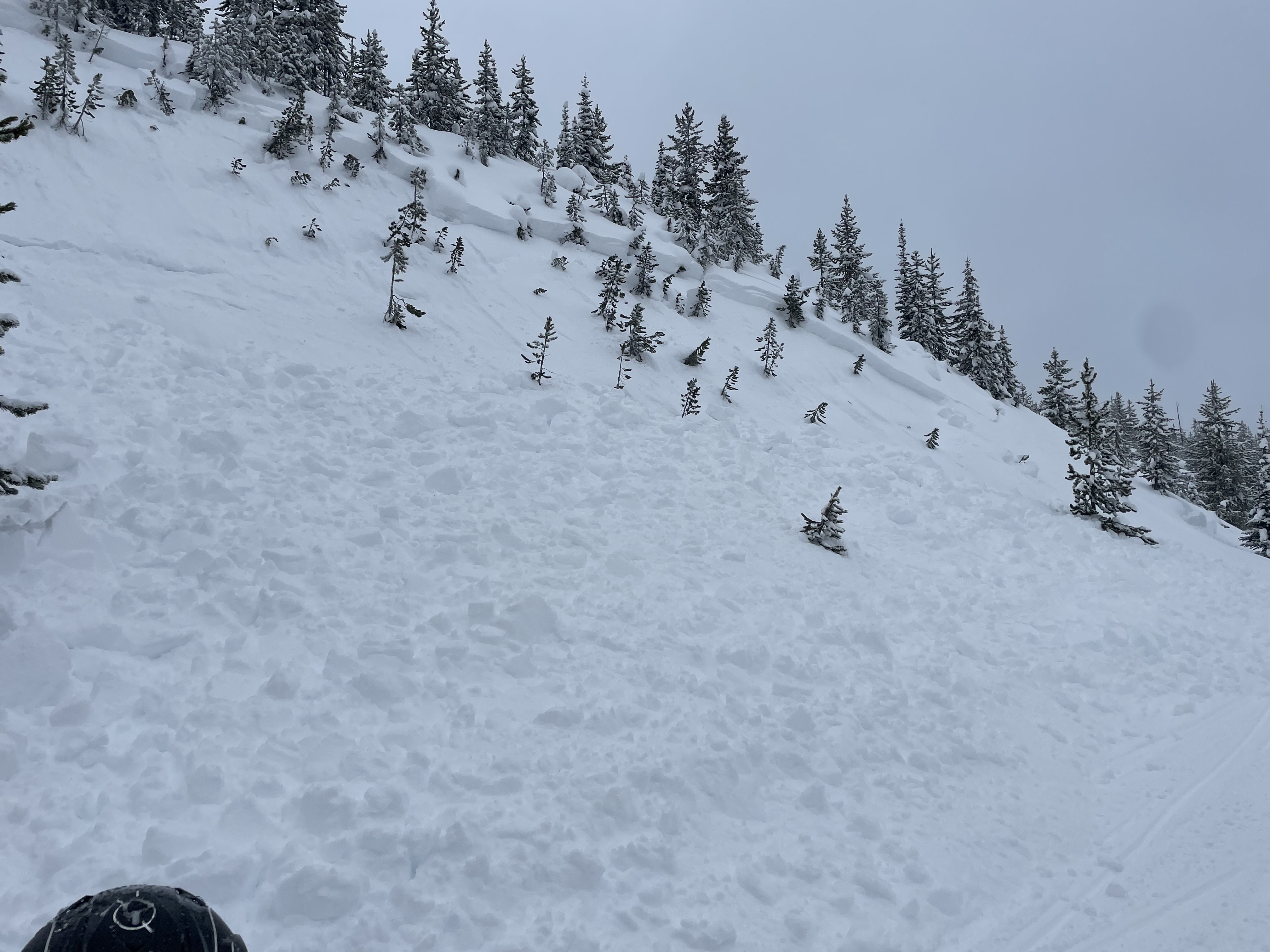
We dug pits and rode on Sawtelle Peak. At 9,100 feet we had unstable test results (ECTP13 x 5; ECTP10 x2; CT4, Q1). When the clouds lifted we could see a crown of a snowmobiler triggered slide that occured yesterday. It broke on the buried surface hoar and facets about 1.5 feet under the surface. Recent snow and wind-loading has created dangerous avalanche conditions.
The avalanche:

Dug pits both above and below Bradley Meadows with a Fundamentals Course. We got ECTNx5 down 30cm on the facets which were first buried Jan 5th. The snow overlying the facets was soft (fist to four finger).
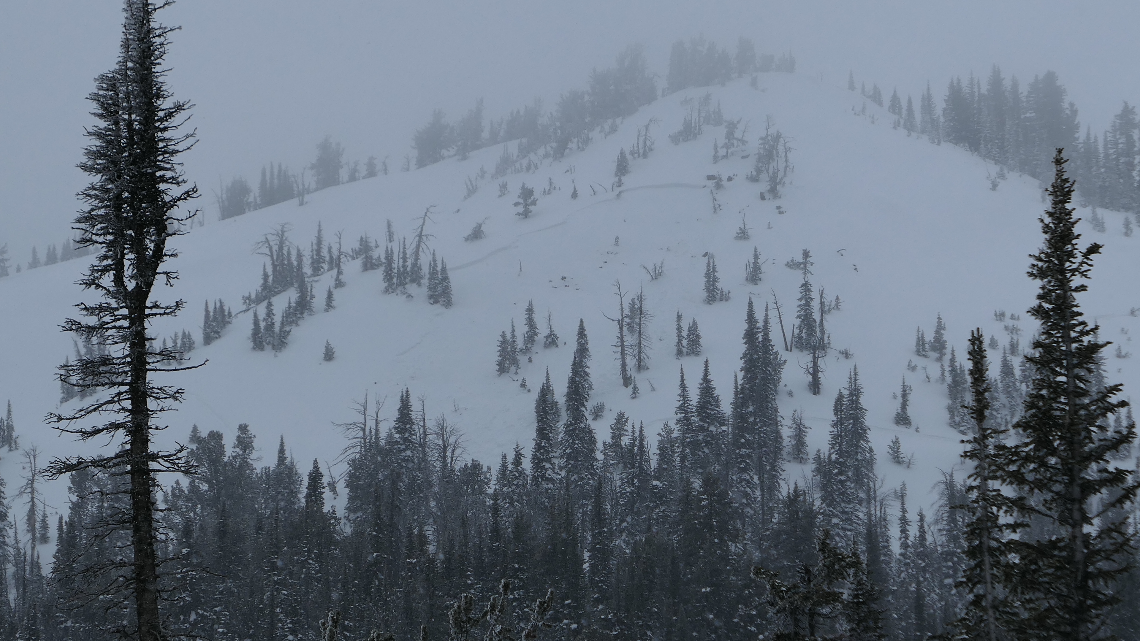
Full Snow Observation ReportObserved the avalanche breaking pretty far down the ridge, but I had a feeling it broke a little bigger judging by how fast the powder cloud was the moving. Went back up there today and saw that it had in fact, broke quite a bit bigger than the 8 inches and 50 feet I initially reported. Photo attached.
Full Snow Observation Report
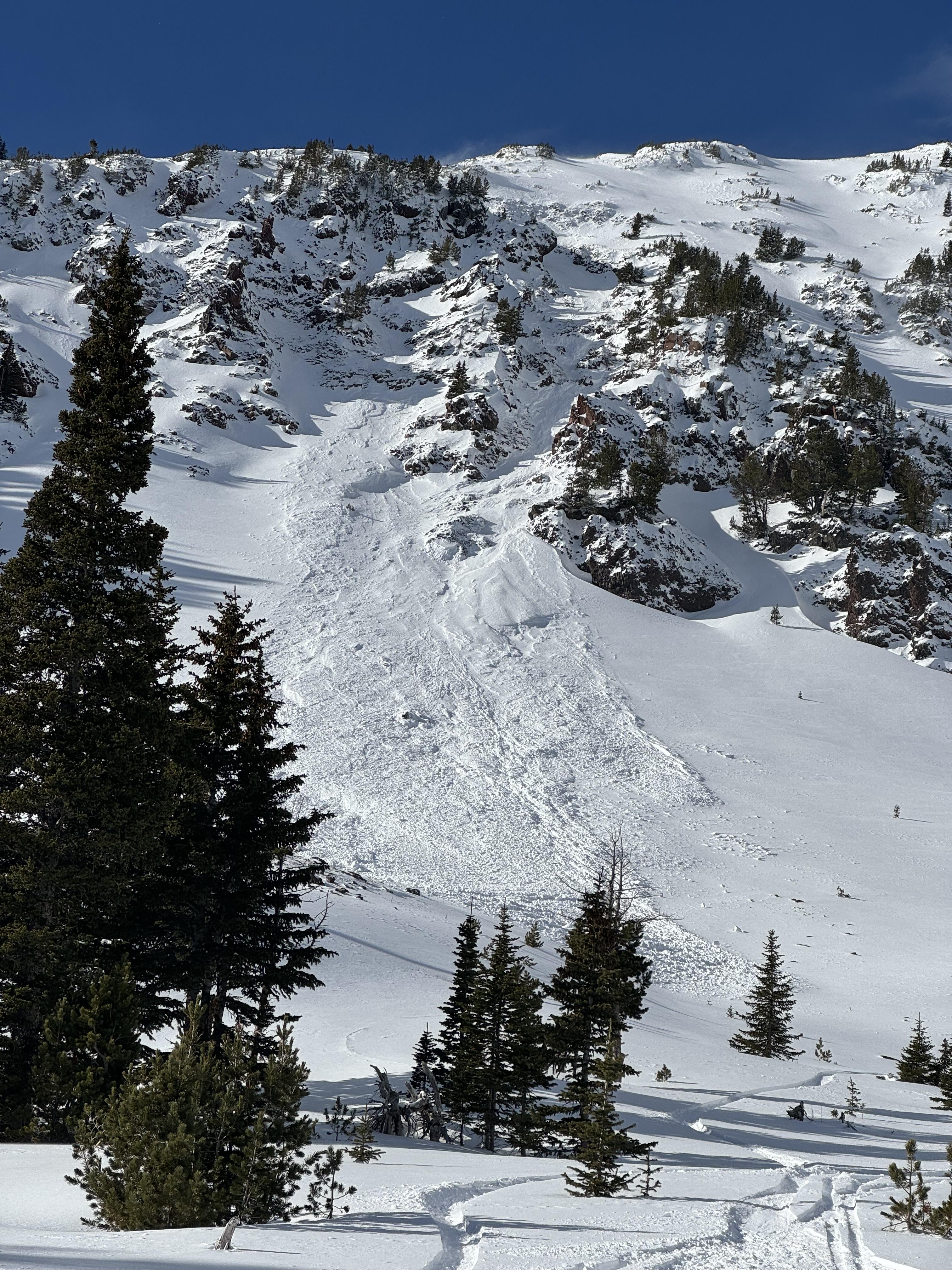
A skier triggered an avalanche on the SE face of Mt. Blackmore near the ridge on the morning of 1/19/24.
From text: "Hard to with the visibility but it ran almost all the way to the skin track (~800 vertical). It definitely broke 8 inches deep and 50 ft wide, but it might've gotten a little wider and deeper."
Full Snow Observation ReportMultiple remotely triggered avalanches. Lots of shooting cracks and visible whomping(poofs of snow dust).
Triggered from over 140 yards
Full Snow Observation Report

Photos from email. Avalanches previously reported - https://www.mtavalanche.com/node/30013
Full Snow Observation Report


From IG: “…, probably propagated a mile long, on a layer of advanced facets 30cm below a wind slab… We dug a pit yesterday and got a ct4, ectp9, pst 25/100 on the same layer.”
Full Snow Observation Report


From facebook message: "Multiple remote triggers across this slope."
Up Targhee Creek, near Lionhead Ridge. 1/18/24
Full Snow Observation Report


Natural & remote trigger avalanches observed on most steep terrain.
Full Snow Observation Report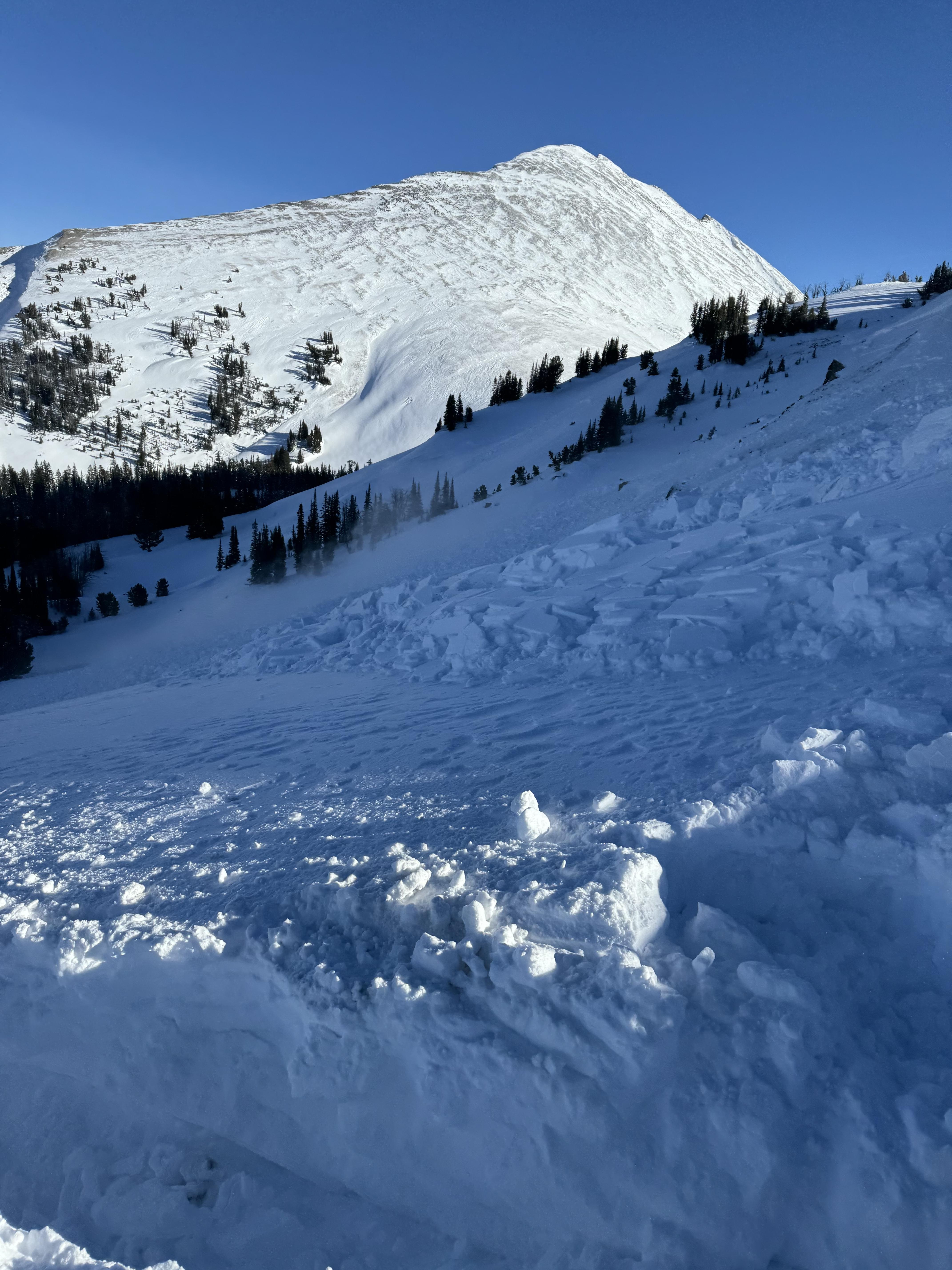


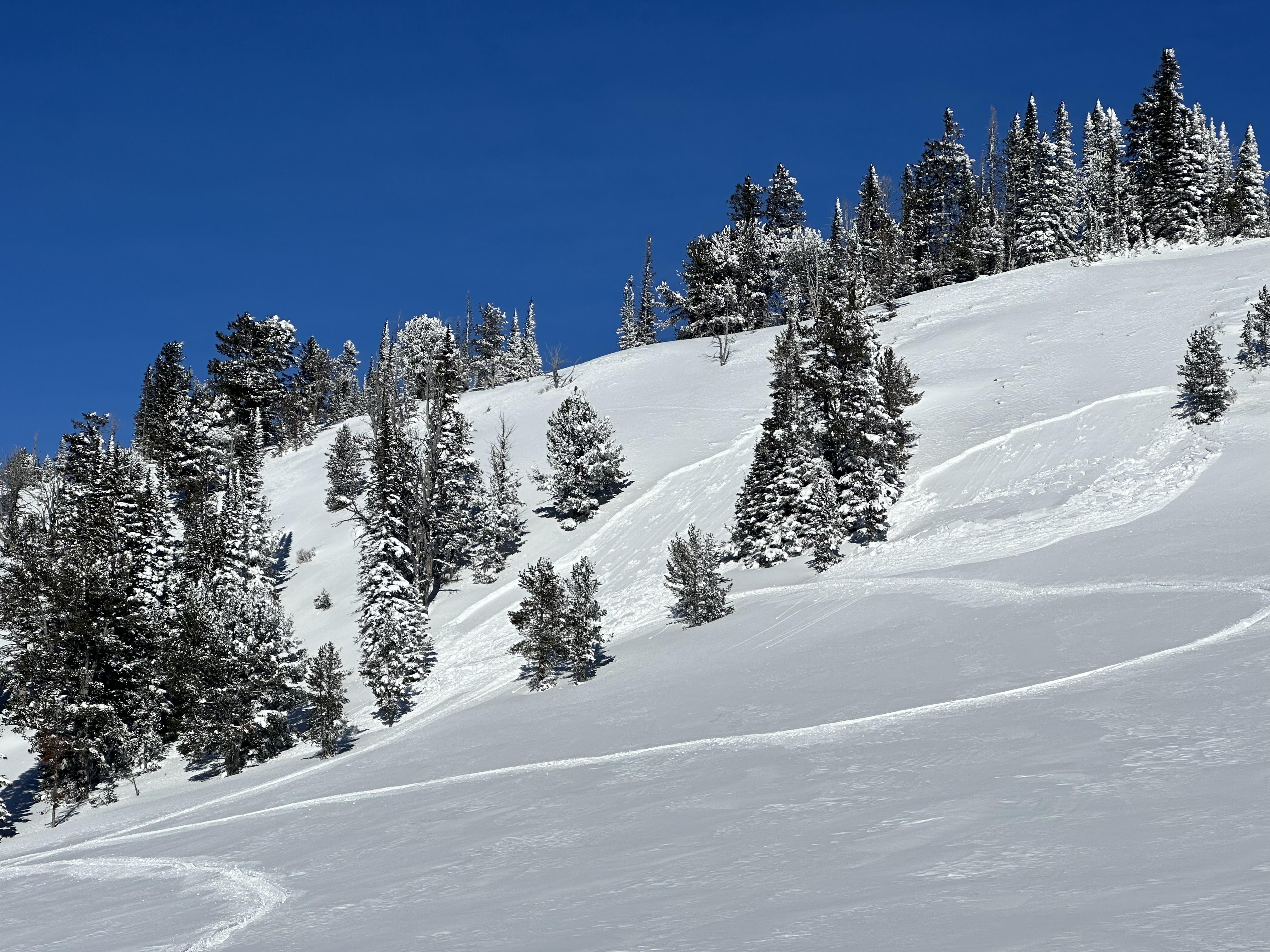
Alex and I began to dip our toes into a Saddle Peak stability assessment. Given the new snow and HIGH danger on wind-loaded terrain in the Bridger Range, we decided early to skip the summit and cross onto the edge of the Football Field from the Bridger Bowl boundary. Upper slopes had fresh drifts of wind-loaded snow and new cornice growth, but there was not as much loading as we feared there might be. We stuck to our conservative plan and skied the "Bitter End" (the closest run to the south boundary of the ski area) down to 8400' elevation before ducking out across the boundary.
The snowpack is thin and weak, with advanced facets making up most of it. Our test results did not reveal obvious instability, just weakness (ECTX). It is unreasonable to apply that same assessment across the Peak. Human-triggered avalanches are certainly possible, especially in areas with thicker slabs of wind-drifted snow (something that is quite common to find on Saddle Peak). Given the very high-consequence nature of the area, we advise patience and conservative terrain choices and decision-making.
Full Snow Observation ReportThe danger felt like a CONSIDERABLE / MODERATE split. We did not observe any thick or reactive wind slabs on the boundary, possibly due to avalanche mitigation efforts at the Bitter End. Alex and I discussed the summit and a Skyline assessment but decided to hold off since we have high pressure returning and the optics of doing so with a HIGH danger on the map.
Without wind tomorrow, Alex and I discussed a return to the MODERATE danger. Remain nimble with regard to incoming observations, strong winds, or more snow and hold it up if additional information suggests it.

