Good morning. This is Alex Marienthal with the Gallatin National Forest Avalanche Forecast on Sunday, January 8th at 7:00 a.m. This information is sponsored by Suzy Hahn: Montana Mountain Real Estate Cooke City, Bridger Bowl and Klim. This forecast does not apply to operating ski areas.
This morning there is no new snow, temperatures are teens to mid-20s F and wind is south-southwest at 5-15 mph with gusts to 25 mph. At the top of Big Sky and in Hyalite southwest wind is 25 mph with gusts to 55 mph. Today will start mostly clear with clouds increasing in the southern areas this afternoon. Temperatures will reach high 20s to low 30s F with southwest wind at 15-25 mph. This evening and tomorrow there is a chance for snow near West Yellowstone and Cooke City with 1-2” possible by morning.

A person can trigger avalanches that break on weak layers buried 1-4 feet deep, or avalanches that involve recently wind-drifted snow. Yesterday, on Buck Ridge near Big Sky a snowboarder triggered a small avalanche on a wind-loaded slope and was partially buried to their waist (photo), and Skiers in the northern Bridger Range saw a recent large natural avalanche that broke 1-2 feet deep and 100 feet wide (photo). Two days ago, a very large avalanche on Saddle Peak broke 550 feet wide and almost 2 feet deep on a buried weak layer (photo of crown up close). It caught and partially buried a person who was hitting a jump in the runout zone (photos and details).
Carefully assess the snowpack for buried weak layers and avoid steep slopes where you suspect they exist. Buried weak layers are not consistently showing instability in our snowpack tests, but avalanche activity over the past week is a clear sign that large avalanches can be triggered. The fatal avalanche last weekend near Cooke City should provide good motivation to take buried weak layers seriously (accident report). Be extra cautious of wind-loaded slopes and slopes where snow depth is variable where a large avalanche may be triggered from a relatively shallow spot. Look for cracks across the snow surface around your skis or sled as a sign that recently drifted snow remains unstable.
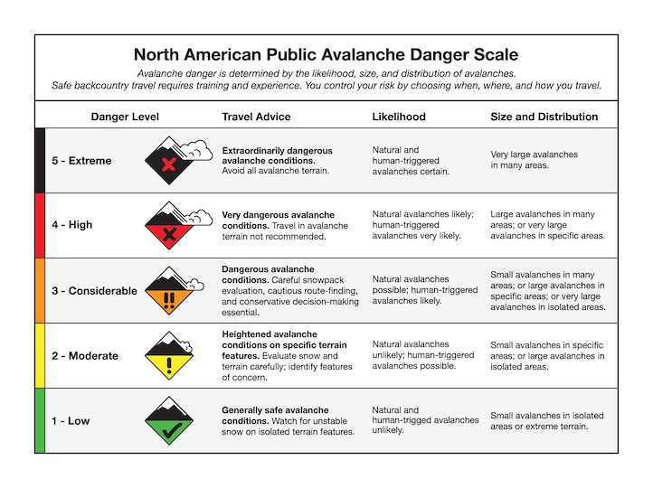
Today, human-triggered avalanches are possible and the avalanche danger is MODERATE.
Please share avalanche, snowpack or weather observations via our website, email (mtavalanche@gmail.com), phone (406-587-6984), or Instagram (#gnfacobs).

In Island Park a person can trigger avalanches that break deep and wide on buried weak layers, or avalanches that involve recently wind-drifted snow. Carefully assess the snowpack for buried weak layers and avoid steep slopes where you suspect they exist. If snow starts to accumulate early today, fresh drifts may form that could avalanche. Look for cracks across the snow surface around your skis or sled as a sign that drifted snow is unstable.
Upcoming Avalanche Education and Events
Our education calendar is full of awareness lectures and field courses. Check it out: Events and Education Calendar.
Tuesday, January 10th, 6PM, Women’s Specific Avalanche Awareness + Beacon Practice at Story Mill Park in Bozeman. Free.
Thursday, Jan 12th, 6:30 PM, 1hr avalanche awareness for mechanized users at BSCO BASE in Big Sky. Free.
Every Saturday, 10 a.m. - 2:00 p.m. Avalanche Rescue Training, drop in for any amount of time. Round Lake Warming Hut, Cooke City. Free.
Loss in the Outdoors, is a support group for those who have been affected by grief and loss related to outdoor pursuits. Check out the link for more information.
Yesterday in Colorado, two snowmobilers were caught, buried, and killed in a large avalanche on the east face of Mount Epworth, about 6 miles east of Winter Park. Grand County Sheriff's Deputies and search and rescue were unable to locate the second rider before dark. They will continue the search on Sunday (Preliminary report).