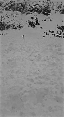
Good morning. This is Alex Marienthal with early season weather and avalanche information from the Gallatin National Forest Avalanche Center on Wednesday, November 22nd at 7:30 a.m. This information is sponsored by Gallatin County Search and Rescue and Stronghold Fabrication. We will begin to issue daily avalanche advisories and danger ratings this Friday.
Snow showers Monday night dropped 4” in the Bridger Range, 1-2” in Hyalite, 3-5” near Big Sky and West Yellowstone, and 7” in Cooke City, with 1-2” more last night. Wind has been west to southwest at 20-30 mph with gusts of 40-50 mph. Temperatures this morning are above freezing up to 9,000’ elevation. There is a chance for light rain this morning, with temperatures in the mid-40s F today and wind out of the west to southwest at 20-30 mph. For Thanksgiving temperatures will reach 50 F, winds of 30-50 mph will precede the passage of a cold front Thursday night, and 2-4” of snow is possible by Friday morning.
The main avalanche concern today is fresh drifts formed by recent snow and wind. On wind loaded slopes it will be possible to trigger an avalanche. Fresh drifts of snow could be triggered by skiers, climbers, or snowmobilers. Avoid these drifts that are likely found near ridgelines or along the steep edges of gullies. A small slide can be harmful in the wrong terrain, and it is possible for a slide to break deeper into old snow (photo).
Throughout our advisory area the mountains have 3-5 feet of snow with 6 feet near Cooke City. Heavy, dense snowfall since mid-September was accompanied by relatively warm temperatures to promote a generally stable snowpack with a lack of widespread weak layers. Doug and Eric are in Cooke City where they checked many slopes yesterday and found a deep, stable snowpack (video, photo). Eric was in Beehive last weekend and was cautiously optimistic about stability (video). These are a few data points within a large advisory area, and stability can change over a short distance. Before committing to ride in avalanche terrain, dig to assess the snowpack on slopes similar to those you plan to ride for the day (video).
Rain and above freezing temperatures are bad for stability, and are unusual weather for late November when there is already 3-5 feet of snow on the ground. Unusual weather creates unusual avalanches. If you get out to earn your turkey for Thanksgiving, be ready to adjust your plan to unexpected or changing conditions. Avoid avalanche terrain if there is more than a few inches of unconsolidated, wet snow on the surface, or if you see loose avalanches or pinwheels (photo).
If you get out and have any avalanche or snowpack observations to share, drop a line via our website, email (mtavalanche@gmail.com), phone (406-587-6984), or Instagram (#gnfacobs).
Upcoming Avalanche Education and Events
BOZEMAN
Nov. 28, Avalanche Awareness, 6-7:30 p.m. at Play it Again Sports
Nov. 29, 30 and Dec. 2, 3 or 9, Introduction to Avalanches w/ Field Day, Info and Register Here
Dec. 6, Avalanche Awareness, 6-7:30 p.m. at REI Bozeman
Dec. 7, Avalanche Awareness and Beacon Practice, 6-8 p.m. at Beall Park, Bozeman
Dec. 13, Avalanche Awareness, 6:30-8 p.m. at Gallatin Valley Snowmobile Association, 4-Corners
Jan. 12 and 13, Companion Rescue Clinic, Info and Register
Jan. 17, 18 and 20 or 21, Introduction to Avalanches w/ Field Day, Info and Register Here
Jan. 24, 25 and 27, Advanced Avalanche Workshop w. Field Day, Info and Register Here
Feb. 9 and 10, Companion Rescue Clinic, Info and Register
HELENA
7 December, Avalanche Awareness, 6-7:30 p.m. at Basecamp, Helena
WEST YELLOWSTONE
Dec. 14 and 15, Snowmobiler Introduction to Avalanches with Field Course, Info and Register Here
COOKE CITY
24 and 25 November, Current Conditions and Avalanche Rescue, 6:30-7:30 p.m. Friday and anytime between 10-2 on Saturday.
Here’s a new video series from BCA outlining how to use an avalanche transceiver to perform an effective rescue.


