Photos
|
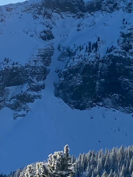
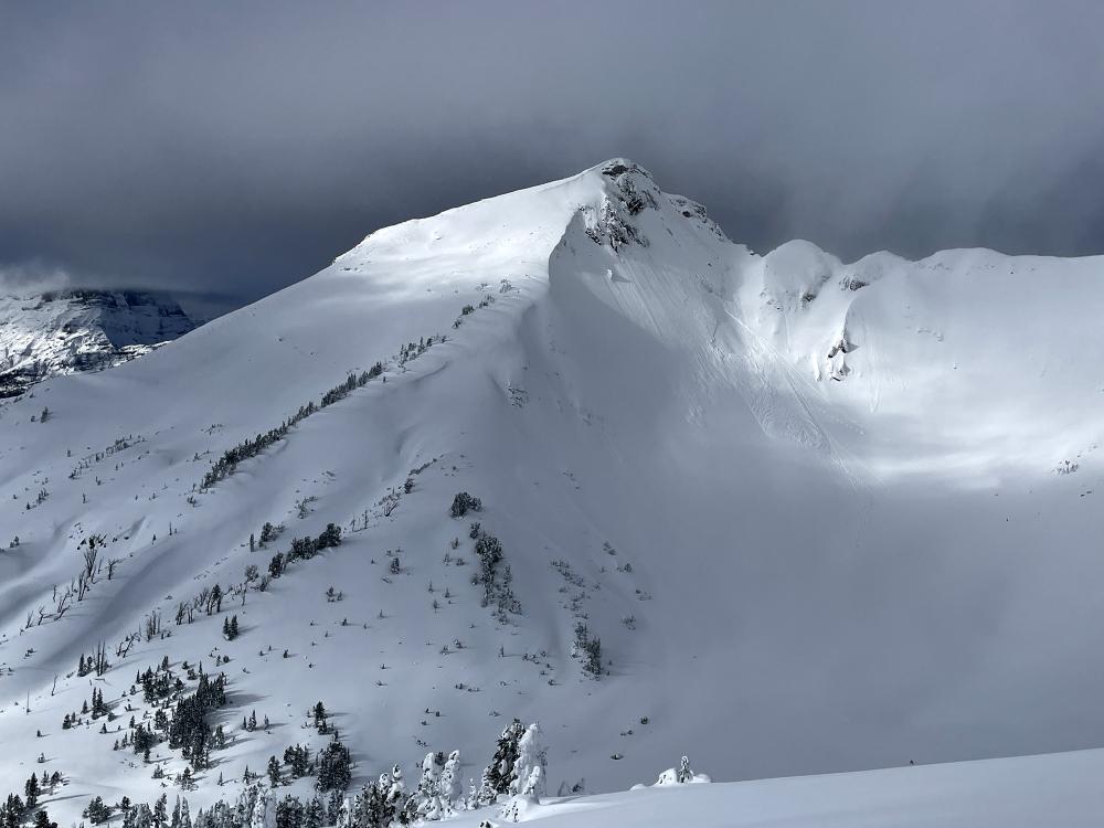
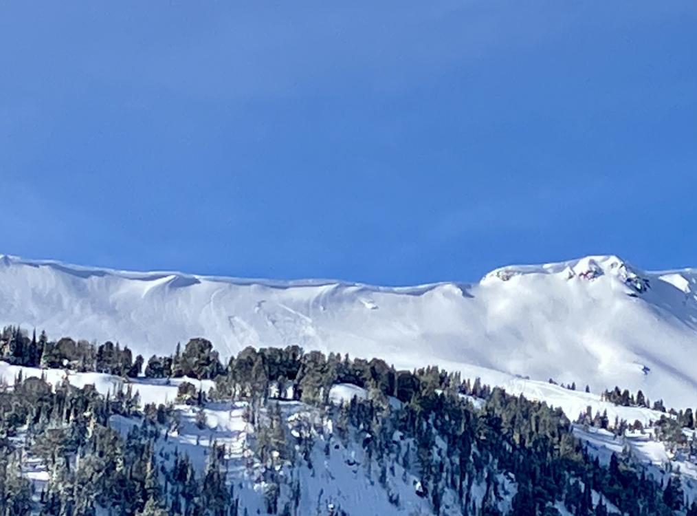
Northern Gallatin, 2023-01-22 Bad quality but a D2, R3 natural in Flanders cirque. Looked like it was just the new snow, but hard to say.... on a NW aspect around 9,500 feet. Photo: O. Desroches Link to Avalanche Details |
|
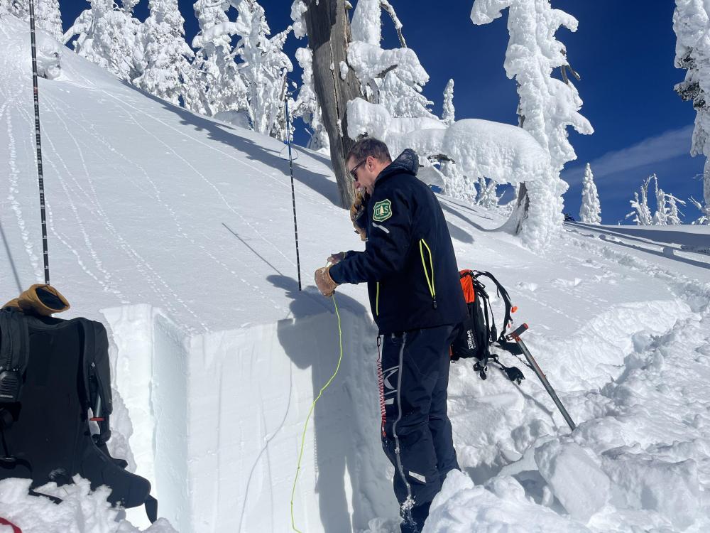
Cooke City, 2023-01-19 We dug five snowpits and performed extended column tests in each on 1/19/23 near Cooke City. Four snowpits were on northeast to north facing slopes between 9,200-10,000', and one pit was on a southwest facing slope at 9,200'. In one pit on a NE aspect at 9,200' we had an ECTP 15 on the surface hoar 35 cm below the surface. In all other pits we had ECTN14-19 at the depth of the surface hoar, and no obvious feathery crystals were visible. The layers where the ECTNs broke appeared to be decomposing, preserved dendrites or maybe decomposing surface hoar. Photo: GNFAC |
|
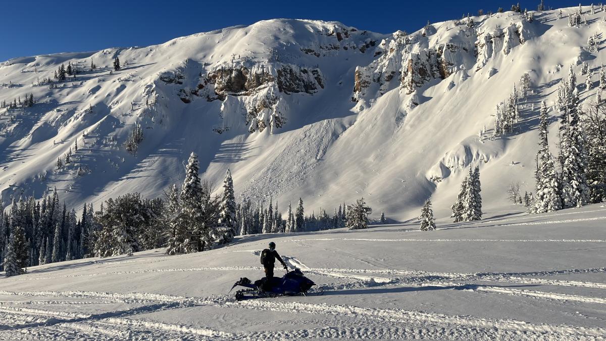
Lionhead Range, 2023-01-19 A natural slide in the back bowls of Lionhead. |
|
Lionhead Range, 2023-01-19 Dave and Doug rode around and saw multiple natural and 1 sledder triggered slide on Lionhead. Some were thin and just involved news snow and others were deeper and broke on the buried surface hoar layer. Link to Avalanche Details |
|
Lionhead Range, 2023-01-19 Dave and Doug rode around and saw multiple natural and 1 sledder triggered slide on Lionhead. Some were thin and just involved news snow and others were deeper and broke on the buried surface hoar layer. Link to Avalanche Details |
|
Cooke City, 2023-01-19 Observed a point release that appeared to have stepped down. This occurred SE of the “rip curl” zone. We also noticed significant sun effect and a warming trend throughout the day. 1/17/23 Link to Avalanche Details |
|
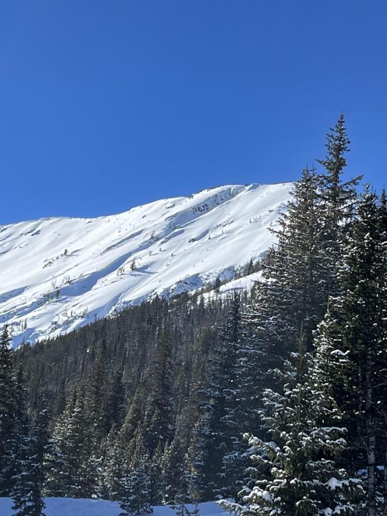
Northern Madison, 2023-01-19 Natural soft slab release likely in the last 36 hours. Seen from in-bounds at the Yellowstone Club. Avalanche location at 45.2116512 N 111.47811 W at the headwaters of Muddy Creek. Link to Avalanche Details |
|
Bridger Range, 2023-01-19 Another slide was seen from the highway in Argentina Bowl. This slide appears to be a shallow soft slab that ~50 ft wide and ran ~500 vertical ft. Link to Avalanche Details |
|
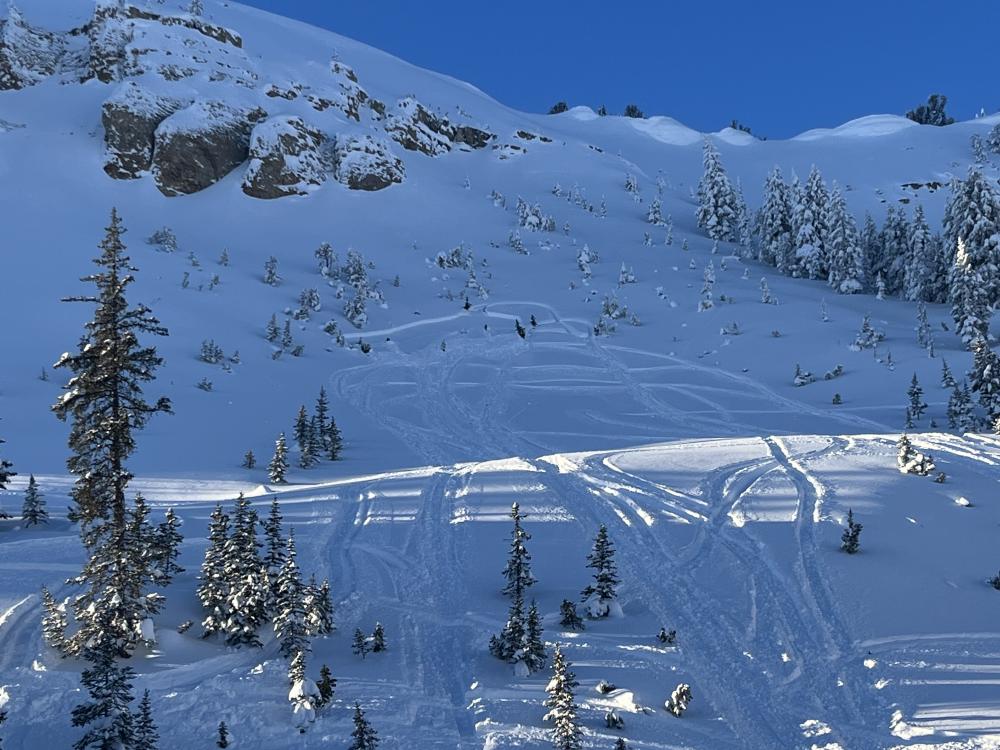
Northern Gallatin, 2023-01-19 Today we toured up Storm Castle Ridge with hopes of skiing the 19th Street Couloir. On the approach we were able to trigger small (2-4") wind slabs on most lee aspects, these slides ran fast and far for their size. Link to Avalanche Details |
|
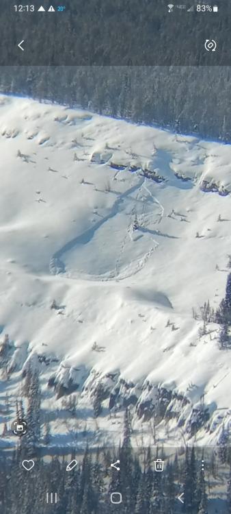
Island Park, 2023-01-19 Small avalanche broke while descending to less exposed areas. Approximately 80 yards wide, 18” deep. Slid for approximately 90 yards from crown. |
|
Island Park, 2023-01-19 Small avalanche broke while descending to less exposed areas. Approximately 80 yards wide, 18” deep. Slid for approximately 90 yards from crown. Link to Avalanche Details |
|
Island Park, 2023-01-19 Small avalanche broke while descending to less exposed areas. Approximately 80 yards wide, 18” deep. Slid for approximately 90 yards from crown. Link to Avalanche Details |
|
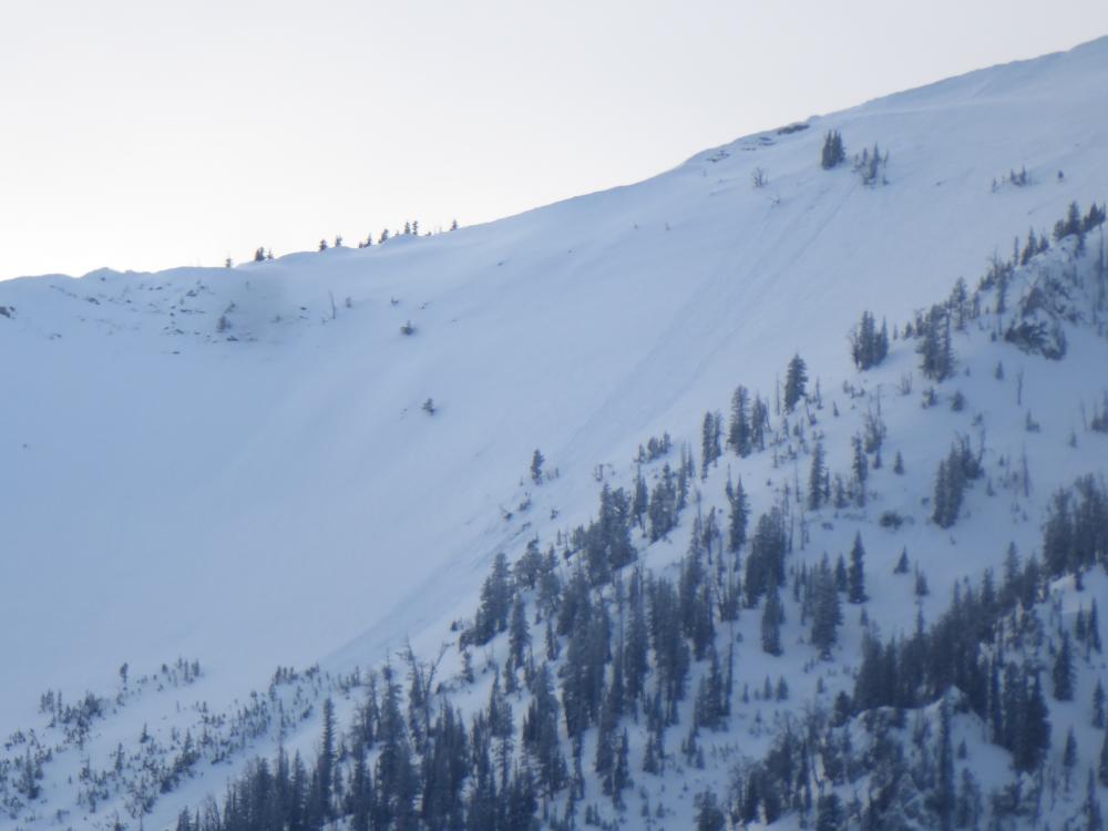
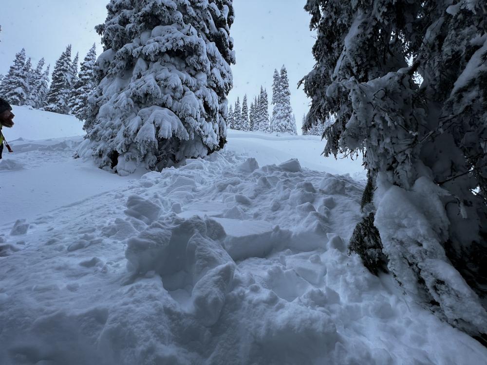
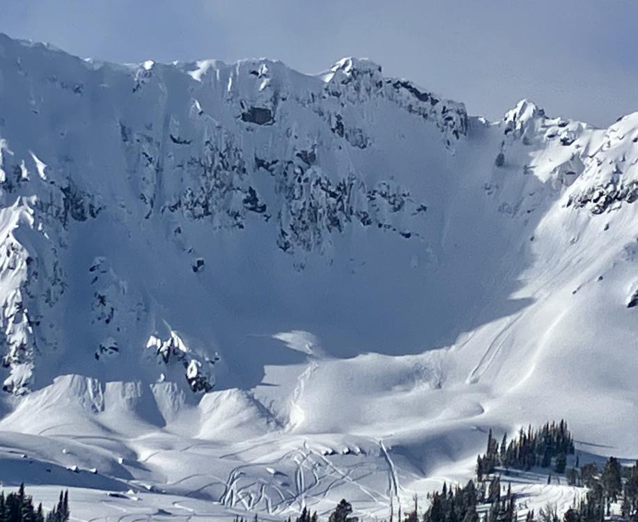
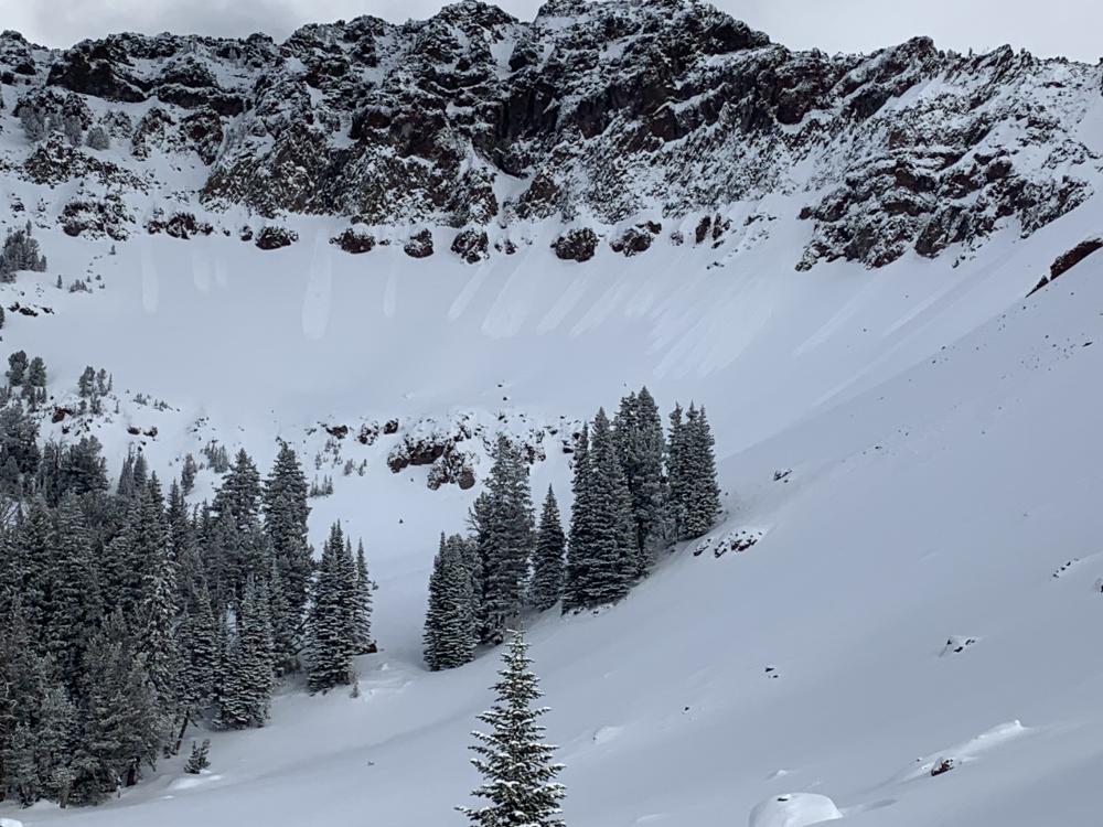
Cooke City, 2023-01-19 East aspect, 10,300. Estimated to be about 75' wide. Likely occurred yesterday, Jan. 17th. Photo: B. Fredlund Link to Avalanche Details |
|
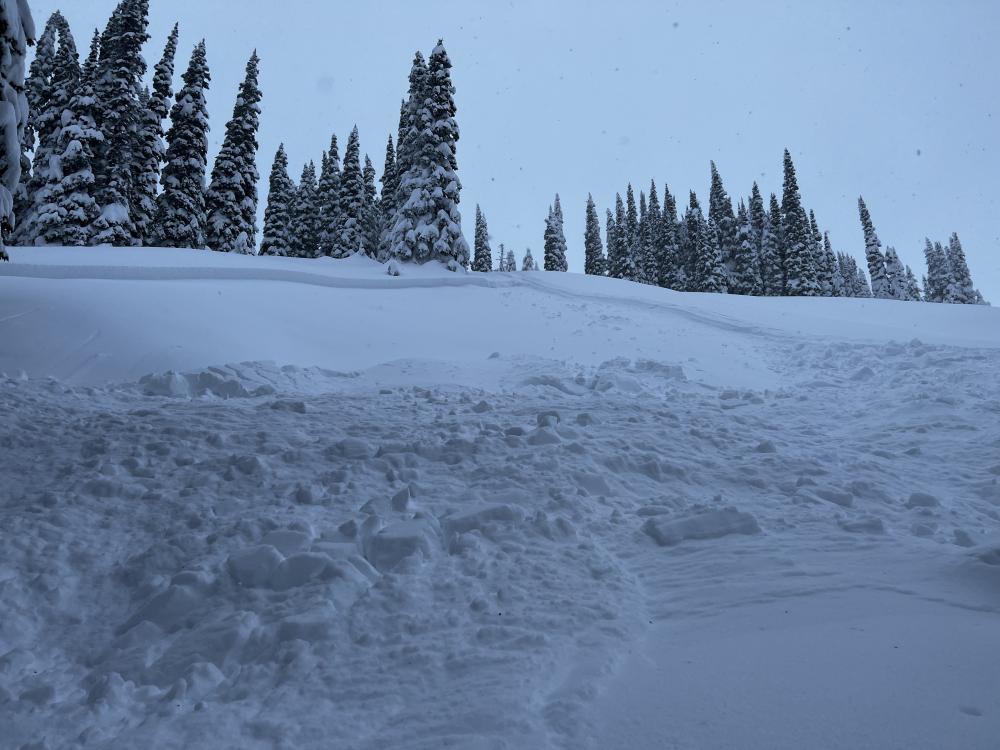
Cooke City, 2023-01-18 Avalanches previously reported on Monday on Miller (photo taken 1/18). GNFAC Link to Avalanche Details |
|
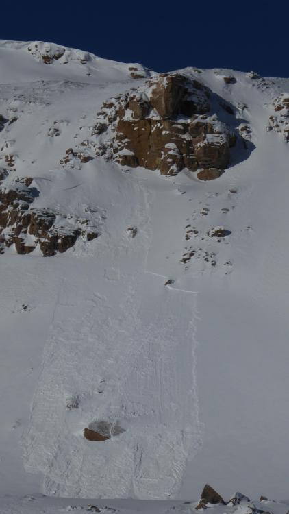
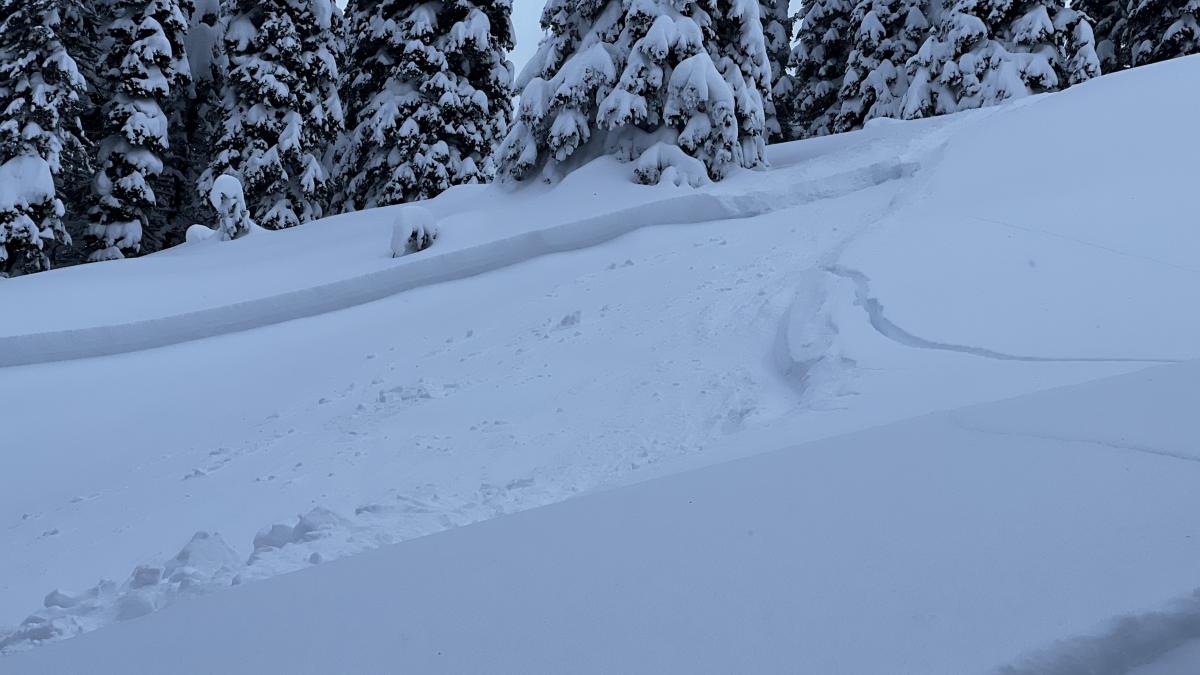
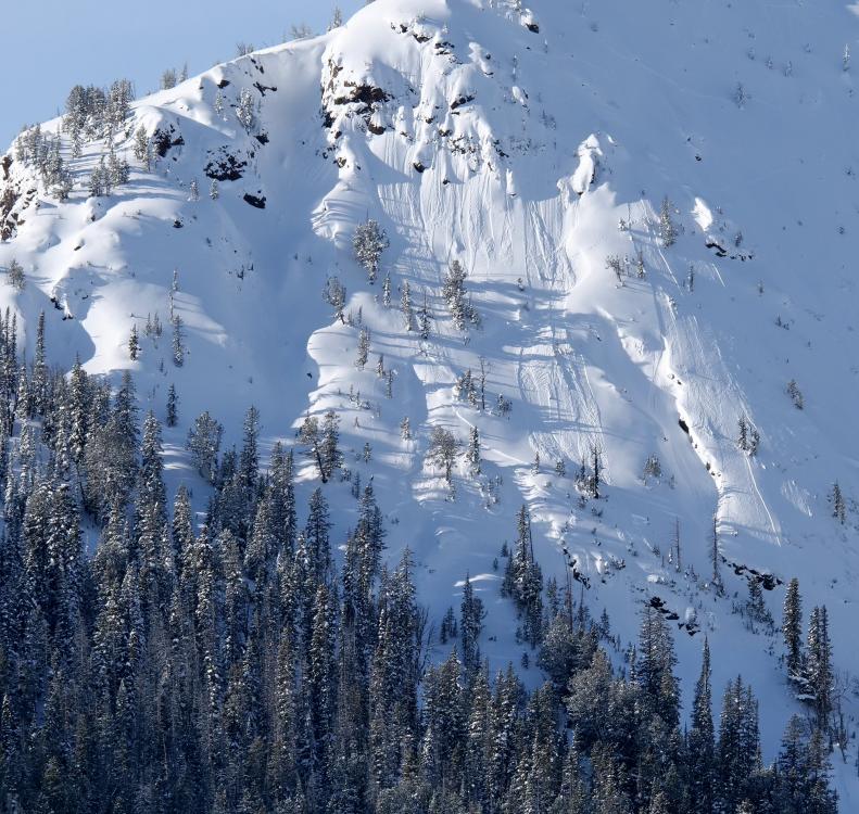
Cooke City, 2023-01-17 Noted a couple of fresh slab avalanches out there today. Both were on northerly aspects around 9300'. Photo: B. Fredlund Link to Avalanche Details |
|
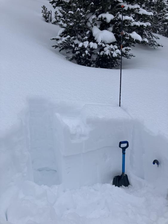
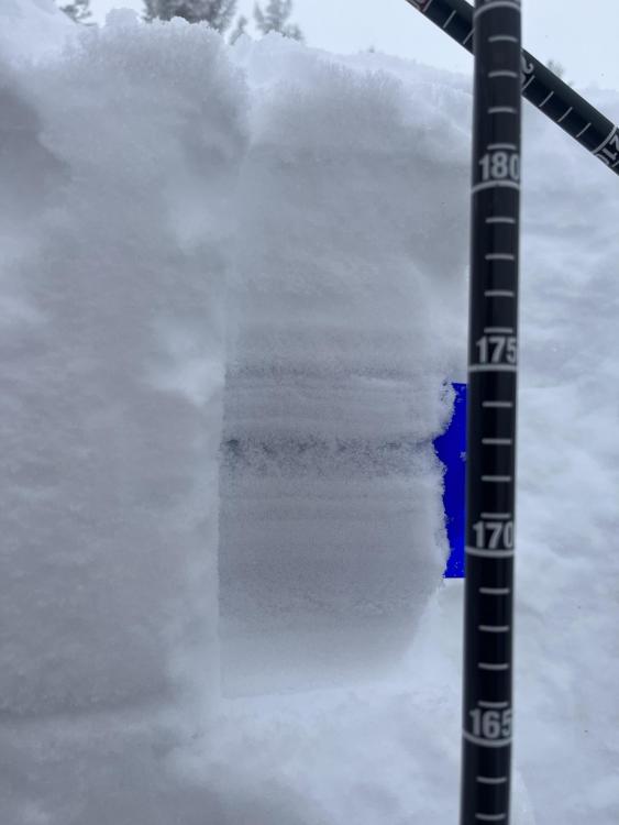
Island Park, 2023-01-17 Digging a pit near East Hotel Creek in Island Park where we found a layer of surface hoar buried two feet deep. Photo: GNFAC |
|
Cooke City, 2023-01-17 Avalanche previously reported on Monday on Henderson (photo taken 1/17). GNFAC Link to Avalanche Details |

|
Dillon Area, 2023-01-17 Snowmobiled to lower rock island lake and ascended to 9200ft. Mostly sunny skies with no wind. No avalanches observed, no collapsing, minor cracking right around skis in wind affected areas 4 inches deep. Dug on due N aspect. HS = 120-150 cm. Soft surface 4-6 inches. 1 finger hard layers with rounding facets in between with 2 layers of concern about 1 foot down and 1 foot off the ground where 4F rounded facets are sandwiched between harder layers. CT6 Q2 down 4 inches on old snow surface. CT 23 Q3 on basal facets. ECTN 6 4 inches down, ECTN 29 about 1 foot down (consistent with last weekend observation in this area). Stubborn old snowpack right now with lack of significant new snow or wind and recent warm temps. Still poor structure in areas where snowpack is thinner, however where it is deeper seems facets are healing. |
|
Northern Gallatin, 2023-01-16 From obs: "Toured into Alex Lowe basin today and noticed lots of point release slides. Most started as spindrift in the cliff bands along the ridge and gained more snow as they fell into the aprons. Skied a north and south-facing couloir, ski cut at the top of both runs and got the new snow to sluff most of the way down. Didn't encounter any cohesive slabs, just lots of sluff sliding down." Photo: S. Lipsteuer Link to Avalanche Details |
|
Northern Madison, 2023-01-16 On a Jan. 16 tour into Beehive, we found the concerning layer of feathery surface hoar buried under 6" of snow. It is widespread from Big Sky through West Yellowstone and Cooke City. It has produced avalanches near Hebgen Lake, with more snow, it will likely produce avalanches in Beehive too. Photo: GNFAC |