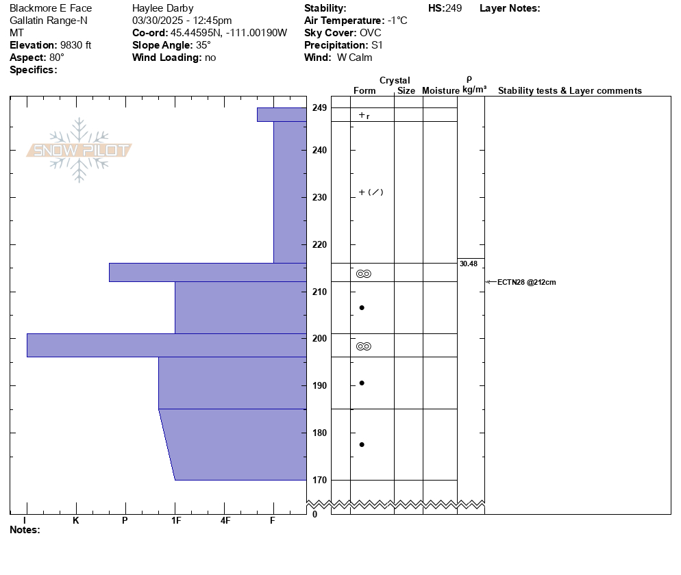
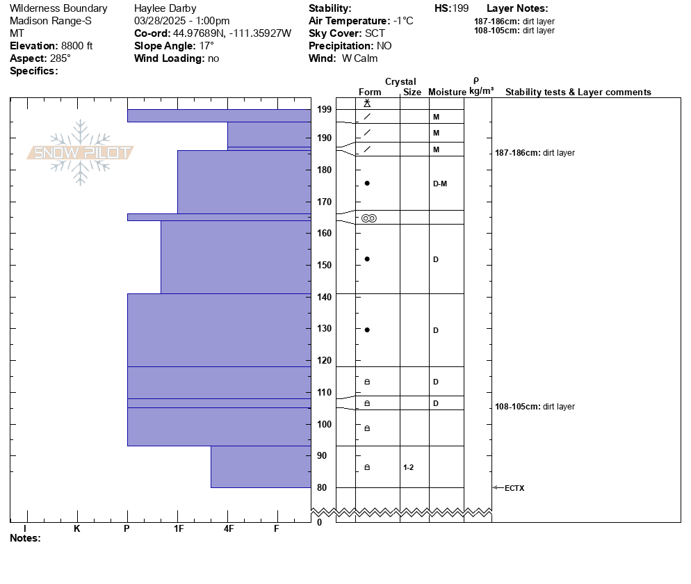
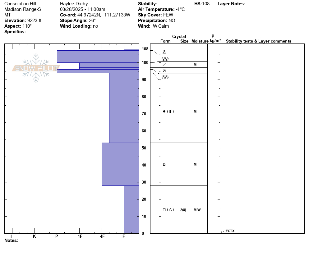
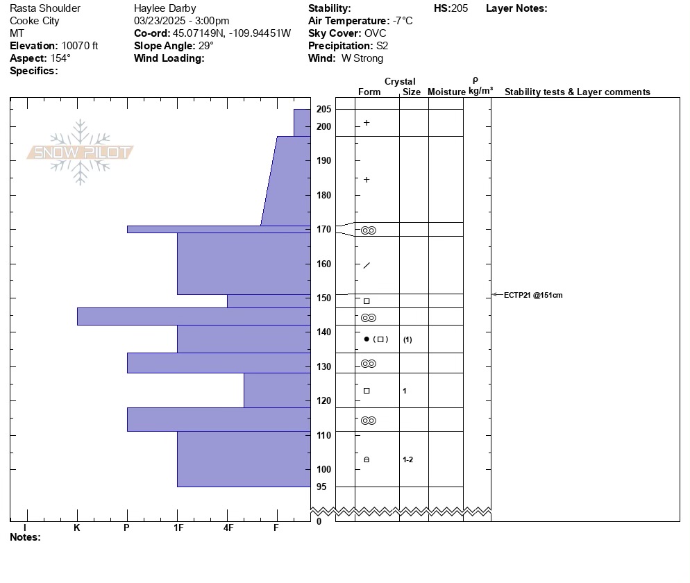
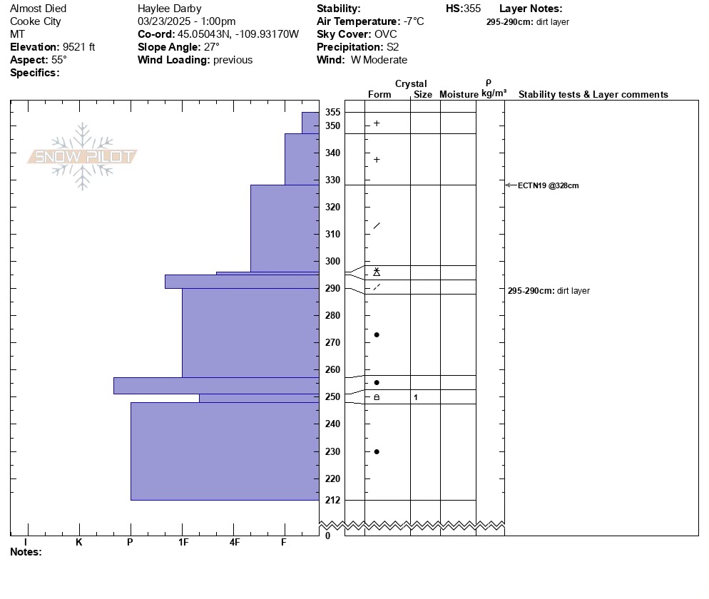
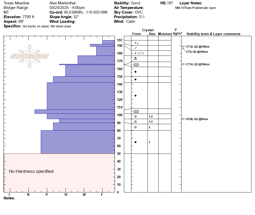
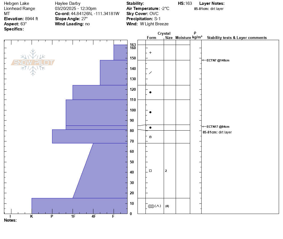
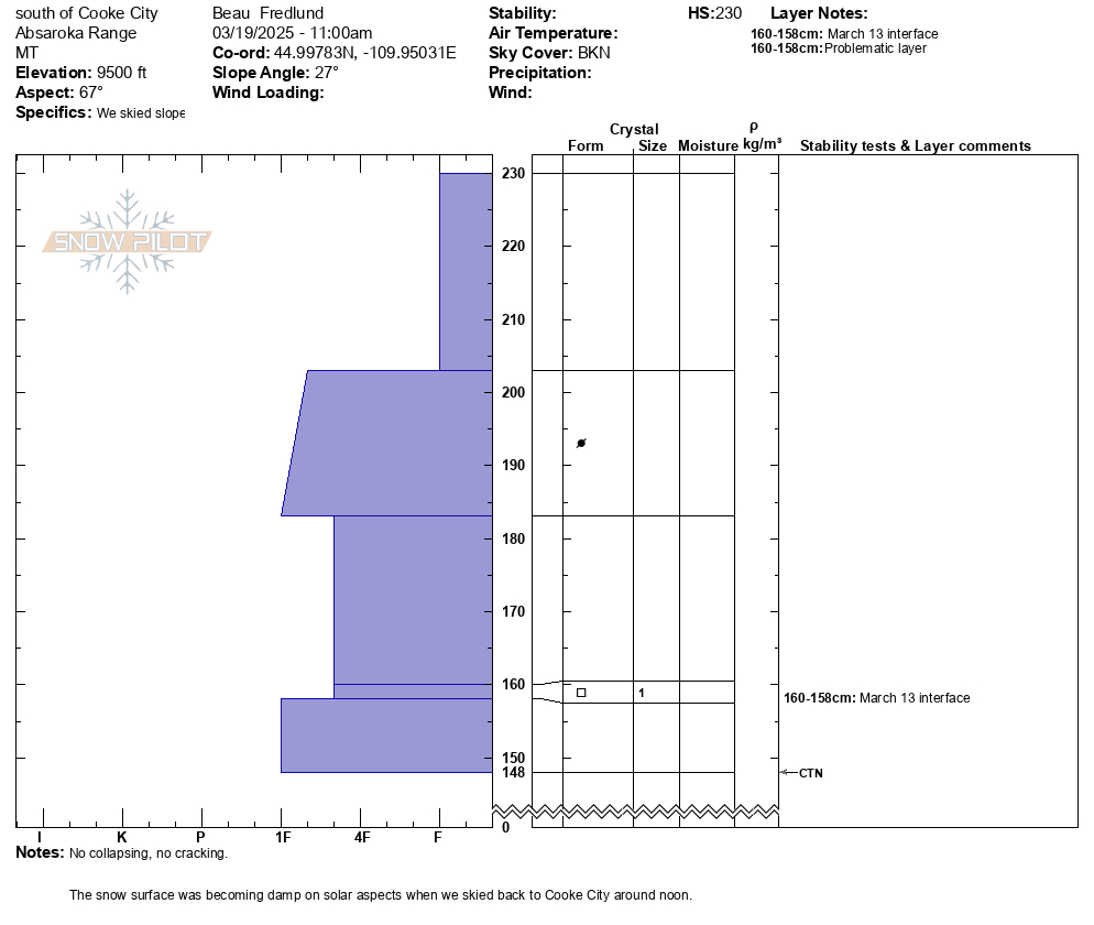
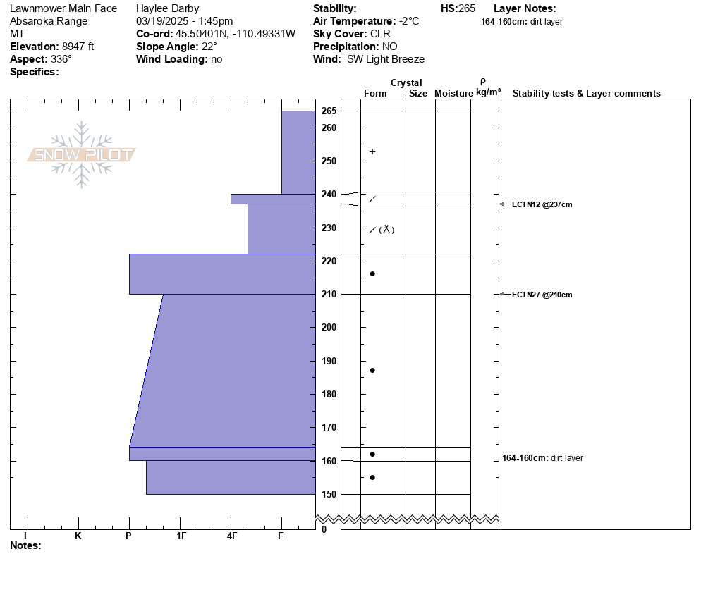
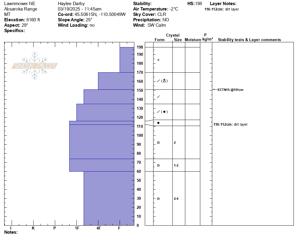
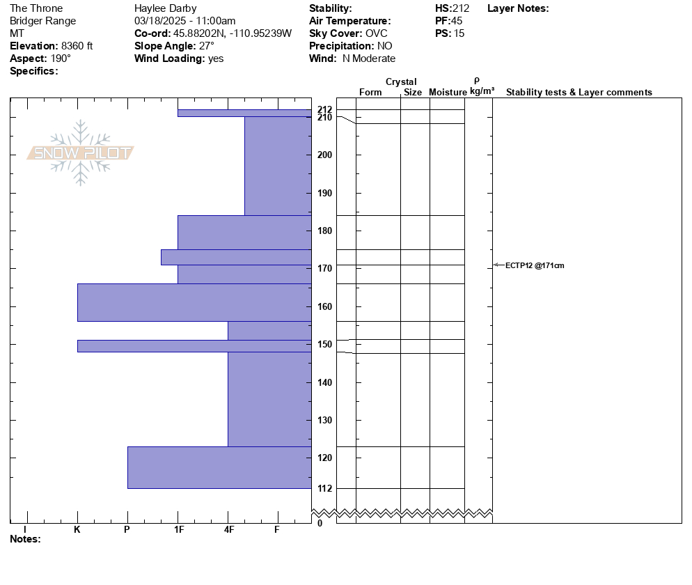
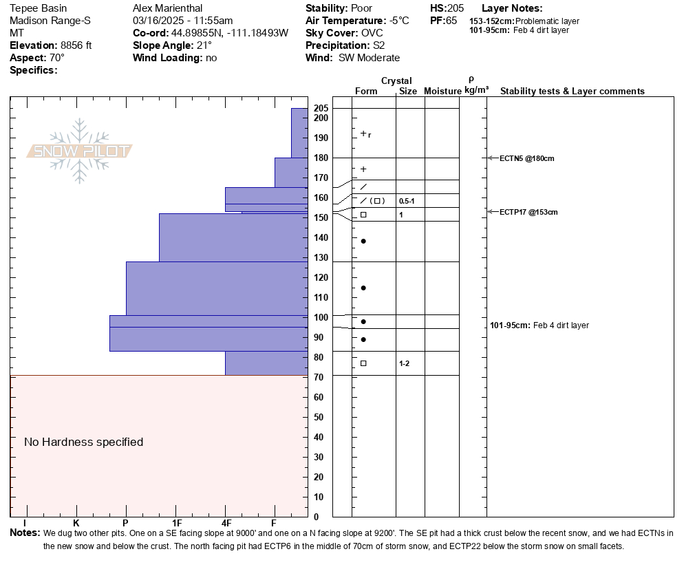
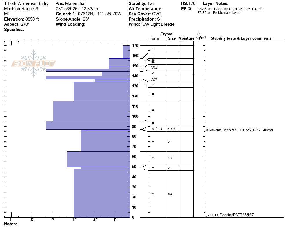
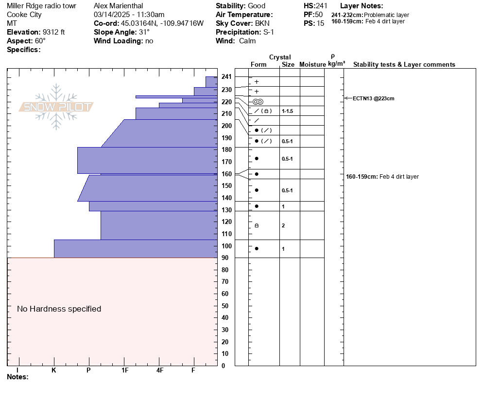
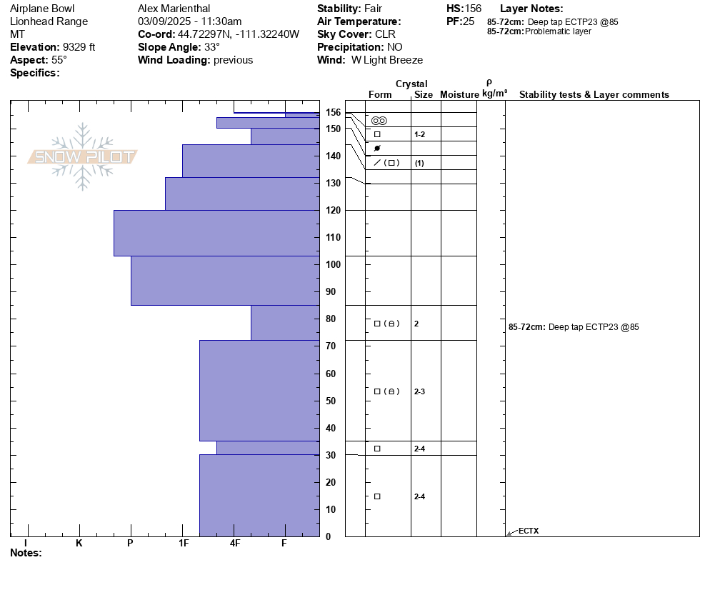
Snowpit Profiles
These pits are generated using a FREE and easy to use program available at www.SnowPilot.org. Through Snowpilot, snowpit data can be uploaded to a international database for use by researchers to study avalanches.
Watch a video that shows how to download and use the software.
Go to either the AAA page about Snow, Weather, and Avalanche Guidelines (SWAG), or NAC websites to get detailed guidelines on snowpits and stability tests.